
Anaklia tide times
Anaklia tide forecast — heights relative to MSL.
Today's tide times for Anaklia
Tide times at Anaklia on Saturday, 4 July 2026: first high tide at 04:00am. Sunrise 05:41am, sunset 08:54pm.
Tide chart for Anaklia
24-hour cosine-interpolated curve around the present moment. Heights relative to MSL. Predictions: Predictions: Open-Meteo Marine (MeteoFrance SMOC, 0.08° grid).
Sun, moon and conditions on Sat 04 Jul
Snapshot at build time — refreshes daily. Sea state from Open-Meteo Marine.
Highs and lows next 7 days
Every predicted high and low for the next week, with the daily tidal coefficient (0–120; higher = bigger swing, > 95 means stronger currents).
Other spots nearby
The three closest curated TideTurtle locations to Anaklia, measured by great-circle distance.
Today's solunar windows
Solunar tradition: major periods are the ≈3h windows around moon transit and opposition; minor are ≈2h around moonrise and moonset. Pair with the local tide stage and wind for the best read.
About tides at Anaklia
A short guide to the coastline at Anaklia — geography, sea state, and what the tide is actually doing under your feet.
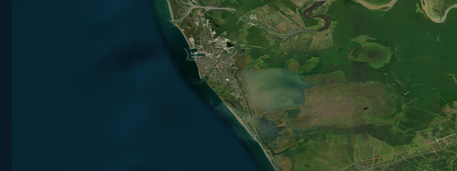
Anaklia is a small Georgian coastal town at the mouth of the Enguri River in the Samegrelo region, roughly 100 km northwest of Kutaisi. Its position defines it in two ways simultaneously: the Enguri is the boundary river between Georgian-administered territory and the Russian-occupied region of Abkhazia to the north, and the town sits at the last navigable point on the Georgian coast before the administrative boundary. The Enguri Hydro Power Plant 60 km upstream is one of the largest in the Caucasus; the river that reaches the sea here is regulated and carries less sediment than the natural Enguri did before the dam.
The beach at Anaklia is wide, sandy, and relatively quiet compared to the resort towns further south. The foreshore faces west-northwest into the open Black Sea, and the Enguri River mouth 2 km to the north creates a defined northern boundary to the beach environment. The river plume can affect water clarity after heavy Caucasian rainfall events, when the Enguri carries turbid snowmelt; the clearest conditions are from late June through August when the spring melt is complete.
A deep-sea port project at Anaklia has been under discussion for years — Anaklia's geography, with deep water close to shore and a sheltered approach angle, made it a candidate for a major container facility in the early 2020s. The project's status has been contested, with Chinese and American competing interests involved in various phases, and construction has not yet proceeded at scale. The potential port would make Anaklia one of the largest freight facilities on the eastern Black Sea if completed.
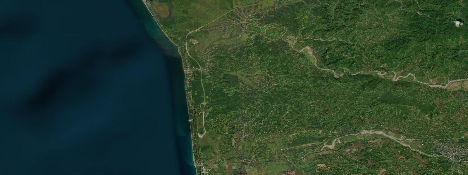
The Colchic lowland behind Anaklia is one of the botanically richest environments in the Caucasus — a relict subtropical forest that survived the Quaternary glaciations in this coastal refugium. Colchic rainforest species including Rhododendron ponticum, Caucasian wing nut, and laurel grow close to the shoreline, and the wetland margins hold a range of waterbirds. The coast here is on the Black Sea migration flyway; visible spring and autumn passage includes waders, raptors, and passerines.
The Black Sea at Anaklia is microtidal: mean astronomical range 0.1 to 0.2 m. This is the characteristic of the entire enclosed Black Sea basin. Water level is dominated by meteorological forcing — wind, atmospheric pressure, and the Black Sea seiche. Autumn and winter northwesterly storms produce the most significant surge events on this exposed west-facing coast. The Enguri River mouth introduces an additional local driver: high river discharge can push the water level slightly higher near the river mouth as freshwater outflow meets the sea.
Predictions on this page come from Open-Meteo Marine, a gridded global ocean model. At the 0.1 to 0.2 m astronomical range of the Georgian Black Sea coast, the model's typical accuracy (plus or minus 45 minutes on timing, 0.2 to 0.3 m on height) exceeds the total tidal signal. The predictions describe the background rhythm; actual water level at Anaklia is driven by the Enguri flow, wind, and the Black Sea seiche cycle.
Tide questions about Anaklia
Quick answers to the most common questions about tide times, range, and water access at Anaklia.
When is the next high tide at Anaklia?
The hero block at the top of this page shows the next predicted high at Anaklia in local Georgia Standard Time (GET, UTC+4). Astronomical range is 0.1 to 0.2 m — essentially unmeasurable at beach level. Water-level conditions at Anaklia are driven by wind, Black Sea seiches, and the Enguri River discharge. After Caucasian snowmelt or heavy rain events, the river plume can extend well into the sea and reduce water clarity. The Georgian Environment and Climate Change Department publishes weather and sea-state information for this coast.
What is the tidal range at Anaklia?
Mean astronomical range is 0.1 to 0.2 m — the standard for the Black Sea. The basin is nearly enclosed, with the Turkish Straits providing only limited tidal exchange with the Mediterranean. The dominant water-level drivers at Anaklia are wind-driven setup (particularly from northwesterly storms), Black Sea basin seiches producing multi-hour oscillations, and the Enguri River discharge pushing water outward from the river mouth. Significant storm events can produce water-level changes of 0.5 to 1.0 m — far exceeding the astronomical tide.
Where do these tide predictions come from?
Open-Meteo Marine, a free gridded global ocean model. For the Black Sea coast with its 0.1 to 0.2 m astronomical range, the model's typical uncertainty (plus or minus 45 minutes, 0.2 to 0.3 m) exceeds the signal being predicted. The predictions are most useful as an orientation to the tidal rhythm. The Georgian Environment and Climate Change Department is the authoritative source for sea-level and weather information on the Georgian coast.
What is the situation with the Anaklia Deep Sea Port project?
The Anaklia port project was proposed to build a deep-water container facility on the Georgian Black Sea coast, exploiting the site's naturally deep water close to shore. The project attracted significant international interest in the early 2020s but has faced repeated delays due to financing disputes, changes in the consortium of developers, and geopolitical considerations involving China and the US. As of the most recent available information, construction had not proceeded at scale. Visitors to Anaklia will find a quiet beach town rather than active port construction. The Georgian government's position on the project has evolved over time — current status should be verified before any visit that depends on the port being operational.
Is this safe to use for navigation?
No. TideTurtle is a planning tool for recreational coastal activity, not a navigation resource. The Anaklia area is adjacent to the administrative boundary with Russian-occupied Abkhazia — maritime approaches to and along this stretch require particular awareness of the security and access restrictions in the border zone. The Georgian Maritime Transport Agency and the relevant Black Sea navigational charts are the authoritative sources. Open-Meteo Marine gridded predictions do not replace authoritative navigation sources.
3-day tide table — Anaklia
Heights relative to MSL. Predictions: Open-Meteo Marine (MeteoFrance SMOC, 0.08° grid) — heights relative to MSL (not chart datum / LAT). Model-derived.
| Day | Type | Time | Height |
|---|---|---|---|
| Sat 04 Jul | High | 04:00 | -0.4m |
| Sun 05 Jul | — | ||
| Mon 06 Jul | Low | 09:00 | -0.4m |