Fakarava tide times
Fakarava tide forecast — heights relative to MSL.
Today's tide times for Fakarava
Tide times at Fakarava on Friday, 3 July 2026: first low tide at 02:00pm, first high tide at 04:18pm, second low tide at 10:45pm. Sunrise 06:11am, sunset 05:22pm.
Tide chart for Fakarava
24-hour cosine-interpolated curve around the present moment. Heights relative to MSL. Predictions: Predictions: Open-Meteo Marine (MeteoFrance SMOC, 0.08° grid).
Sun, moon and conditions on Fri 03 Jul
Snapshot at build time — refreshes daily. Sea state from Open-Meteo Marine.
Highs and lows next 7 days
Every predicted high and low for the next week, with the daily tidal coefficient (0–120; higher = bigger swing, > 95 means stronger currents).
Other spots nearby
The three closest curated TideTurtle locations to Fakarava, measured by great-circle distance.
Today's solunar windows
Solunar tradition: major periods are the ≈3h windows around moon transit and opposition; minor are ≈2h around moonrise and moonset. Pair with the local tide stage and wind for the best read.
Cycle dates near Fakarava
Last spring tide on Fri 03 Jul (range 0.4m). Next spring tide on Thu 09 Jul (range 0.5m). Next neap on Tue 07 Jul.
Spring tides cluster around new and full moons (biggest swings). Neap tides land on quarter moons (smallest swings). See the spring tide and neap tide glossary entries for the why.
About tides at Fakarava
A short guide to the coastline at Fakarava — geography, sea state, and what the tide is actually doing under your feet.
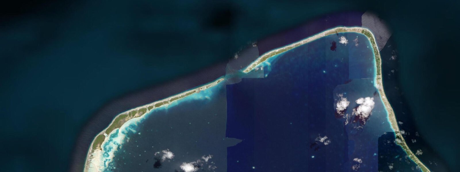
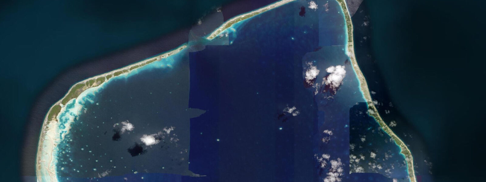
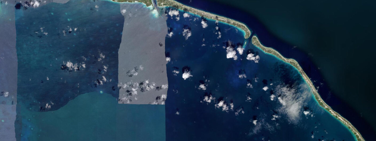
Fakarava is a UNESCO Biosphere Reserve atoll in the Tuamotu Archipelago, approximately 500 kilometres northeast of Tahiti and 200 kilometres southeast of Rangiroa. The atoll has a rectangular shape — 60 kilometres long and 25 kilometres wide — and two passes: Garuae Pass in the north, the widest pass in French Polynesia at approximately 1,600 metres, and Tumakohua Pass in the south, narrower at 200 metres and the subject of one of the most-discussed shark aggregation events in the world.
Garuae Pass carries a flood current of 4 to 6 knots at springs — strong, but manageable for drift diving with an operator familiar with the pass geometry. The walls of Garuae are coral-covered to 40 metres, with large Napoleon wrasse, grouper, and schools of surgeon fish and snapper in the mid-water. The breadth of the pass means the current is distributed over a wider cross-section than at Rangiroa's Tiputa; individual dives can follow the wall rather than being swept entirely by the main channel flow. The pass is diveable on both flood and ebb, with the dive profile adjusted to the current direction.
Tumakohua (South Pass) is the site of the Fakarava shark aggregation. Grey reef sharks (Carcharhinus amblyrhynchos) gather in the south pass in numbers that have been counted at up to 700 individuals during the grouper spawning aggregation, which occurs at the full moon in June and July. The mechanism: grouper aggregate in the south pass to spawn, concentrated by the tidal current into a dense biomass. The sharks exploit this concentration, patrolling the pass walls in overlapping circuits. The spectacle on the incoming tide — when the grouper are tightest and the sharks are most active — is described by experienced divers as the most intense predator aggregation they have witnessed outside the open ocean.
The tidal regime at Fakarava is mixed semidiurnal, with a spring range of approximately 0.4 to 0.6 metres in the open ocean water around the atoll. The lagoon exchange is driven by this modest range, but the constriction of the passes amplifies the flow dramatically. On the incoming tide, cleaner, denser Pacific water drops under the lighter, warmer lagoon water at the pass mouth, creating a salinity boundary layer visible as a shimmer in the water column — a halocline that is disorienting to visibility through. On the outgoing tide, the turbid lagoon water drains over the outer reef in a visible brown plume from above.
The Fakarava lagoon interior, accessible only by boat, has isolated motu (islet) beaches on the northern rim reachable in 45 minutes from the Rotoava village at the north end. Pearl farming takes place on the inner lagoon in longline culture systems; Fakarava black pearls are among the Tuamotus' commercial outputs. A UNESCO-organised marine research station operates from Rotoava, with a focus on grouper spawning dynamics and the trophic consequences of the shark aggregation.
Accommodation in Fakarava is at pensions in Rotoava (north) and Tetamanu village (south, adjacent to the south pass) — the two ends of the atoll are a significant boat journey apart. Divers visiting Tumakohua Pass from Rotoava face a 45-minute to 1-hour lagoon crossing; accommodation at Tetamanu eliminates this transit.
Predictions on this page come from Open-Meteo Marine, a gridded global ocean model. Accuracy is typically within plus or minus 45 minutes on timing and 0.2 to 0.3 metres on height — model-derived, not from a local gauge. The local authority for tide information in French Polynesia is the Service Hydrographique et Océanographique de la Marine (SHOM).
Tide questions about Fakarava
Quick answers to the most common questions about tide times, range, and water access at Fakarava.
What is the Fakarava shark aggregation?
Each June and July, at the full moon, grouper aggregate in Fakarava's south pass (Tumakohua) to spawn. This dense concentration of prey attracts up to 700 grey reef sharks, which patrol the pass walls in overlapping circuits and hunt the spawning grouper on the incoming tide. The full moon timing corresponds to the peak spawning moment; the incoming tidal current concentrates the grouper at specific locations in the pass. The aggregation is the largest regularly occurring grey reef shark concentration documented in French Polynesia and is considered one of the world's most significant marine wildlife events. The dive is conducted with accredited local operators who time the entry to the current phase.
How do I get to the south pass at Fakarava?
The south pass (Tumakohua) is at the southern end of the atoll, approximately 55 kilometres from the main village of Rotoava in the north. From Rotoava, the lagoon crossing by boat takes 45 minutes to 1 hour each way. Several dive operators in Rotoava run full-day south pass excursions, departing early and returning in the afternoon. Alternatively, accommodation at Tetamanu village (adjacent to the south pass) eliminates the lagoon transit — Tetamanu has a small pension and dive operation. Access to Fakarava itself is by Air Tahiti flight from Papeete (1.5 hours) to Rotoava.
What is Garuae Pass and how does it compare to Tiputa at Rangiroa?
Garuae Pass is the widest pass in French Polynesia at approximately 1,600 metres. The flood current runs at 4 to 6 knots at springs — strong, but distributed over a wider cross-section than Tiputa at Rangiroa (which is narrower and carries a more concentrated flow of 6 to 8 knots). Garuae drift dives follow the walls rather than being entirely swept through the middle, giving divers more control over their position. The wall communities in Garuae are well-developed — large Napoleon wrasse, grouper, surgeon fish, and sharks on the current. Garuae is considered slightly more accessible for less experienced drift divers than Tiputa.
Can I see Fakarava black pearls?
Fakarava has active pearl farming on the inner lagoon using longline culture systems for Pinctada margaritifera (black-lipped oyster). The pearls produced are sold locally and through the Papeete pearl market. Some pension owners in Rotoava have pearl farm connections and can arrange a tour of the operation. The pearl farming process takes 18 to 24 months from graft to harvest; what is visible on a lagoon excursion are the longlines with oysters hanging at various stages of development. Purchasing pearls directly from producers in Fakarava is possible and generally less expensive than the Papeete market.
What is the tidal range at Fakarava?
Spring tidal range in the open ocean around Fakarava is approximately 0.4 to 0.6 metres — modest by any standard. But the confined geometry of the two passes converts this small range into significant current: 4 to 6 knots through Garuae, 2 to 4 knots through Tumakohua. The lagoon water level inside the atoll responds to the tidal cycle with a slight lag relative to the open ocean outside. Predictions here come from Open-Meteo Marine (±45 minutes on timing, ±0.3 m on height). Not for navigation; consult SHOM tide tables for Tuamotu reference stations.
8-day tide table — Fakarava
Heights relative to MSL. Predictions: Open-Meteo Marine (MeteoFrance SMOC, 0.08° grid) — heights relative to MSL (not chart datum / LAT). Model-derived.
| Day | Type | Time | Height |
|---|---|---|---|
| Fri 03 Jul | Low | 14:00 | 0.7m |
| High | 16:18 | 0.8m | |
| Low | 22:45 | 0.4m | |
| Sat 04 Jul | High | 17:06 | 0.8m |
| Sun 05 Jul | Low | 11:15 | 0.5m |
| High | 17:54 | 0.8m | |
| Mon 06 Jul | — | ||
| Tue 07 Jul | — | ||
| Wed 08 Jul | Low | 03:00 | 0.5m |
| High | 09:00 | 0.8m | |
| Thu 09 Jul | Low | 03:54 | 0.4m |
| High | 10:00 | 0.8m | |
| Fri 10 Jul | Low | 04:50 | 0.4m |
| High | 10:54 | 0.8m | |
| Low | 13:00 | 0.7m | |