Toulon, Provence tide times
Toulon, Provence tide forecast — heights relative to MSL.
Today's tide times for Toulon, Provence
Tide times at Toulon, Provence on Friday, 19 June 2026: first high tide at 02:00, first low tide at 18:00. Sunrise 05:56, sunset 21:18.
Tide chart for Toulon, Provence
24-hour cosine-interpolated curve around the present moment. Heights relative to MSL. Predictions: Predictions: Open-Meteo Marine (MeteoFrance SMOC, 0.08° grid).
Sun, moon and conditions on Fri 19 Jun
Snapshot at build time — refreshes daily. Sea state from Open-Meteo Marine.
Highs and lows next 7 days
Every predicted high and low for the next week, with the daily tidal coefficient (0–120; higher = bigger swing, > 95 means stronger currents).
Other spots nearby
The three closest curated TideTurtle locations to Toulon, Provence, measured by great-circle distance.
Today's solunar windows
Solunar tradition: major periods are the ≈3h windows around moon transit and opposition; minor are ≈2h around moonrise and moonset. Pair with the local tide stage and wind for the best read.
Cycle dates near Toulon, Provence
Last spring tide on Fri 19 Jun (range 0.2m). Next neap on Wed 24 Jun.
Spring tides cluster around new and full moons (biggest swings). Neap tides land on quarter moons (smallest swings). See the spring tide and neap tide glossary entries for the why.
About tides at Toulon, Provence
A short guide to the coastline at Toulon, Provence — geography, sea state, and what the tide is actually doing under your feet.
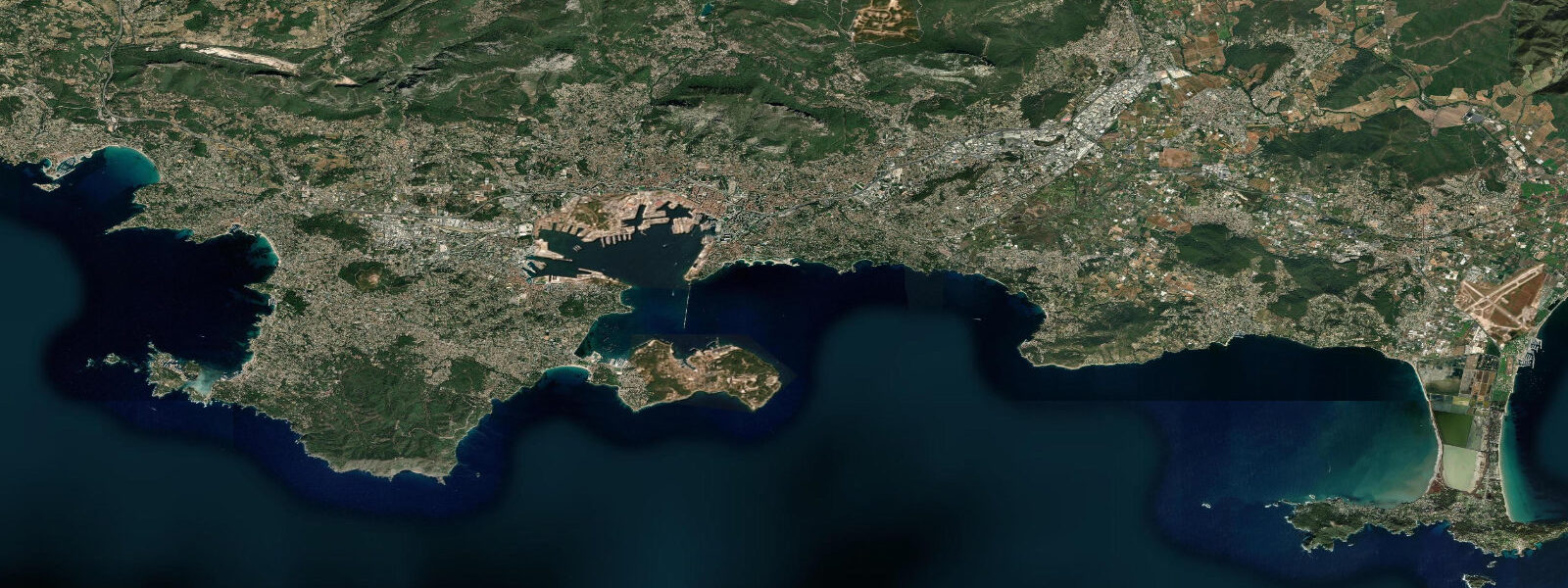
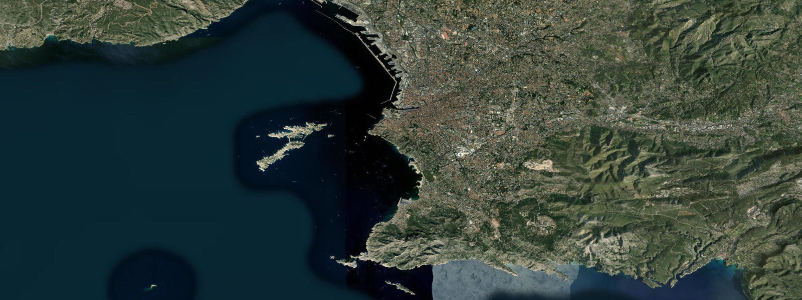
The Rade de Toulon is one of the largest natural deep-water harbours in the Mediterranean — a broad inland sea, roughly 8 kilometres east–west and 6 kilometres north–south, enclosed by Cap Cépet to the east and La Seyne-sur-Mer and Cap Sicié to the west and southwest. The city of Toulon stacks up the hillside above the northern quay, with Mont Faron (584 m) forming the immediate backdrop — visible from anywhere in the Rade, its television mast on the summit a fixed landmark. France's principal naval base occupies the eastern two-thirds of the northern waterfront; the naval presence is fundamental to the city's economy, identity, and the character of its waterfront.
The Mediterranean tidal regime at Toulon is genuinely small. Mean range is 0.15–0.25 m with considerable variation driven by atmospheric pressure and wind rather than the Moon. The pattern is mixed semidiurnal with strong diurnal inequality: on some days one of the two daily tidal cycles is so small it barely registers. A high-pressure system sitting over the western Mediterranean can depress sea level at Toulon by 15–20 cm; a low-pressure system raises it by a similar amount. In practical terms, the "tide" at Toulon is mainly a meteorological signal with a small gravitational component modulating it.
The consequence for users is simple: there is no tidal window here, no need to time a launch for high water, no risk of being stranded on an exposed flat. The Rade is accessible at all times of day, year-round. Depths in the main basin are 15–30 metres. The harbour at Toulon's Quai Cronstadt and the civilian marina at Le Mourillon have consistent water throughout.
Le Mourillon is the quarter where Toulon's civilian waterfront is most accessible. The Plage du Mourillon — technically four beaches separated by rocky outcrops — runs east of the naval zone along the Rade's northern shore. The water is calm, the bottom is sand and gravel, and the visibility underwater is typically 8–15 metres in summer. This is where the city swims. The rocky sections between the sand beaches hold sea urchins, octopus, and wrasse; snorkelling from the shore is productive without leaving the beach zone.
Diving is the serious water sport at Toulon. The Rade and the surrounding coastal zone hold a collection of WWII wrecks accessible from shore or from short boat trips. The most visited is the Rubis — a French submarine sunk in 1944 during the German occupation and resting at 42 metres, accessible as a technical dive. The Togo, a cargo vessel at 18–20 metres in the Petite Rade (the inner eastern basin), is accessible to recreational open-water divers. The Cyclone, a torpedo boat at 25 metres near the Cap Cépet peninsula, is a penetration dive with light requirements. Multiple dive schools operate from the Mourillon marina and can organise wreck dives with equipment and a guide.
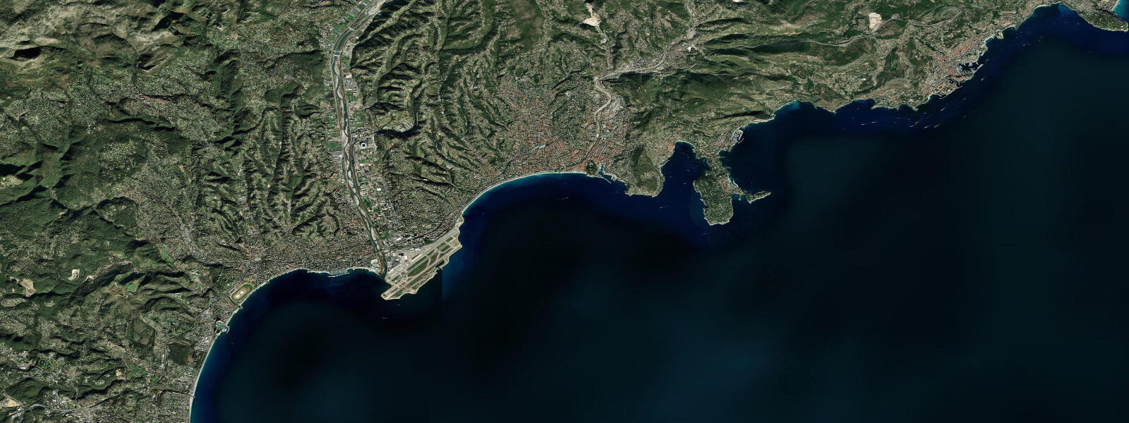
Cap Sicié, 8 kilometres southwest of the city, is the exposed promontory that closes the western approach to the Rade. The cape faces directly into the Gulf of Lion and receives Mistral wind from the northwest without shelter. On Mistral days — the north-northwest wind that can blow 30–40 knots for 3–6 days continuously — Cap Sicié is windy, rough, and visually dramatic; the Rade itself, shielded by the cape and the surrounding hills, remains much calmer than the open Mediterranean to the south. The contrast between the conditions at Cap Sicié and the conditions at Le Mourillon on the same Mistral afternoon is sometimes 20 knots of wind difference.
Le Pradet, 8 kilometres east along the coast from Toulon, has a different character: smaller rocky coves, the Calanque de l'Eoube and its accessible snorkelling, and the Musée de la Mine de Cap Garonne (a former copper mine open to visitors). For those who want Mediterranean coves without driving to the Var calanques or the Calanque National Park west of Marseille, Le Pradet is the practical alternative from Toulon.
The cable car (téléphérique) from the city to the summit of Mont Faron runs when wind conditions allow — Mistral days it shuts. The summit view over the Rade is the best available perspective on the harbour's geometry: the naval base, the Grand Rade, the Petite Rade, La Seyne-sur-Mer across the western basin, and Cap Sicié to the southwest.
Tide data for Toulon, Provence comes from the Open-Meteo Marine API, a gridded model product. Timing accuracy is ±45 minutes, height accuracy ±0.3 m — usable for trip planning, not for navigation.
Tide questions about Toulon, Provence
Quick answers to the most common questions about tide times, range, and water access at Toulon, Provence.
What is the tidal range at Toulon?
The mean tidal range at Toulon is 0.15–0.25 m — the Mediterranean is effectively non-tidal. The pattern is mixed semidiurnal with strong diurnal inequality: some daily tidal cycles are so small they barely register. Water level variations are dominated by atmospheric pressure and wind rather than the Moon. A Mistral low-pressure sequence or a persistent high over the western Mediterranean can shift sea level at the Rade by 15–20 cm independently of any tidal signal. There are no tidal windows to plan around — the Rade is accessible at all times of day.
What WWII wrecks can I dive at Toulon?
The Rade de Toulon holds multiple accessible WWII wrecks. The Rubis is a French submarine resting at 42 metres — a technical dive requiring appropriate certification and equipment. The Togo, a cargo vessel at 18–20 metres in the Petite Rade, is accessible to recreational open-water divers. The Cyclone, a torpedo boat at 25 metres near Cap Cépet, is a penetration dive requiring a torch and experience. Dive schools operating from the Mourillon marina run guided wreck dives with full equipment. Underwater visibility averages 8–15 metres in summer, dropping after heavy rain events that introduce turbidity from the Var and Gapeau rivers.
What is the Mistral and how does it affect conditions at Toulon?
The Mistral is a north-northwest wind that accelerates down the Rhône valley and across the Gulf of Lion, reaching 30–40 knots in strong episodes lasting 3–6 days. Cap Sicié and the open Mediterranean south of Toulon are fully exposed; the Rade de Toulon, sheltered by the surrounding hills and the cap, experiences significantly reduced wind — sometimes 15–20 knots less than the open coast. On a strong Mistral day the Rade is choppy but manageable; the cape and the open coast are not suitable for small craft. The téléphérique to Mont Faron closes on Mistral days. The wind typically brings exceptional visibility and cooler temperatures.
Where is the best snorkelling near Toulon without a boat?
The rocky sections between the Plage du Mourillon beaches on the Rade's northern shore are accessible from shore and hold sea urchins, octopus, and wrasse in 2–5 metres of water. Visibility is typically 8–12 metres in summer. Le Pradet, 8 km east, has the Calanque de l'Eoube — a small rocky cove with clearer water and a sandy bottom at 3–6 metres. Both are reachable by bus from the city centre. A basic mask, snorkel, and fins are sufficient; the water temperature reaches 24–25°C in August.
How do I get the best view over the Rade de Toulon?
The téléphérique (cable car) from the city to the summit of Mont Faron at 584 metres gives the best overview of the Rade's full geometry — the Grand Rade, the Petite Rade, the naval base occupying the eastern waterfront, La Seyne-sur-Mer across the western basin, and Cap Sicié closing the southwest horizon. The cable car runs daily except during Mistral conditions when it closes for wind. Journey time is about 10 minutes. The summit also has walking trails through the scrubland and a Second World War memorial museum. Arrive before 10:00 in summer to avoid the queues.
7-day tide table — Toulon, Provence
Heights relative to MSL. Predictions: Open-Meteo Marine (MeteoFrance SMOC, 0.08° grid) — heights relative to MSL (not chart datum / LAT). Model-derived.
| Day | Type | Time | Height |
|---|---|---|---|
| Fri 19 Jun | High | 02:00 | -0.4m |
| Low | 18:00 | -0.7m | |
| Sat 20 Jun | — | ||
| Sun 21 Jun | High | 02:00 | -0.5m |
| Low | 20:00 | -0.7m | |
| Mon 22 Jun | High | 03:00 | -0.5m |
| Low | 10:00 | -0.6m | |
| Tue 23 Jun | — | ||
| Wed 24 Jun | High | 04:00 | -0.4m |
| Thu 25 Jun | Low | 00:00 | -0.5m |
| High | 05:00 | -0.5m | |
| Low | 12:00 | -0.6m | |