Quiberon tide times
Quiberon tide forecast — heights relative to MSL.
Today's tide times for Quiberon
Tide times at Quiberon on Friday, 19 June 2026: first low tide at 02:00, first high tide at 20:47. Sunrise 06:14, sunset 22:12.
Tide chart for Quiberon
24-hour cosine-interpolated curve around the present moment. Heights relative to MSL. Predictions: Predictions: Open-Meteo Marine (MeteoFrance SMOC, 0.08° grid).
Sun, moon and conditions on Fri 19 Jun
Snapshot at build time — refreshes daily. Sea state from Open-Meteo Marine.
Highs and lows next 7 days
Every predicted high and low for the next week, with the daily tidal coefficient (0–120; higher = bigger swing, > 95 means stronger currents).
Other spots nearby
The three closest curated TideTurtle locations to Quiberon, measured by great-circle distance.
Today's solunar windows
Solunar tradition: major periods are the ≈3h windows around moon transit and opposition; minor are ≈2h around moonrise and moonset. Pair with the local tide stage and wind for the best read.
Cycle dates near Quiberon
Last spring tide on Fri 19 Jun (range 4.0m). Next neap on Wed 24 Jun.
Spring tides cluster around new and full moons (biggest swings). Neap tides land on quarter moons (smallest swings). See the spring tide and neap tide glossary entries for the why.
About tides at Quiberon
A short guide to the coastline at Quiberon — geography, sea state, and what the tide is actually doing under your feet.
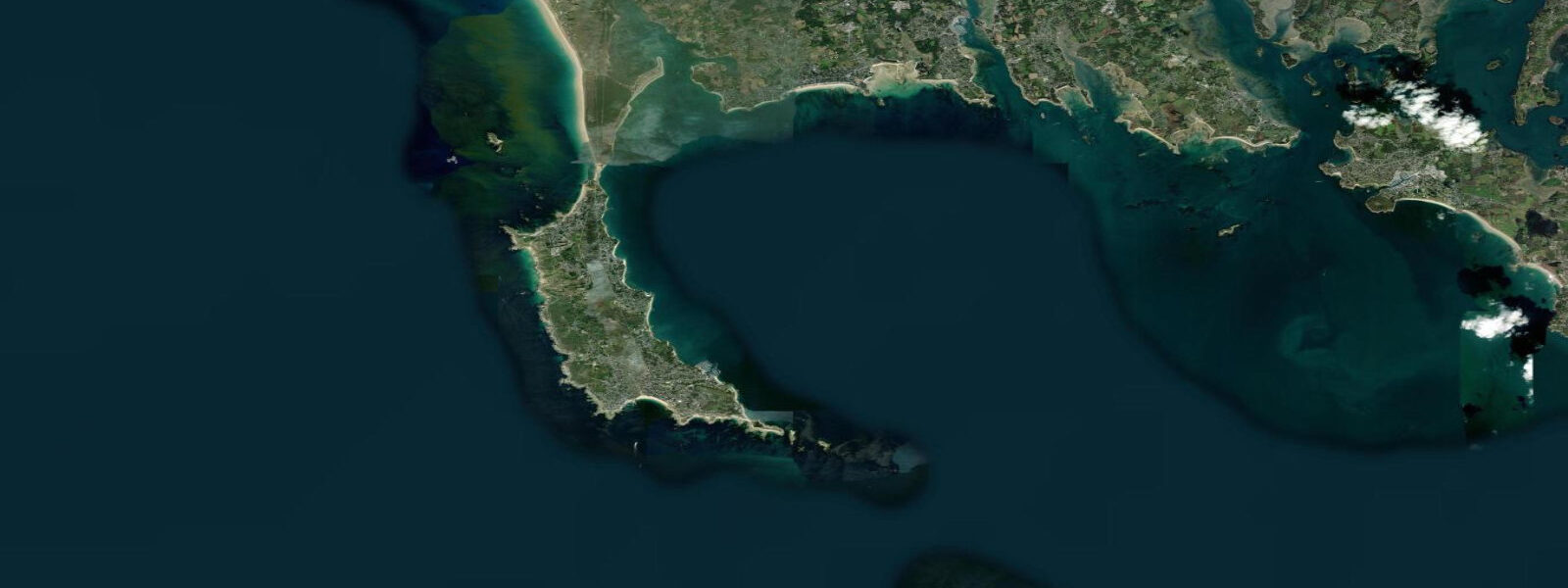
Quiberon sits at the southern tip of a 3-kilometre-wide peninsula in the Morbihan department of southern Brittany, connected to the mainland by a narrow causeway road that becomes vulnerable during the combination of extreme storm surge and high spring tide. The January 2014 and February 2020 Atlantic storms both flooded the causeway, cutting the peninsula off. That is not a remote geological fact — it is the lived condition of the 5,000 people who live here year-round, and it makes tide awareness genuinely practical.
5 metres, with the typical Breton semidiurnal pattern of two high and two low tides each day. The peninsula has two distinct personalities, divided by the spine of the land itself. On the east side, Port Maria harbour faces the sheltered Quiberon Bay — a broad, calm expanse that is one of the most productive shellfish grounds in France.
Mussel and oyster farms are laid out across the intertidal zone of the bay; the farms here have operated continuously for generations, with the tidal cycle governing when boats can access the beds and when harvest is possible. Ferries depart Port Maria for Belle-Île-en-Mer roughly every 45 minutes in summer — the crossing takes 45 minutes on the fast catamaran — and the ferry terminal, the fishing quays, and the tourist infrastructure all occupy this sheltered eastern shore. The west side — the Côte Sauvage — is a different coast entirely.
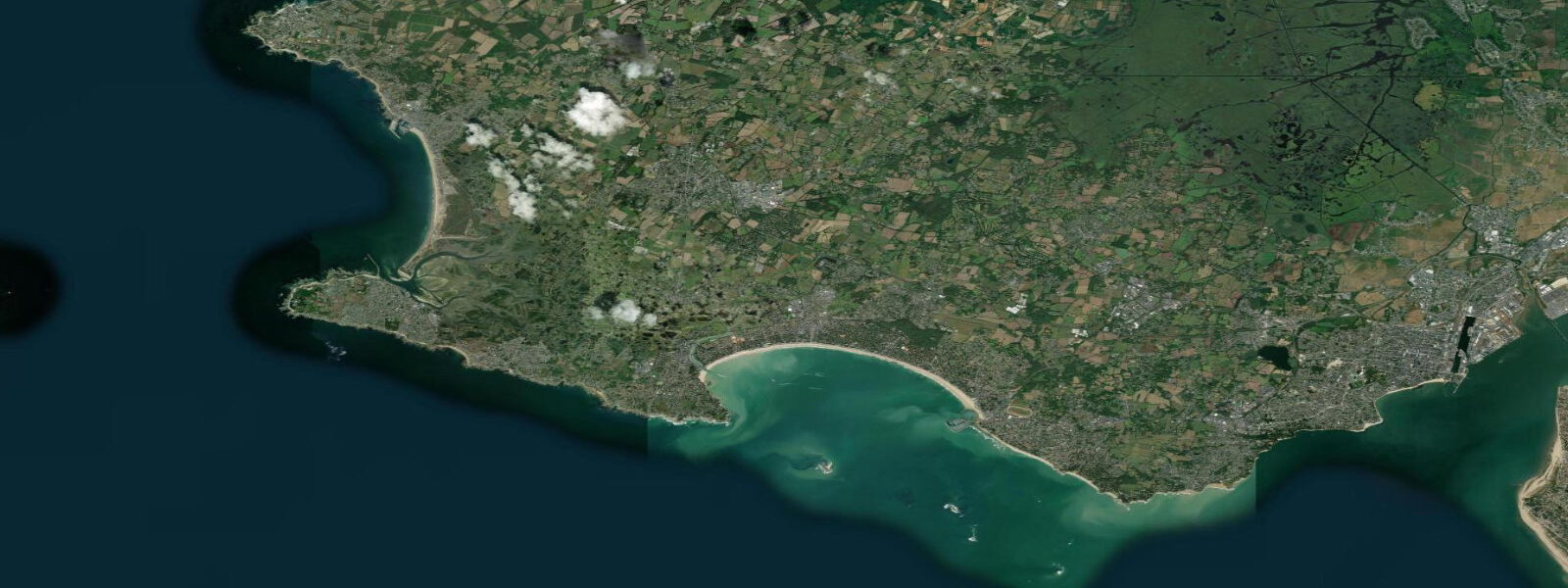
Here the full Atlantic swell from the Bay of Biscay meets the cliffs directly with no offshore shelter, and the sea state on any SW wind is dramatic. Swimming is prohibited along most of the Côte Sauvage: the combination of exposed swell, rip currents in the coves between rock outcrops, and the irregular bottom makes it genuinely hazardous, and the prohibition is not a bureaucratic formality. The cliff walk, however, is extraordinary.
The path runs the full length of the Côte Sauvage with the Atlantic in full view, and on clear days the Pen-Men lighthouse on the western tip of Belle-Île is visible across the 15 kilometres of open water. Quiberon is also established as a thalassotherapy destination — seawater therapy based on the cold, mineral-rich Atlantic water pumped directly from the bay. Several large spa centres operate here, and the thalassotherapy economy is as significant to the town as the fishing and tourism.
Low water on a big spring tide exposes extensive rock platforms along the sheltered eastern shore — accessible for rockpooling, shore fishing for bass and mullet, and collecting the wild mussels that colonise the intertidal boulders. The tidal timing shifts by approximately 50 minutes later each day across the lunar month. 5-metre spring range coast, the rate of flood across any gently sloping ground is fast enough to cut off rockpool explorers who have not checked which way the water is moving.
The neap-to-spring transition is visible in the bay itself: on large spring tides the sea retreats hundreds of metres across the shallow intertidal flats around the oyster beds, exposing ground that is fully submerged for the entire neap period. Anglers working the rocky ground on the eastern shore target bass and sea bream on the flood, with the first two hours of the incoming tide consistently the most productive window as baitfish are pushed onto the reef by the rising water. 5-metre tidal range also drives a measurable tidal current along the western side of Quiberon Bay; vessels departing Port Maria for Belle-Île need to factor the tidal stream into departure timing, particularly on spring ebbs when the current through the bay mouth runs with enough strength to affect course and speed over ground on a small motorboat.
Predictions on this page come from Open-Meteo Marine, a gridded global ocean model. 3 metres on height — model-derived, not from a local gauge. fr.
Tide questions about Quiberon
Quick answers to the most common questions about tide times, range, and water access at Quiberon.
What is the tidal range at Quiberon?
Mean spring tidal range at Quiberon is approximately 4.5 metres — two high tides and two low tides each day with around 4.5 metres of vertical difference between them at the largest tides near new and full moon. Neap range, around the quarter moons, drops to roughly 1.5 to 2 metres. The tidal pattern is semidiurnal, meaning both daily high tides are broadly similar in height, with a regular 6-hour interval between high and low water. This range is large enough to make the timing of low water significant for accessing rock platforms, oyster beds, and the ferry quay at Port Maria. For official French predictions, consult SHOM at shom.fr.
Can the Quiberon causeway road flood at high tide?
The D768 causeway connecting Quiberon to the mainland can flood during the combination of a high spring tide and significant storm surge from Atlantic low-pressure systems. This happened notably during the storms of January 2014 and February 2020, when the causeway was temporarily impassable. Normal high spring tides do not flood the road in calm conditions — the vulnerability only arises when meteorological surge adds 0.5 metres or more on top of the astronomical tide. If you are planning to drive to or from Quiberon during an Atlantic storm, check both the tide table and the local weather forecast. The regional Météo-France alert system issues coastal flooding warnings when conditions are dangerous.
Is it safe to swim along the Côte Sauvage at Quiberon?
Swimming is prohibited along most of the Côte Sauvage, the exposed Atlantic-facing western side of the Quiberon Peninsula. The combination of direct Atlantic swell exposure, rip currents in the coves between rock outcrops, and the irregular rocky bottom creates genuinely dangerous conditions independent of the tidal state. Lifeguarded swimming beaches are on the sheltered eastern side of the peninsula, facing Quiberon Bay — at Plage de Penthièvre, Plage du Goviro, and others in Port Maria. These beaches face calm, protected water and are suitable for families. The Côte Sauvage cliff walk is excellent for sightseeing but is not a swimming destination.
When do ferries run from Quiberon to Belle-Île-en-Mer, and does the tide affect them?
Ferries depart from Port Maria harbour on the eastern (sheltered) side of the Quiberon Peninsula, with Compagnie Océane operating the crossing to Belle-Île's Le Palais harbour year-round. The fast catamaran takes approximately 45 minutes; the conventional car ferry takes around 50 minutes. Service frequency increases substantially in summer — up to every 45 minutes at peak times. The ferry schedule is not directly tide-dependent because Port Maria is sheltered and the crossing is an open-water passage rather than a tidal channel transit. However, high-pressure spring departures and severe storm days can cause cancellations on the Biscay route.
Where does the tide data for Quiberon come from, and how accurate is it?
Predictions on this page come from Open-Meteo Marine, a free gridded global ocean model. They are model-derived, not from a dedicated local gauge at Quiberon — accuracy is typically within plus or minus 45 minutes on timing and 0.2 to 0.3 metres on height. Given Quiberon's 4.5-metre spring range, the height uncertainty is proportionally small and the predictions are a reliable planning reference for beach visits, rockpooling, and ferry connections. For authoritative data — navigation, commercial shellfish operations, or scientific reference — SHOM operates the French national tide gauge network and publishes the official Annuaire des marées at shom.fr.
8-day tide table — Quiberon
Heights relative to MSL. Predictions: Open-Meteo Marine (MeteoFrance SMOC, 0.08° grid) — heights relative to MSL (not chart datum / LAT). Model-derived.
| Day | Type | Time | Height |
|---|---|---|---|
| Fri 19 Jun | Low | 02:00 | -2.5m |
| High | 20:47 | 1.4m | |
| Sat 20 Jun | Low | 02:52 | -2.4m |
| High | 09:25 | 1.0m | |
| Low | 15:08 | -2.1m | |
| High | 21:43 | 1.2m | |
| Sun 21 Jun | Low | 03:46 | -2.1m |
| High | 10:22 | 0.7m | |
| Low | 16:03 | -1.9m | |
| High | 22:41 | 0.9m | |
| Mon 22 Jun | Low | 04:42 | -1.8m |
| High | 11:21 | 0.7m | |
| Low | 17:04 | -1.6m | |
| High | 23:43 | 0.7m | |
| Tue 23 Jun | Low | 05:45 | -1.7m |
| High | 12:26 | 0.5m | |
| Low | 18:10 | -1.6m | |
| Wed 24 Jun | High | 00:45 | 0.5m |
| Low | 06:45 | -1.6m | |
| High | 13:26 | 0.5m | |
| Low | 19:15 | -1.5m | |
| Thu 25 Jun | High | 01:48 | 0.6m |
| Low | 07:46 | -1.5m | |
| High | 14:19 | 0.6m | |
| Low | 20:16 | -1.5m | |
| Fri 26 Jun | High | 01:00 | 0.3m |