Naissaar Island, Estonia tide times
Naissaar Island, Estonia tide forecast — heights relative to MSL.
Today's tide times for Naissaar Island, Estonia
Tide times at Naissaar Island, Estonia on Friday, 19 June 2026: first high tide at 03:00am. Sunrise 04:02am, sunset 10:43pm.
Tide chart for Naissaar Island, Estonia
24-hour cosine-interpolated curve around the present moment. Heights relative to MSL. Predictions: Predictions: Open-Meteo Marine (MeteoFrance SMOC, 0.08° grid).
Sun, moon and conditions on Fri 19 Jun
Snapshot at build time — refreshes daily. Sea state from Open-Meteo Marine.
Highs and lows next 7 days
Every predicted high and low for the next week, with the daily tidal coefficient (0–120; higher = bigger swing, > 95 means stronger currents).
Other spots nearby
The three closest curated TideTurtle locations to Naissaar Island, Estonia, measured by great-circle distance.
Today's solunar windows
Solunar tradition: major periods are the ≈3h windows around moon transit and opposition; minor are ≈2h around moonrise and moonset. Pair with the local tide stage and wind for the best read.
About tides at Naissaar Island, Estonia
A short guide to the coastline at Naissaar Island, Estonia — geography, sea state, and what the tide is actually doing under your feet.
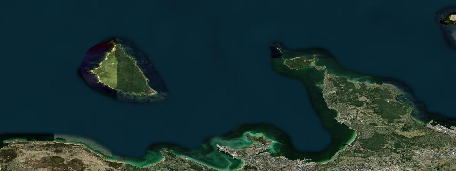
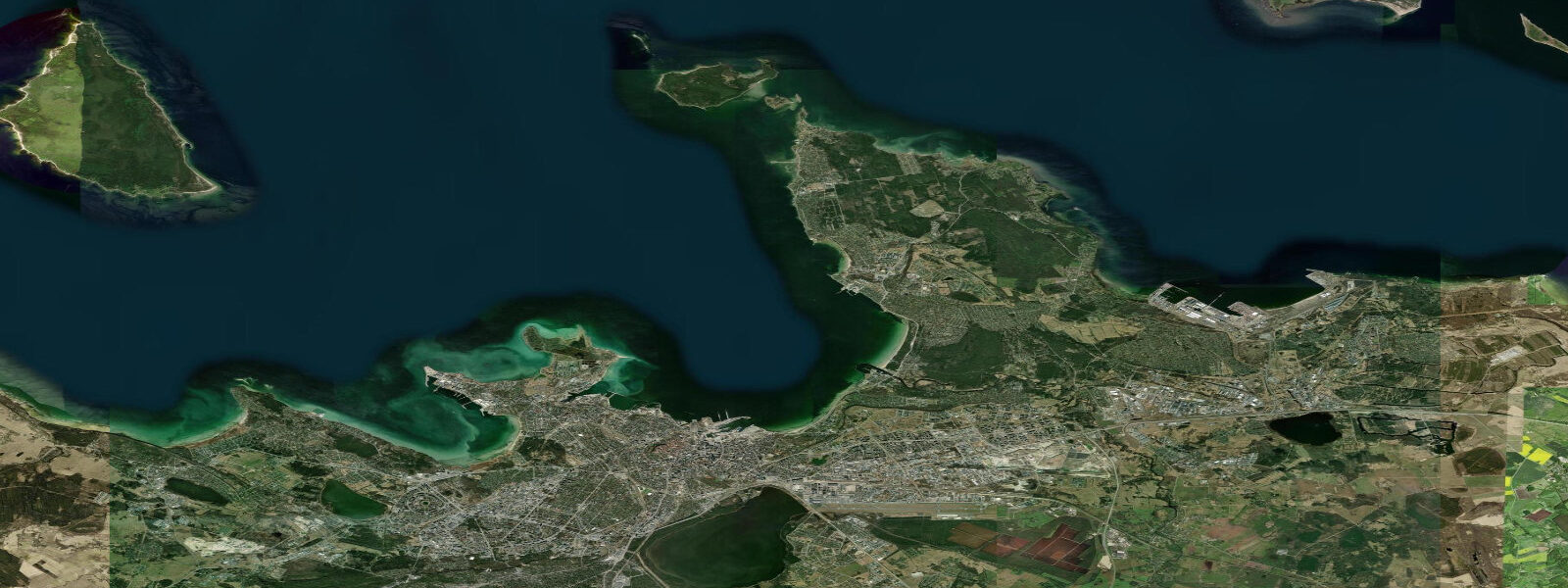
Naissaar lies 12 kilometres north of Tallinn in the Gulf of Finland — forested, uninhabited year-round, and visible from the Tallinn waterfront on any clear day as a dark horizontal band above the water. The island is 8.3 kilometres long and 3.5 kilometres wide at its broadest point. Tallinn's Old Town spires are visible from the south shore of Naissaar on a clear day. The ferry crossing from Tallinn Old Harbour takes 45 minutes in summer; the island is accessible only seasonally.
The Gulf of Finland tidal regime at Naissaar is meteorological rather than astronomical. Mean astronomical tidal range is 0.2–0.5 m — the enclosed, brackish Baltic basin produces almost no gravitational tide signal. What matters more is seasonal water level variation of 0.5–1.0 m driven by prevailing wind patterns over the Baltic and the Bothnian seas. Autumn and early winter are the periods of highest storm-surge risk: southwest winds push water eastward into the narrowing Gulf of Finland and can temporarily raise water levels significantly above mean at the island's exposed north shore. Spring and early summer tend toward lower mean water levels. For visitors, this means the shoreline character — especially on the exposed north coast — varies by season and weather event more than by time of day.
Naissaar's defining post-history is Soviet. From 1944 to 1993 the island served as a Soviet naval military base with an operational focus on naval mines. Mine production, storage, and testing facilities occupied the eastern part of the island. The Soviets built an extensive infrastructure to support the garrison: barracks, workshops, a communication tower, and an underground bunker complex. The infrastructure that draws visitors today is the narrow-gauge railway network.
The narrow-gauge railway runs approximately 9 kilometres through the island's pine forest. It was built to move military supplies and equipment between the harbour and the inland facilities. The rolling stock — small locomotives and flat-bed wagons — is partially preserved at several points along the route. The track is intact enough to walk; sections of the route pass through mature boreal forest with no other visible trace of human occupation, then emerge into open clearings where concrete bunker foundations and rusted equipment appear in the undergrowth. The railway route is the spine of any visit to Naissaar and takes roughly three hours to walk end to end at a relaxed pace.
Before the Soviet period, Naissaar was inhabited by Coastal Swedes — the ethnic Swedish-speaking communities that lived along the Estonian coast and on the Baltic islands for several centuries. The Naissaar community spoke a dialect of Swedish distinct from mainland Swedish and maintained its own fishing culture centred on the Baltic herring and cod fishery. When the Soviets occupied Estonia in 1940 and again in 1944, the Coastal Swedish communities were evacuated or fled to Sweden. The Naissaar community resettled in Sweden and did not return. The village at the south harbour — a cluster of stone foundations and remnant walls — is what they left behind. A small Lutheran church survives in partial condition.
The island's two coastlines face in opposite directions and behave differently. The north shore faces directly into the Gulf of Finland and receives the full exposure of northerly and northwesterly swell, along with storm surge from sustained southwesterlies that pile water across the gulf. It is the rougher, more exposed coast — gravel and sand beaches backed by dune ridges with the open water of the gulf running away to Finland 80 kilometres north. The south shore faces Tallinn Bay, which provides shelter from the north and northwest. Water on the south side is calmer in most conditions; the crossing to Tallinn looks deceptively short and flat.
For photographers, Naissaar delivers two distinct subjects: the Soviet industrial archaeology of the railway and bunker network in the forest, and the open coastal landscapes on the north shore. Both photograph well in the low-angle Baltic light of early morning and late afternoon. The rusted railway equipment in forest clearings requires no special access and sits exactly where it was abandoned in 1993.
The island is a protected nature reserve. No permanent residents, no cars, and limited visitor infrastructure outside the harbour area. Day visitors bring their own food. The summer ferry schedule runs from Tallinn Old Harbour; outside the season the island is inaccessible to the public. The combination of military history, Coastal Swedish heritage, and intact boreal forest makes Naissaar one of the more distinctive day trips from Tallinn.
Tide data for Naissaar Island, Estonia comes from the Open-Meteo Marine API, a gridded model product. Timing accuracy is ±45 minutes, height accuracy ±0.3 m — usable for trip planning, not for navigation.
Tide questions about Naissaar Island, Estonia
Quick answers to the most common questions about tide times, range, and water access at Naissaar Island, Estonia.
How do I get to Naissaar Island from Tallinn?
The summer ferry from Tallinn Old Harbour (Vanasadam) takes approximately 45 minutes to reach Naissaar's south harbour. Ferries run seasonally — typically late May through early September, depending on the operator's schedule. Outside the summer season the island is not accessible to the public. There is no bridge. Day visitors should check the return ferry time before arriving; missing the last boat means an unplanned overnight. Bring food and water — visitor infrastructure on the island is minimal. The ferry runs weather-dependent; crossings may be cancelled in strong northerly or southwesterly conditions.
What is the Soviet military history of Naissaar?
Naissaar served as a Soviet naval base from 1944 to 1993, with a primary focus on naval mine production, storage, and testing. The Soviets built an extensive garrison infrastructure on the island, including barracks, workshops, a narrow-gauge railway network approximately 9 km long, and underground bunker facilities. When Soviet forces withdrew in 1993, the military equipment and infrastructure were largely left in place. The narrow-gauge railway, partially preserved locomotives, and bunker foundations are now the island's main visitor attraction. The island became a nature reserve after the Soviet withdrawal; the military heritage is preserved as found.
Who lived on Naissaar before the Soviets?
Naissaar was inhabited by Coastal Swedes (Aibofolk) — ethnic Swedish-speaking communities that lived along the Estonian coast and on the Baltic islands for several centuries. The Naissaar community maintained a fishing culture centred on Baltic herring and cod, and spoke a distinct dialect of Swedish. When Soviet occupation began in 1940 and definitively in 1944, the Coastal Swedish communities were evacuated or fled to Sweden. The Naissaar community resettled in Sweden and did not return. Their village at the south harbour survives as stone foundations, remnant walls, and a partially standing Lutheran church. The Swedish-Estonian cultural heritage organisation has documented the community's history.
Does Naissaar have a meaningful tide to plan around?
No. The astronomical tidal range at Naissaar in the Gulf of Finland is 0.2–0.5 m — negligible for any practical activity. Water level variation at the island is dominated by meteorological effects: sustained southwest winds can raise levels 0.5–1.0 m above mean over a multi-day storm event, while persistent northeasterlies can lower them. The north shore is more exposed to both swell and surge; the south shore facing Tallinn Bay is considerably calmer in most conditions. Seasonal variation in mean water level (0.5–1.0 m between autumn-high and spring-low) is more relevant than the daily astronomical tide.
What is the difference between the north and south shores of Naissaar?
The north shore faces directly into the open Gulf of Finland — exposed to northerly and northwesterly swell and the full effect of storm surges from southwest winds pushing water eastward across the gulf. It is a rougher, more open coast with gravel and sand beaches backed by dune ridges. The south shore faces Tallinn Bay, which provides shelter from the north and northwest; water on this side is calmer in most wind conditions. The south harbour ��— where the ferry arrives and the Coastal Swedish village remains stand — is on the sheltered south coast. The north shore is the wilder, more dramatic coastline; the south shore is the accessible, historically inhabited one.
4-day tide table — Naissaar Island, Estonia
Heights relative to MSL. Predictions: Open-Meteo Marine (MeteoFrance SMOC, 0.08° grid) — heights relative to MSL (not chart datum / LAT). Model-derived.
| Day | Type | Time | Height |
|---|---|---|---|
| Fri 19 Jun | High | 03:00 | 0.0m |
| Sat 20 Jun | — | ||
| Sun 21 Jun | — | ||
| Mon 22 Jun | Low | 09:00 | -0.1m |