Taba, South Sinai tide times
Taba, South Sinai tide forecast — heights relative to MSL.
Today's tide times for Taba, South Sinai
Tide times at Taba, South Sinai on Friday, 19 June 2026: first low tide at 03:55am, first high tide at 10:07am. Sunrise 05:40am, sunset 07:42pm.
Tide chart for Taba, South Sinai
24-hour cosine-interpolated curve around the present moment. Heights relative to MSL. Predictions: Predictions: Open-Meteo Marine (MeteoFrance SMOC, 0.08° grid).
Sun, moon and conditions on Fri 19 Jun
Snapshot at build time — refreshes daily. Sea state from Open-Meteo Marine.
Highs and lows next 7 days
Every predicted high and low for the next week, with the daily tidal coefficient (0–120; higher = bigger swing, > 95 means stronger currents).
Other spots nearby
The three closest curated TideTurtle locations to Taba, South Sinai, measured by great-circle distance.
Today's solunar windows
Solunar tradition: major periods are the ≈3h windows around moon transit and opposition; minor are ≈2h around moonrise and moonset. Pair with the local tide stage and wind for the best read.
Cycle dates near Taba, South Sinai
Last spring tide on Fri 19 Jun (range 0.6m). Next neap on Wed 24 Jun.
Spring tides cluster around new and full moons (biggest swings). Neap tides land on quarter moons (smallest swings). See the spring tide and neap tide glossary entries for the why.
About tides at Taba, South Sinai
A short guide to the coastline at Taba, South Sinai — geography, sea state, and what the tide is actually doing under your feet.
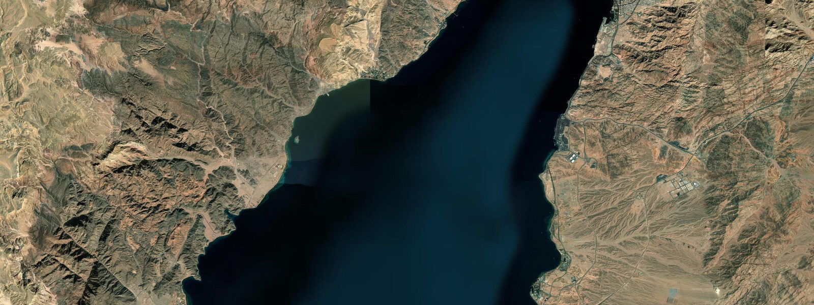
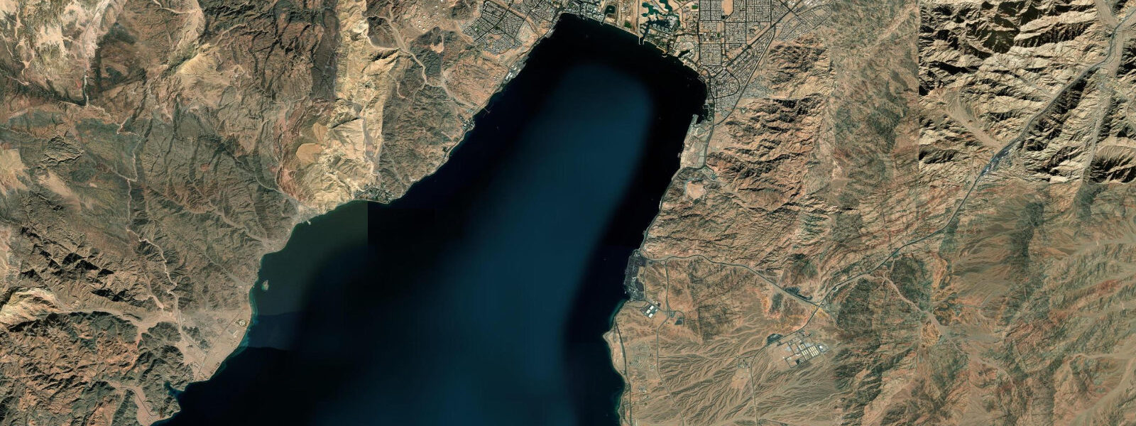
Taba is the northernmost settlement on Egypt's Gulf of Aqaba coast, and the land border crossing into Israel at Eilat is within walking distance of the beach. Stand on the shore north of the Taba Hotel and you see four countries simultaneously: Egyptian Sinai behind you, Eilat's white apartment blocks and port cranes across the water to the north-east, the Jordanian city of Aqaba 6 km to the east with its container terminal and the green hillside above it, and — further south along the Saudi coast — the shoreline of Haql. The Gulf of Aqaba is only 15 km wide at this point. It is one of the few places on earth where four sovereign borders converge within a single bay.
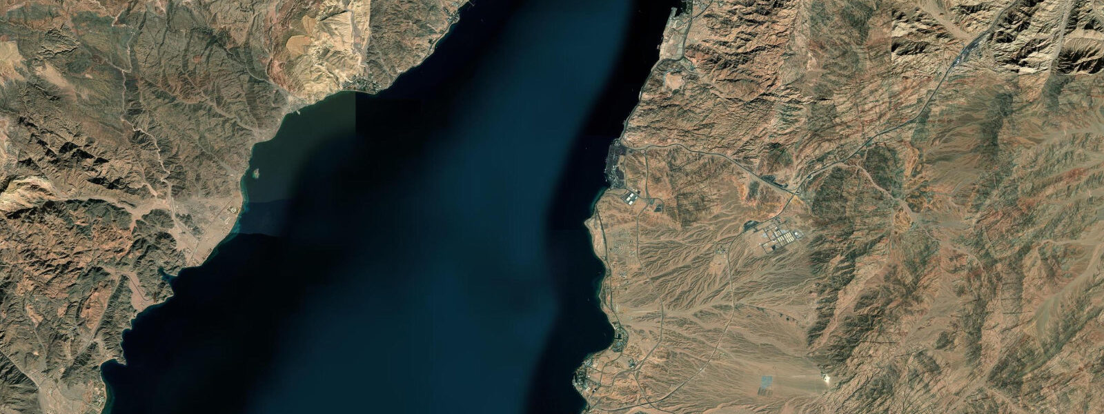
The tide at Taba is the largest on Egypt's Red Sea and Sinai coasts. The mean range here is 1.2–1.8 m, with spring tides occasionally reaching 2.0 m. This is because the Gulf of Aqaba functions as a resonant tidal basin — essentially a closed-end pipe for tidal waves. The narrow, deep trench of the Gulf channels the semidiurnal tidal wave from the Red Sea northward; as the Gulf narrows and the wave approaches the closed northern end, it has nowhere to go except up. The amplitude amplifies progressively toward Eilat and Aqaba, and Taba, at the head of the Gulf, experiences the full effect. The regime is semidiurnal: two approximately equal highs and two approximately equal lows each day.
The practical consequence on the ground is visible at low water north of the Taba Hotel. The tidal flats here expose at low water, changing the beach profile significantly. At a 1.6 m low tide (measured below the mean water level), the water's edge retreats 50–100 m from the high-water line, exposing sand and gravel flats that are completely submerged at high water. This makes beach access and equipment staging very different across the tidal cycle. Anglers and snorkellers who park at the north Taba beach access point should check whether the tide is flooding or ebbing before walking to the water's edge — the distance to the waterline can change by 80 m in two hours.
Pharaoh's Island (Île de Graye in French cartographic tradition, Jazīrat Fir'awn in Arabic) is 7 km south of Taba, accessible by short boat trip from the Egyptian coast. The island holds the ruins of a Crusader fortress, later reinforced by Saladin's forces in the 12th century. The fortress occupies the high point of the island and is visible from the coastal road. The channel between Pharaoh's Island and the Egyptian mainland is roughly 300–400 m wide and experiences tidal currents of 1.5–2.0 knots on spring tides. Boats making the crossing time their passage to avoid the strongest phases of the current, typically transiting around the slack between flood and ebb. The island is a day-trip destination; most visits run in the morning to catch the favourable current window and return before the afternoon north-westerly wind builds.
Taba Heights, 12 km south of Taba on the road toward Nuweiba, is a purpose-built resort complex set on the cliff faces above a series of small coves. The approach road descends through dramatic pink and orange granite formations. The coves below Taba Heights have their own reef systems; snorkelling from the private resort beaches is possible at all tidal states, though the deeper the water at high tide, the less navigating you need to do over shallow reef heads on the entry. Fjord Bay, further south past Taba Heights, cuts inland between vertical granite walls — the name is accurate, the setting is geologically similar to a Norwegian fjord in profile if not in temperature.
For the four-country visual: the best vantage point is the elevated ground behind the Taba border crossing on the Egyptian side, or the beach north of the Taba Hotel at dusk when the Eilat and Aqaba waterfronts are lit. The narrow width of the Gulf at this point means the lights of all four countries are visible from a single spot after dark.
For beach families, Taba's beach north of the Taba Hotel is accessible and sheltered from the dominant northerly wind by the gulf geometry. The large tidal range means children should be aware that the waterline moves significantly between morning and afternoon on a full-range day. The safest family time is the two hours around high water, when the beach profile is most consistent and the tidal flat hazard of a rapidly retreating shoreline is lowest.
For anglers, the tidal flats north of Taba are productive for wading at low water during the first of the flood, when fish move onto the exposed flat to feed as the water returns. Species here include small emperor fish, trevally, and flathead on sandy patches. The channel off Pharaoh's Island, with its spring-tide current of 1.5–2.0 knots, concentrates pelagic species: barracuda and small kingfish are taken by casting lures from the shore of the island or by trolling the channel on the flood.
Tide data for Taba, South Sinai comes from the Open-Meteo Marine API, a gridded model product. Timing accuracy is ±45 minutes, height accuracy ±0.3 m — usable for trip planning, not for navigation.
Tide questions about Taba, South Sinai
Quick answers to the most common questions about tide times, range, and water access at Taba, South Sinai.
Why are the tides at Taba so much larger than at the southern Red Sea?
The Gulf of Aqaba acts as a resonant tidal basin — a narrow, deep channel closed at its northern end. As the semidiurnal tidal wave propagates northward from the Red Sea into the Gulf, the narrowing walls and the closed-end geometry cause the wave amplitude to build progressively. At Dahab, midway up the Gulf, the mean range is 0.8–1.2 m. At Taba, near the head of the Gulf, it reaches 1.2–1.8 m, with spring tides occasionally touching 2.0 m. This compares with the near-zero tidal signal in the central Red Sea around 20°N. The full amplification from the central Red Sea minimum to the Gulf of Aqaba maximum spans roughly 0.3 m to 2.0 m over a stretch of coast about 600 km long. Taba sits at the amplified end of that gradient.
How much does the beach at Taba change between high and low tide?
On a full spring-tide cycle the water's edge north of the Taba Hotel area retreats 50–100 m from the high-water mark at low water. The tidal flat exposed is sand and gravel, and the transition happens gradually over approximately six hours. On a neap tide the range shrinks to 0.8–1.0 m and the retreat is proportionally smaller, around 30–50 m. If you are planning a beach day at Taba, the mid-to-high-water phase gives the most beach area in the water. Arriving at the beach around low tide means a longer walk to the water's edge, particularly north of the hotel area where the flat is widest. The Open-Meteo model heights carry ±0.3 m accuracy — add a safety margin when planning around low-water access.
What is the tidal current like in the channel beside Pharaoh's Island?
The channel between Pharaoh's Island (Jazīrat Fir'awn) and the Egyptian mainland is 300–400 m wide. On spring tides, the current through the channel reaches 1.5–2.0 knots. Boats making the crossing time the transit to coincide with the slack water between flood and ebb — typically a 20–30 minute window of calmer conditions. On neap tides the current is noticeably weaker, around 0.8–1.2 knots, and the crossing is straightforward for a small motor boat at any tidal phase. The current direction reverses with the tidal cycle: flooding current sets southward into the Gulf, ebbing current sets northward. Anglers trolling the channel target barracuda and kingfish during the active current phases on both flood and ebb.
Can you see all four countries from Taba?
Yes, and clearly. Standing on the beach north of the Taba Hotel you see Egyptian Sinai as the immediate landscape, Israeli Eilat directly across the water to the north-east at about 4 km, Jordanian Aqaba across to the east at approximately 6 km, and the Saudi Arabian coastline to the south-east (Haql is visible at 15–20 km in good visibility). The Gulf of Aqaba is only 15 km wide at Taba, and the lack of industrial haze on most days makes all four shorelines distinctly visible. After dark, Eilat and Aqaba are both lit and identifiable by the density and character of their waterfront lighting. The elevated ground behind the Egyptian border crossing and the beach north of the Taba Hotel are both good vantage points.
When is the best time to visit Pharaoh's Island and what tidal state is safest for the crossing?
Pharaoh's Island day trips typically depart from the Egyptian coast around 09:00–10:00, crossing when the morning slack water gives reduced current in the channel. The return trip is timed to arrive before the afternoon northerly wind builds, usually by 13:00–14:00. On spring-tide days the 1.5–2.0 knot channel current is strong enough to affect small boat handling, so departure timing matters. Operators at the Taba area shoreline know the local current pattern; confirm departure time with the boat operator rather than inferring it solely from the tidal height prediction. The Crusader fortress on the island is best photographed in the morning light from the western (mainland) approach. Bring water and sun protection — the island has limited shade outside the fortress ruins.
8-day tide table — Taba, South Sinai
Heights relative to MSL. Predictions: Open-Meteo Marine (MeteoFrance SMOC, 0.08° grid) — heights relative to MSL (not chart datum / LAT). Model-derived.
| Day | Type | Time | Height |
|---|---|---|---|
| Fri 19 Jun | Low | 03:55 | -0.3m |
| High | 10:07 | 0.3m | |
| Sat 20 Jun | Low | 05:00 | -0.3m |
| High | 11:04 | 0.3m | |
| Low | 17:15 | -0.3m | |
| High | 23:38 | 0.3m | |
| Sun 21 Jun | Low | 06:00 | -0.3m |
| Mon 22 Jun | High | 00:47 | 0.3m |
| Low | 07:06 | -0.3m | |
| Tue 23 Jun | High | 01:50 | 0.2m |
| Low | 08:18 | -0.3m | |
| Wed 24 Jun | High | 02:42 | 0.2m |
| Low | 09:12 | -0.3m | |
| High | 15:20 | 0.1m | |
| Low | 21:40 | -0.2m | |
| Thu 25 Jun | High | 03:40 | 0.1m |
| Low | 10:06 | -0.3m | |
| Fri 26 Jun | High | 02:00 | -0.0m |