Dahab, South Sinai tide times
Dahab, South Sinai tide forecast — heights relative to MSL.
Today's tide times for Dahab, South Sinai
Tide times at Dahab, South Sinai on Friday, 19 June 2026: first low tide at 03:52am, first high tide at 10:00am, second low tide at 04:15pm, second high tide at 10:37pm. Sunrise 05:44am, sunset 07:41pm.
Tide chart for Dahab, South Sinai
24-hour cosine-interpolated curve around the present moment. Heights relative to MSL. Predictions: Predictions: Open-Meteo Marine (MeteoFrance SMOC, 0.08° grid).
Sun, moon and conditions on Fri 19 Jun
Snapshot at build time — refreshes daily. Sea state from Open-Meteo Marine.
Highs and lows next 7 days
Every predicted high and low for the next week, with the daily tidal coefficient (0–120; higher = bigger swing, > 95 means stronger currents).
Other spots nearby
The three closest curated TideTurtle locations to Dahab, South Sinai, measured by great-circle distance.
Today's solunar windows
Solunar tradition: major periods are the ≈3h windows around moon transit and opposition; minor are ≈2h around moonrise and moonset. Pair with the local tide stage and wind for the best read.
Cycle dates near Dahab, South Sinai
Last spring tide on Fri 19 Jun (range 0.6m). Next neap on Thu 25 Jun.
Spring tides cluster around new and full moons (biggest swings). Neap tides land on quarter moons (smallest swings). See the spring tide and neap tide glossary entries for the why.
About tides at Dahab, South Sinai
A short guide to the coastline at Dahab, South Sinai — geography, sea state, and what the tide is actually doing under your feet.
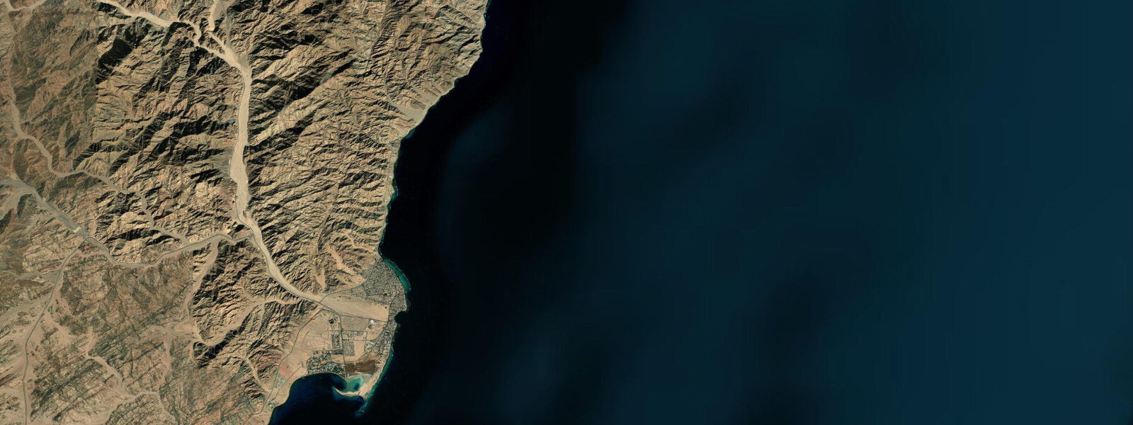
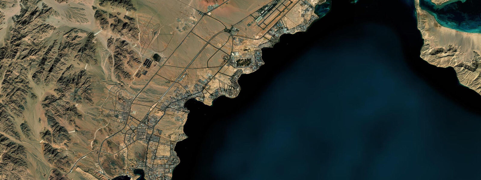
Dahab was a Bedouin fishing camp before it became a destination. That sequence still shows in the layout: the town runs along a single coastal road, the lagoon beach is the social centre, and the dive sites are accessed by walking north along the coast track or loading gear onto a small truck. The Sinai mountains rise immediately inland — bare red granite ridges that catch the light from sunrise through to late afternoon before the shadow line crosses the valley floor. The combination of mountain backdrop and clear Gulf of Aqaba water defines the visual character of Dahab as much as any specific feature.
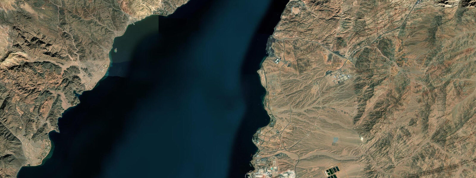
The Gulf of Aqaba is a narrow, deep rift running north from the Red Sea proper. At Dahab, the tidal regime is semidiurnal: two broadly equal highs and two broadly equal lows each day. The mean range at Dahab is 0.8–1.2 m, larger than the central Red Sea minimum but still moderate by global standards. The Gulf acts as a tidal funnel: the further north you travel toward the closed end at Eilat and Aqaba, the larger the range becomes, reaching 1.5–2.0 m at the head of the Gulf. At Dahab, midway up the Gulf, the range is in the transitional zone — noticeable but not dramatic.
The Lagoon — the main beach area fronting Dahab town — is sheltered by the reef crest offshore. The reef creates a shallow, protected flat of 0.5–1.5 m depth at low water, deepening to 2–3 m at high. Shore entry to the house reef is from the reef edge, where the flat drops to the reef slope. At low water the edge is more easily located and the short swim across the flat is shallower; at high water there is more clearance over the coral but the edge position is slightly harder to judge for first-time visitors. Both tidal states are diveable; the difference is in entry logistics rather than dive quality.
The Blue Hole is 8 km north of Dahab town on the coastal track — a roughly 20-minute drive or 2-hour walk along the shore. It is a roughly circular submarine sinkhole, approximately 300 m in diameter at the surface, dropping vertically to around 100 m depth. The rim of the sinkhole is at the surface, meaning you enter directly into open blue water from shore. The site's notoriety comes partly from the Arch: a passage connecting the interior of the Blue Hole to the open sea, starting at around 52 m on the Blue Hole side and exiting at about 56 m on the outer reef wall. The Arch itself is approximately 26 m long. Reaching and transiting the Arch requires technical dive planning — it sits well beyond recreational dive limits. The Blue Hole is diveable and frequently dived at recreational depths on its interior walls down to 30–40 m; the wall has healthy soft coral and fish life at those depths. The site's fatal history is associated specifically with attempts to reach or transit the Arch without adequate trimix planning and training.
Freedivers use the Blue Hole differently. The open circular water column in the interior is used for constant-weight and free-immersion training; the geometry — calm, enclosed, and deep — makes it one of the more famous freediving training locations in the world. World records have not been set here, but the site has hosted national and unofficial record attempts. The freediving community in Dahab has operated continuously since the late 1990s and is a significant part of the town's identity.
The Canyon, south of Dahab town, is a different geological feature: a narrow crack in the reef flat that widens into a passage descending to around 52 m. The entry is from the reef flat, and the passage requires navigating a narrow chimney section before opening into the canyon proper. It is a recreational dive site (to 30 m) and a popular introduction to overhead environment diving. Canyon access is at any tide; the shallow reef flat crossing to the entry point is easiest at mid-to-high water.
For beach families, The Lagoon is a practical beach with calm, clear water and visual depth gauging possible from the surface. The reef edge is clearly marked with buoys in the main swimming area. The tidal range of 0.8–1.2 m changes the character of the inner flat across the cycle: at low water the flat is very shallow and warm, favoured for small children; at high water there is more depth and clearer separation between swimmer and diver zones.
Photographers working Dahab typically shoot the Blue Hole at dawn before the wind arrives — the surface of the sinkhole reflects the sky cleanly in the first hour after sunrise. The Sinai mountain light in the late afternoon throws warm colour onto the granite faces visible from the Lagoon beach. The town itself photographs best before 09:00, when foot traffic is low and the light is lateral.
Tide data for Dahab, South Sinai comes from the Open-Meteo Marine API, a gridded model product. Timing accuracy is ±45 minutes, height accuracy ±0.3 m — usable for trip planning, not for navigation.
Tide questions about Dahab, South Sinai
Quick answers to the most common questions about tide times, range, and water access at Dahab, South Sinai.
What are the tides like at Dahab in the Gulf of Aqaba?
Dahab has a semidiurnal tidal regime — two roughly equal highs and two roughly equal lows each day. The mean range is 0.8–1.2 m. The Gulf of Aqaba functions as a narrowing funnel: tidal amplitude increases progressively toward the north. Dahab sits midway up the Gulf, so the range is moderate — larger than the central Red Sea minimum but smaller than at Eilat and Aqaba at the Gulf's head. The cycle runs approximately 12 hours 25 minutes per half-cycle. At Dahab, this means both highs occur roughly 12.5 hours apart, one typically in the morning and one in the evening, shifting forward by about 50 minutes each day. Heights given by Open-Meteo carry ±0.3 m accuracy; use them for trip planning only.
How deep is the Blue Hole at Dahab, and is it safe to dive?
The Blue Hole sinkhole is approximately 100 m deep, with a roughly circular opening of about 300 m diameter at the surface. Diving the interior walls to 30–40 m is a straightforward recreational dive: the walls have healthy coral and fish life and the site is accessed directly from shore without a boat. The hazard associated with the Blue Hole is The Arch — a passage at 52–56 m depth connecting the sinkhole interior to the open reef wall. Reaching The Arch requires exceeding recreational depth limits, and transiting it requires technical dive training and trimix gas planning. Recreational divers on standard air or nitrox should not attempt to approach The Arch. Freedivers use the sinkhole's open water column regularly for training dives.
What is the best time of year to dive or snorkel in Dahab?
Water temperature at Dahab ranges from around 21°C in February to 28°C in August. Visibility is high year-round in the Gulf of Aqaba — typically 20–30 m — because the Gulf has limited freshwater input and low turbidity. The best all-round conditions fall between October and May: water is comfortable in a 3 mm or 5 mm wetsuit, air temperatures are moderate, and the afternoon wind (which creates surface chop by early afternoon most days) arrives later. Summer diving is warm but the midday heat above water is intense. The Lagoon snorkel is accessible year-round; the Blue Hole is a short drive north and is visited at all seasons. Arrive at the Blue Hole before 09:00 to get calm surface conditions before the wind builds.
Does tidal height affect dive site entry in Dahab?
Yes, at sites accessed across the reef flat. The Lagoon house reef and The Canyon both involve a short crossing of a shallow reef flat to reach the entry point. At low water — particularly on spring tides when the range reaches 1.2 m — the flat can be very shallow (0.3–0.5 m), requiring careful fin removal and a wade of 20–50 m before you reach diveable depth. At mid-to-high tide the same crossing is a comfortable swim. The Blue Hole is accessed differently: you enter directly from a rocky shore into open water at the sinkhole rim, so tidal height has almost no effect on entry. For reef-flat sites in Dahab, mid-tide to high tide makes entry easier and protects the coral from fin contact.
Is freediving training available at Dahab, and how does the Blue Hole suit it?
Dahab has hosted freediving instruction for over 25 years and has multiple AIDA-accredited and SSI freediving centres. The Blue Hole is used for open-water training dives, primarily constant-weight and free-immersion disciplines, because the sinkhole geometry gives a calm, enclosed water column with a clean vertical reference line. Courses run year-round. The site's depth of 100 m is more than adequate for all recreational freediving levels (which top out at 40 m for AIDA 4-star). Training sessions typically start between 07:00 and 08:00 to use the pre-wind calm. The Lagoon is used for introductory pool-equivalent confined-water sessions in shallow, protected water. Dahab's combination of Blue Hole depth, predictable calm mornings, and established instructor community makes it one of the more practical freediving training bases in the Middle East.
7-day tide table — Dahab, South Sinai
Heights relative to MSL. Predictions: Open-Meteo Marine (MeteoFrance SMOC, 0.08° grid) — heights relative to MSL (not chart datum / LAT). Model-derived.
| Day | Type | Time | Height |
|---|---|---|---|
| Fri 19 Jun | Low | 03:52 | -0.3m |
| High | 10:00 | 0.3m | |
| Low | 16:15 | -0.3m | |
| High | 22:37 | 0.3m | |
| Sat 20 Jun | Low | 04:55 | -0.3m |
| High | 11:04 | 0.3m | |
| Low | 17:12 | -0.3m | |
| High | 23:38 | 0.3m | |
| Sun 21 Jun | Low | 05:55 | -0.3m |
| High | 12:18 | 0.3m | |
| Low | 18:20 | -0.2m | |
| Mon 22 Jun | High | 00:47 | 0.3m |
| Low | 07:00 | -0.2m | |
| High | 13:20 | 0.3m | |
| Low | 19:38 | -0.2m | |
| Tue 23 Jun | High | 01:42 | 0.3m |
| Low | 08:18 | -0.2m | |
| Wed 24 Jun | High | 02:42 | 0.2m |
| Thu 25 Jun | Low | 10:06 | -0.3m |
| High | 16:18 | 0.1m |