Agami, Alexandria tide times
Agami, Alexandria tide forecast — heights relative to MSL.
Today's tide times for Agami, Alexandria
Tide times at Agami, Alexandria on Friday, 19 June 2026: first high tide at 02:00pm. Sunrise 05:56am, sunset 08:06pm.
Tide chart for Agami, Alexandria
24-hour cosine-interpolated curve around the present moment. Heights relative to MSL. Predictions: Predictions: Open-Meteo Marine (MeteoFrance SMOC, 0.08° grid).
Sun, moon and conditions on Fri 19 Jun
Snapshot at build time — refreshes daily. Sea state from Open-Meteo Marine.
Highs and lows next 7 days
Every predicted high and low for the next week, with the daily tidal coefficient (0–120; higher = bigger swing, > 95 means stronger currents).
Other spots nearby
The three closest curated TideTurtle locations to Agami, Alexandria, measured by great-circle distance.
Today's solunar windows
Solunar tradition: major periods are the ≈3h windows around moon transit and opposition; minor are ≈2h around moonrise and moonset. Pair with the local tide stage and wind for the best read.
About tides at Agami, Alexandria
A short guide to the coastline at Agami, Alexandria — geography, sea state, and what the tide is actually doing under your feet.
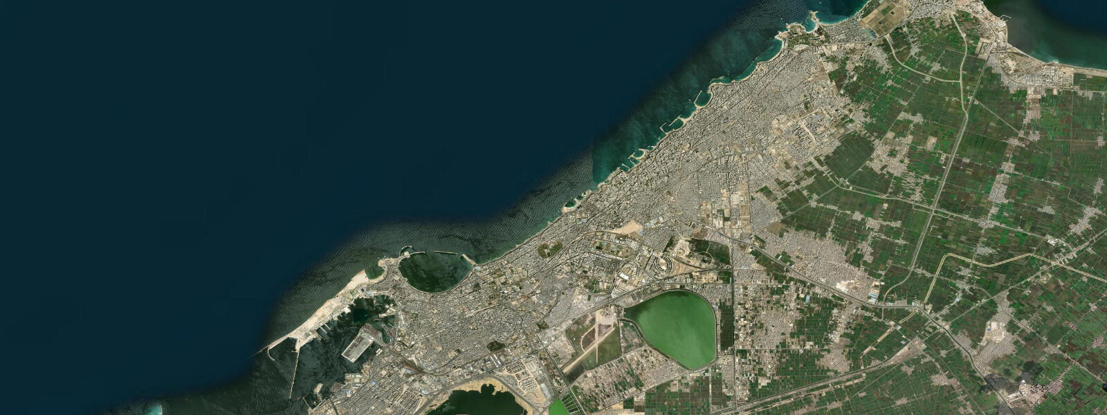
Agami is a summer resort suburb 12 km west of Alexandria city centre, on the Mediterranean coast of Egypt's western Delta. Where Sidi Bishr is urban public beach at maximum density, Agami is the villa-and-private-compound strip preferred by Egyptian middle and upper-class families for quieter conditions and controlled beach access. The character difference between the two locations is about 30 minutes of road travel and a significant shift in crowd density and beach management.
The Mediterranean tidal regime at Agami is the same as the rest of the Alexandrian coast: microtidal, with a mean range of 0.1 to 0.3 m. The astronomical tide is essentially irrelevant for beach and water-sport planning. Meteorological water level changes — storm surge from NW depressions tracking across the Mediterranean — dominate. The western Alexandria coast, with its more direct exposure to NW wind fetch, can see storm wave heights and surge that match or slightly exceed the eastern corniche during major NW events. The flat sandy beach at Agami absorbs and reflects wave energy differently from the embankment-backed beaches further east; storm surge here washes across the beach face and reaches the base of villa compounds rather than overtopping a promenade wall.
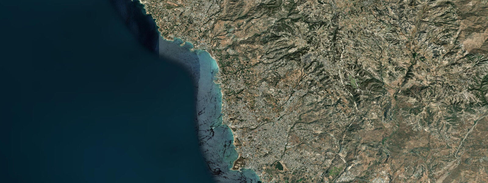
The Abu Sir lighthouse, 5 km south-southwest of Agami, is one of the primary navigational marks on the western approach to Alexandria. It stands on a rocky promontory above a wave-cut platform — the accumulated result of marine abrasion across many thousands of years of wave action at the base of the coastal limestone. The lighthouse marks the southernmost usable point on the western approach track for vessels making for Alexandria's Western Harbour. Its light is visible for 22 nautical miles on a clear night.
Directly adjacent to the Abu Sir lighthouse are the ruins of Taposiris Magna, known locally as Abu Sir temple. The site is 4 m above current mean sea level, but the original temple precinct stood at the shoreline when it was active in the Ptolemaic and Roman periods — roughly 300 BCE to 400 CE. The elevation difference between the ancient shore position and the current sea level reflects post-Roman land emergence in this part of the Egyptian coast, as the Delta platform has continued slow isostatic adjustment. The site is archaeological rather than beach-adjacent; access is from the road above the promontory, not from the water.
Agami's flat sandy beach is backed by a series of villa compounds. Public beach access exists at designated points between private developments — in practice, these are named gaps in the compound wall line rather than managed public facilities. Facilities at public access points are minimal; beach users bring equipment. The beach surface is generally clean fine sand. In summer, the beach fills with Egyptian families; in winter it is nearly empty, and the compound character of the development creates an out-of-season quiet that makes Agami more interesting for off-season walking than most Alexandrian beaches.
For paddleboarders and kayakers, Agami's beach profile presents a clean launch over a shallow sandy bottom with no reef obstruction in the nearshore zone. Morning conditions before 10:00 are typically flat — the NW sea breeze builds through late morning and by afternoon creates a 10 to 15 knot onshore wind that makes return paddling into the wind work against beginners. The absence of harbour or marina infrastructure means equipment must be transported to the beach by vehicle; there is no rental operation on the beach itself.
Beach families at Agami find the lower density relative to eastern Alexandria beaches and the villa-scale context means more space per group. Sea temperature matches the rest of the Alexandria coast: 26 to 29°C in summer, dropping to 17 to 19°C in winter. The water clarity at Agami is generally slightly better than the eastern city beaches because river discharge from the Nile Delta distributaries, which reduces clarity at the eastern sites in summer, has less influence on this western section of coast.
Photographers working the western Alexandria coast should visit Abu Sir lighthouse at first light. The rocky promontory platform, the lighthouse tower, and the adjacent temple ruins create a composition that is archaeologically specific to this coast — limestone wave-cut shelves, Roman-period masonry, and the open Mediterranean behind. Abu Qir Bay is visible 20 km to the east from the promontory elevation — on a clear morning, the lighthouse and bay form a long coastal panorama that puts the Agami shore in its full geographic context.
For shore anglers, the rocky Abu Sir platform is the productive ground — rock fish including grouper and sea bream work the wave-cut shelves at the base of the promontory. Access requires careful timing: the platform is accessible in calm weather at normal water levels but wave wash at the base is significant during NW swells. The flat Agami beach itself is limited as a shore-fishing platform; the rocky southern promontory is the productive ground.
Tide data for Agami, Alexandria comes from the Open-Meteo Marine API, a gridded model product. Timing accuracy is ±45 minutes, height accuracy ±0.3 m — usable for trip planning, not for navigation.
Tide questions about Agami, Alexandria
Quick answers to the most common questions about tide times, range, and water access at Agami, Alexandria.
What makes Agami different from the central Alexandria beaches?
Agami is a villa-and-compound suburb 12 km west of the city centre, where beach access is through named gaps between private developments rather than an open public promenade. The crowd density is substantially lower than Sidi Bishr or the central corniche beaches — Egyptian families who have access to Agami through compound membership or villa rental choose it specifically for that reason. The beach is flat, sandy, and wider on average than the erosion-prone central city beaches. Water clarity is marginally better, as the Nile Delta discharge that reduces visibility at eastern Alexandria sites has less influence on this western section of coast.
What is the Abu Sir lighthouse and can I visit it?
The Abu Sir lighthouse stands 5 km south-southwest of Agami on a rocky promontory above a wave-cut limestone platform. It marks the southernmost approach point on the western track to Alexandria's Western Harbour and is visible for 22 nautical miles. The lighthouse itself is a working navigational aid; public access to the tower interior is restricted. The Abu Sir temple ruins (Taposiris Magna) immediately adjacent are the visitor-accessible component of the site — a Ptolemaic-period temple precinct whose original shoreline position was at sea level during Roman occupation, 4 m below the current site elevation, reflecting subsequent land emergence on this section of coast.
How does tidal range affect beach and water-sport planning at Agami?
The Mediterranean at Agami is microtidal — the tidal range is 0.1 to 0.3 m, which has negligible effect on beach width or water entry depth. Planning around the tidal cycle is not meaningful here. What matters is meteorological forcing: NW storms can raise water levels 0.5 to 0.8 m above predicted astronomical level and produce wave wash that reaches the base of villa compound walls. For paddleboarding and kayaking, the relevant planning variable is wind — NW sea breeze builds from late morning to 10 to 15 knots by afternoon, making outbound paddling easy and return harder. Launch in the morning window before 10:00.
Is Agami beach accessible to visitors without a villa or compound membership?
Yes, though the access points are less obvious than a conventional public promenade. Public beach access at Agami is through designated gaps in the villa compound frontage — these are the spaces between private developments where the public right of way to the beach is maintained. There are no facilities at these points: no toilets, no changing areas, no rentals. Bring everything you need. Signage can be minimal, so first-time visitors should look for the vehicle parking areas along the road that mark the access gaps. In high summer, these public sections fill with families by mid-morning.
Where is the best shore fishing near Agami?
The Abu Sir rocky promontory, 5 km south of Agami, is the productive shore fishing ground — rock fish including grouper and sea bream work the wave-cut limestone shelves at the base of the promontory. Access requires reaching the platform, which is feasible in calm weather and unsafe in NW swell. Target the early morning before wind builds and wave energy increases. The flat Agami beach itself is limited as a fishing platform — sandy bottom species like mullet are present but the rocky promontory consistently outperforms the open beach. Check the NW swell forecast before committing to the Abu Sir platform; 1 m or higher offshore swell makes the wave-cut shelf dangerous.
6-day tide table — Agami, Alexandria
Heights relative to MSL. Predictions: Open-Meteo Marine (MeteoFrance SMOC, 0.08° grid) — heights relative to MSL (not chart datum / LAT). Model-derived.
| Day | Type | Time | Height |
|---|---|---|---|
| Fri 19 Jun | High | 14:00 | -0.3m |
| Sat 20 Jun | — | ||
| Sun 21 Jun | — | ||
| Mon 22 Jun | — | ||
| Tue 23 Jun | — | ||
| Wed 24 Jun | Low | 13:00 | -0.5m |