Havana tide times
Havana tide forecast — heights relative to MSL.
Today's tide times for Havana
Tide times at Havana on Wednesday, 29 July 2026: first low tide at 01:50am, first high tide at 09:00am. Sunrise 06:58am, sunset 08:13pm.
Tide chart for Havana
24-hour cosine-interpolated curve around the present moment. Heights relative to MSL. Predictions: Predictions: Open-Meteo Marine (MeteoFrance SMOC, 0.08° grid).
Sun, moon and conditions on Wed 29 Jul
Snapshot at build time — refreshes daily. Sea state from Open-Meteo Marine.
Highs and lows next 7 days
Every predicted high and low for the next week, with the daily tidal coefficient (0–120; higher = bigger swing, > 95 means stronger currents).
Other spots nearby
The three closest curated TideTurtle locations to Havana, measured by great-circle distance.
Today's solunar windows
Solunar tradition: major periods are the ≈3h windows around moon transit and opposition; minor are ≈2h around moonrise and moonset. Pair with the local tide stage and wind for the best read.
Cycle dates near Havana
Next spring tide on Wed 29 Jul (range 0.5m). Next neap on Sat 01 Aug.
Spring tides cluster around new and full moons (biggest swings). Neap tides land on quarter moons (smallest swings). See the spring tide and neap tide glossary entries for the why.
About tides at Havana
A short guide to the coastline at Havana — geography, sea state, and what the tide is actually doing under your feet.
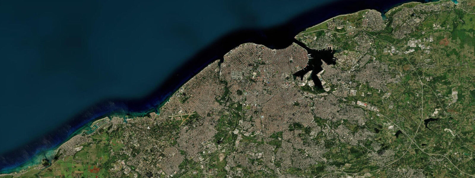
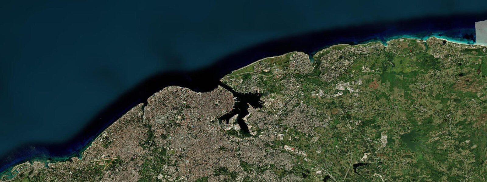
Havana faces the Florida Straits from the northern coast of Cuba, where the limestone shelf drops sharply into deep water and the Gulf Stream runs eastward only a few kilometres offshore. The tide here is mixed semidiurnal and genuinely small. Mean astronomical range inside Bahía de la Habana, the bottle-shaped harbour entered through the narrow channel between Castillo del Morro on the eastern headland and the Castillo de la Punta on the western, runs roughly 25 to 40 cm, with two unequal highs and two unequal lows each day.
The diurnal inequality is real: most lunar phases produce one stronger high and one weaker high, with a corresponding pair of lows of different magnitude. That is microtidal by any conventional measure, and it places Havana in the same practical category as the inner Baltic — the predicted high and low describe a small water-level signal that other forces routinely exceed. The dominant non-astronomical driver is weather.
Winter cold fronts (frentes fríos) sweeping down across the Gulf of Mexico arrive at the Cuban north coast as sustained northerlies that push water against the shore; during these events the wave overtopping along the Malecón seawall, from the Castillo de la Punta west past the Hotel Nacional and the Vedado coast to the mouth of the Almendares river, is the visible signature, and the elevated water level beneath the spray is real. Atmospheric pressure variation and the meander of the Florida Current contribute additional centimetres on either side of the predicted level. The Florida Current speeds and slows on a multi-day cycle, and a slower current slope offshore corresponds to a higher water level along the Cuban shore by several centimetres — small in absolute terms, but a meaningful fraction of the astronomical range.
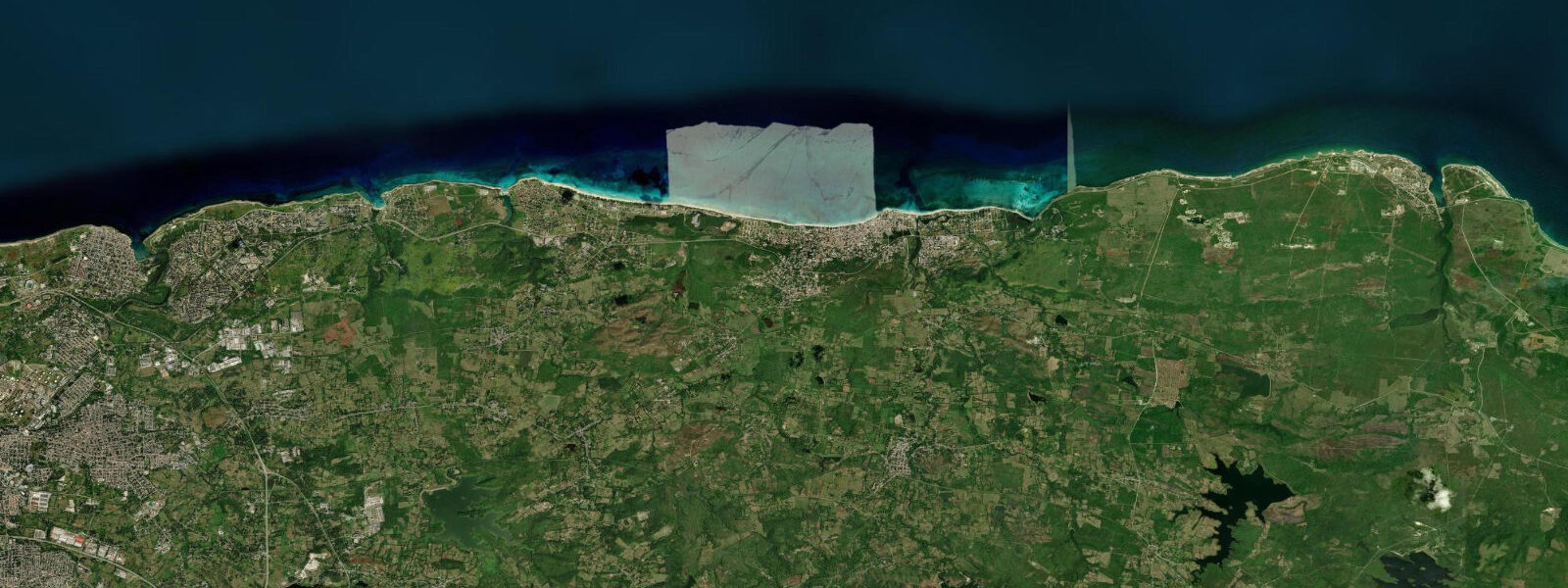
Shore anglers casting from the Malecón work the rocky shelf for jack, snapper and the occasional barracuda; they read the swell and the front forecast far more than the tide table. Paddlers launching from the Marina Hemingway west of the city or from the Bahía entrance navigate around vessel traffic and wind rather than tide state, since the current at the harbour mouth is driven by the bay-to-strait water exchange and dominated by wind setup. Beach-walkers and families heading east to Playas del Este — Santa María del Mar, Boca Ciega and Guanabo — find a wider sandy regime than the rocky urban coast offers, with gentle slope and moderate Atlantic exposure; the small tide range means the visible beach width changes only modestly between high and low, but the slope is shallow enough that the water line still moves several metres on a spring low.
Snorkellers head east to the patch reefs at Playa Jibacoa, where the inshore reef ledge holds visibility windows on calm days; the slack period either side of the predicted change of tide aligns with the clearest water. Photographers on the Malecón at sunset plan around the front cycle and the swell forecast for the dramatic overtopping shots; the tide itself is rarely the deciding factor, but the early-morning low does pull the water back from the Castillo del Morro rocks for a tighter foreground if the swell is gentle. The Vedado coast and the rocky shelf at La Puntilla, just east of the Hotel Nacional, are popular swim entry points in summer; the small tide means the access regime is similar at high and low, but the swell forecast determines whether the entry is comfortable or rough.
The authoritative tidal reference for Cuban waters is the Instituto Cubano de Hidrografía (GEOCUBA), which publishes harmonic predictions for the principal Cuban ports including La Habana. NOAA tide stations in the Florida Keys, particularly Key West, provide a useful regional cross-reference once the local offset is applied. Predictions on this page come from Open-Meteo Marine, a gridded global ocean model.
3 metres on height — is a meaningful fraction of, and in some hours exceeds, the actual astronomical signal. Treat the predicted highs and lows as approximate. For activity-critical timing, weight GEOCUBA's authoritative predictions and the front and swell forecast issued by the Instituto de Meteorología de Cuba.
Tide questions about Havana
Quick answers to the most common questions about tide times, range, and water access at Havana.
When is the next high tide at Havana?
The hero block at the top of this page shows the next predicted high at Havana in local Cuba Standard Time (CST/CDT, UTC-5/UTC-4 with daylight saving). The astronomical range here is roughly 25 to 40 cm, so the labels 'high' and 'low' describe a small swing in water level. What actually moves the water along the Malecón and inside Bahía de la Habana on most days is wind, the Florida Current and the winter front cycle. The Instituto Cubano de Hidrografía (GEOCUBA) publishes the authoritative harmonic predictions for Cuban ports.
Why is the tide range so small at Havana?
Caribbean and western Atlantic basins north of the equator have a relatively weak astronomical tidal signal compared to the open ocean and the European shelf seas. At Havana the regime is mixed semidiurnal microtidal, with mean range around 25 to 40 cm. The Gulf Stream and the Florida Current run eastward through the Florida Straits a few kilometres offshore, and meander, eddies, atmospheric pressure and wind setup routinely produce water-level changes that match or exceed the predicted tidal range. Winter cold fronts (frentes fríos) push elevated water along the Malecón that has nothing to do with the moon.
Where do these tide predictions come from?
Open-Meteo Marine, a free gridded global ocean model. The model estimates tidal height across a geographic grid rather than computing from harmonic analysis of the local Havana gauge record. Accuracy is typically within plus or minus 45 minutes on timing and 0.2 to 0.3 metres on height — at Havana, where the full astronomical range is 25 to 40 cm, that uncertainty is a meaningful fraction of the total signal. The Instituto Cubano de Hidrografía (GEOCUBA) is the authoritative source for Cuban tide data; NOAA's Key West gauge serves as a useful Florida Straits regional cross-reference.
Is it safe to walk the Malecón or fish from the seawall?
The Malecón is safe in calm weather and during light wind. The Cuban authorities close sections of the Avenida del Puerto and barricade the seawall when a frente frío or tropical system produces wave overtopping; pedestrians and anglers should respect those closures. Shore anglers fishing from the rocks at Bacuranao and the western Vedado coast work the swell windows between fronts. The tide itself rarely makes the difference between safe and unsafe — swell, wind direction, and the front cycle do. For Playas del Este beach use, ordinary Caribbean beach safety applies: easterly trade swell, gentle slope, and a generally benign regime outside named storms.
Is this safe to use for navigation?
No. Bahía de la Habana, the harbour entrance between Castillo del Morro and Castillo de la Punta, and the approaches along the Cuban north coast carry commercial shipping and require licensed pilotage and standard chart navigation. Use the Cuban official charts published by GEOCUBA, the Instituto Cubano de Hidrografía harmonic predictions, and the relevant Avisos a los Navegantes. Open-Meteo Marine gridded predictions are not gauge-calibrated harmonic data and do not replace authoritative sources for any vessel operation.
7-day tide table — Havana
Heights relative to MSL. Predictions: Open-Meteo Marine (MeteoFrance SMOC, 0.08° grid) — heights relative to MSL (not chart datum / LAT). Model-derived.
| Day | Type | Time | Height |
|---|---|---|---|
| Wed 29 Jul | Low | 01:50 | 0.3m |
| High | 09:00 | 0.7m | |
| Thu 30 Jul | Low | 02:45 | 0.3m |
| High | 09:45 | 0.7m | |
| Low | 16:50 | 0.2m | |
| Fri 31 Jul | High | 10:18 | 0.7m |
| Low | 17:10 | 0.3m | |
| High | 23:10 | 0.5m | |
| Sat 01 Aug | Low | 04:15 | 0.3m |
| High | 11:06 | 0.6m | |
| Low | 17:42 | 0.3m | |
| High | 23:45 | 0.5m | |
| Sun 02 Aug | Low | 17:54 | 0.3m |
| Mon 03 Aug | High | 00:10 | 0.6m |
| Low | 06:10 | 0.3m | |
| Tue 04 Aug | High | 00:45 | 0.6m |
| Low | 07:15 | 0.3m | |
| High | 12:50 | 0.5m |