Quepos, Puntarenas tide times
Quepos, Puntarenas tide forecast — heights relative to MSL.
Today's tide times for Quepos, Puntarenas
Tide times at Quepos, Puntarenas on Friday, 19 June 2026: first high tide at 05:20am, first low tide at 11:28am, second high tide at 05:37pm, second low tide at 11:52pm. Sunrise 05:17am, sunset 05:58pm.
Tide chart for Quepos, Puntarenas
24-hour cosine-interpolated curve around the present moment. Heights relative to MSL. Predictions: Predictions: Open-Meteo Marine (MeteoFrance SMOC, 0.08° grid).
Sun, moon and conditions on Fri 19 Jun
Snapshot at build time — refreshes daily. Sea state from Open-Meteo Marine.
Highs and lows next 7 days
Every predicted high and low for the next week, with the daily tidal coefficient (0–120; higher = bigger swing, > 95 means stronger currents).
Other spots nearby
The three closest curated TideTurtle locations to Quepos, Puntarenas, measured by great-circle distance.
Today's solunar windows
Solunar tradition: major periods are the ≈3h windows around moon transit and opposition; minor are ≈2h around moonrise and moonset. Pair with the local tide stage and wind for the best read.
Cycle dates near Quepos, Puntarenas
Next spring tide on Fri 19 Jun (range 2.5m). Next neap on Wed 24 Jun.
Spring tides cluster around new and full moons (biggest swings). Neap tides land on quarter moons (smallest swings). See the spring tide and neap tide glossary entries for the why.
About tides at Quepos, Puntarenas
A short guide to the coastline at Quepos, Puntarenas — geography, sea state, and what the tide is actually doing under your feet.
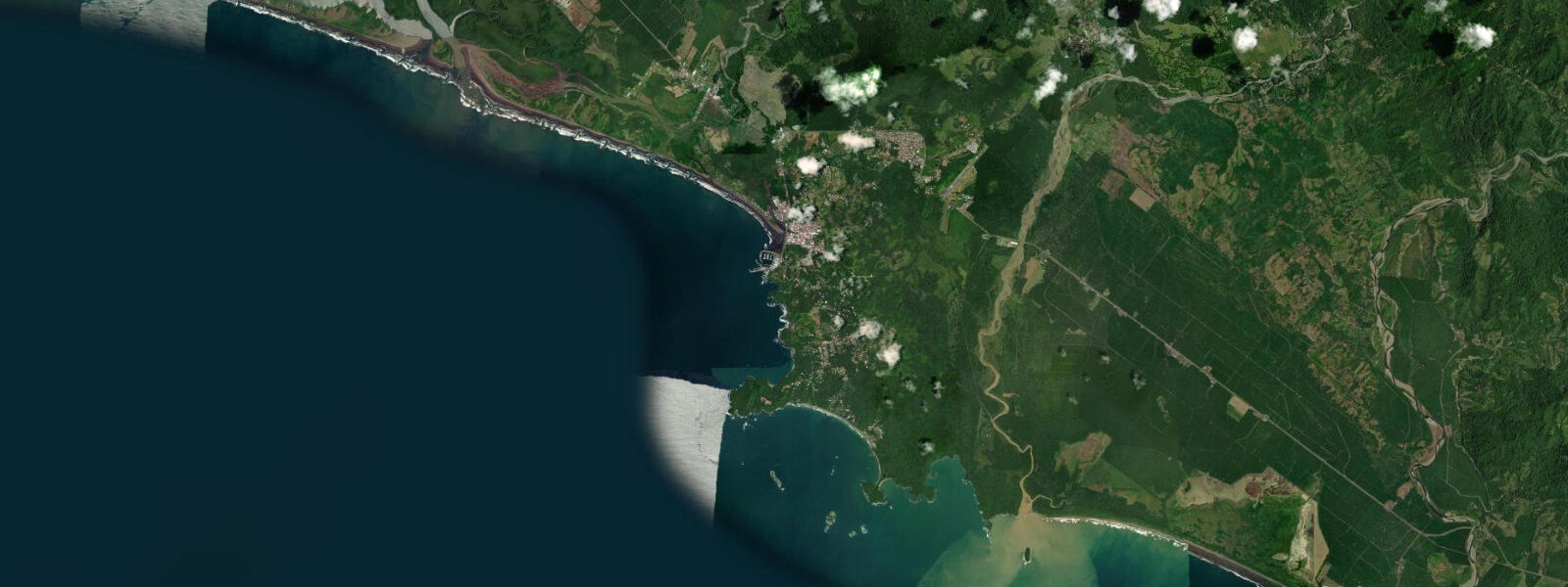
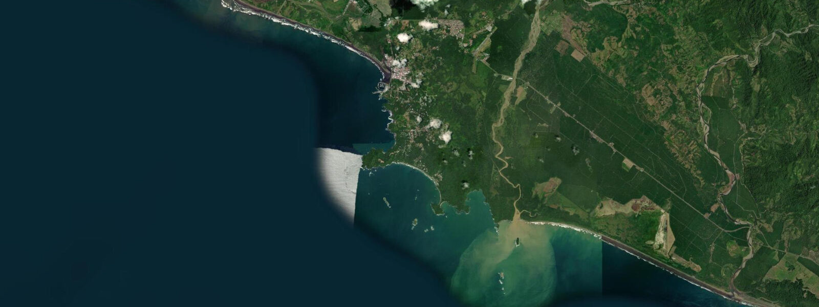
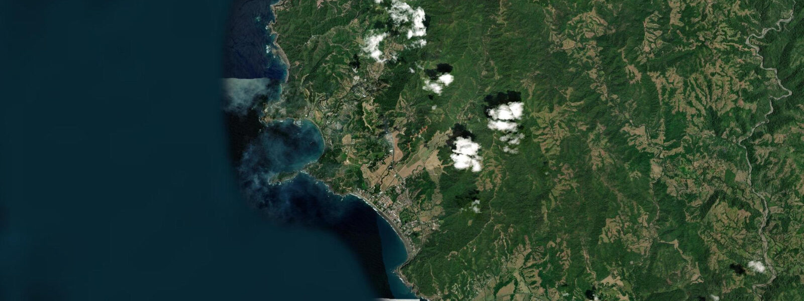
Quepos is a working port town on Costa Rica's central Pacific coast, in Puntarenas province, situated at the intersection of sportfishing infrastructure and one of the country's most-visited national parks. The marina is a serious facility; the park, 7 km south, draws hundreds of thousands of visitors per year. The tide is the thread connecting both.
The Pacific at Quepos runs semidiurnal with diurnal inequality — two highs and two lows per day, with one daily high consistently larger than the other. Mean spring range is 2.5–3.5 m, the same tidal regime that governs the entire Costa Rican Pacific coast south of the Nicoya Peninsula. Neap tides bring that range down to 1.0–1.5 m. Datum is mean lower low water (MLLW). The largest tides of the year occur during the December and June new and full moons, when ranges can push toward 3.5 m.
Marina Pez Vela, Quepos's full-service marina, is the primary infrastructure reference point for anyone bringing a vessel here. The approach channel carries 3.5–4.0 m at low spring tide — enough for most keelboats and the large charter sportfishing vessels (typically 30–43 feet with 1.2–1.5 m draft) that make up the bulk of the marina traffic. Channel clearance at high tide adds the tidal range: on a spring high of 3.0 m, the approach carries 6.5–7.0 m, which is sufficient for the occasional larger yacht transiting the Central American Pacific. The channel entrance is protected by a concrete breakwater. Current at the entrance runs 1–2 knots on spring tidal exchanges — nothing demanding for a crewed vessel, but worth timing if you are single-handing something with limited auxiliary power. Enter and exit Quepos Marina within one hour of slack water for the most comfortable approach.
The Boca Vieja estuary sits immediately north of the marina. This is a tidal mangrove system — channels cutting through mangrove forest that floods and drains with each tidal cycle. The flood tide is the productive window for fishing here: as water rises, snook (Centropomus undecimalis) and cubera snapper (Lutjanus cyanopterus) push out of the deeper channel into the mangrove fringe to feed on the baitfish and crustaceans flushed from the roots. Most local guides target the first two hours of the flood, beginning approximately 90 minutes before the predicted high. The ebb reverses the opportunity — fish drop back into the main channel as the mangrove drains. Fly fishing and light spin tackle are both productive here; the fish are not large by offshore standards but the mangrove setting makes for tight, technical work.
Seven kilometres south, Manuel Antonio National Park holds three beaches that are directly tide-controlled in their character and accessibility. Playa Espadilla Norte is outside the park boundary and connects at low water to the park entrance beach. Playa Manuel Antonio, inside the park, is sheltered and calm — a half-moon bay with gentle swimming suitable for families at any tidal stage. Playa Biesanz is a smaller cove further inside the park, accessible only on foot, with good snorkelling on its rock outcrops at low to mid tide when visibility improves.
The most photographed tidal feature in Manuel Antonio is the tombolo connecting the main beach to El Perezoso, a forested island just offshore from Playa Espadilla Norte. A tombolo is a sand bar linking an island to the mainland — at low tide, typically 0.5 m or below MLLW, the sand connection becomes walkable and the island is accessible on foot. At high spring water, the tombolo is submerged by 0.5–0.8 m and the island is entirely cut off. The transition happens fast: from a 3.0 m spring high, the water drops 1.5 m in roughly three hours, so the tombolo can go from knee-deep to ankle-deep to dry sand in under two hours. Check the tide table before crossing — the return window can close faster than expected if you linger on the island.
Quepos's offshore sportfishing targets are among the best on the Pacific coast. Pacific sailfish (Istiophorus platypterus) are present year-round, with peak months November through April. The boats leave Marina Pez Vela before 06:00 on most fishing days, timing the offshore run to reach productive water around first light. Tidal state matters less offshore than inshore — sailfish follow current breaks and temperature gradients — but inshore structure fishing around the headlands south of the marina is tide-sensitive, with the ebb exposing rocky structure that holds roosterfish and jack crevalle.
Tide data for Quepos, Puntarenas comes from the Open-Meteo Marine API, a gridded model product. Timing accuracy is ±45 minutes, height accuracy ±0.3 m — usable for trip planning, not for navigation.
Tide questions about Quepos, Puntarenas
Quick answers to the most common questions about tide times, range, and water access at Quepos, Puntarenas.
What is the minimum depth in Quepos Marina channel at low spring tide?
The approach channel to Marina Pez Vela at Quepos carries 3.5–4.0 m at low spring tide — the minimum depth you should plan against when entering or departing on a falling or low tide. Most charter sportfishing vessels operating out of the marina draft 1.0–1.5 m, so there is comfortable clearance at all tidal stages. For deeper-draft cruising yachts, add the tidal range to the low-water depth for high-tide clearance: on a 3.0 m spring high, the channel carries 6.5–7.0 m. The channel entrance current runs 1–2 knots on spring tidal exchanges. Vessel operators with limited auxiliary power should plan to arrive or depart within one hour of slack water. Contact the marina directly for current dredging status and any reported shoaling before your approach.
When is the best time to fish the Boca Vieja mangrove estuary near Quepos?
The productive window in Boca Vieja is the flood tide — the first two hours of rising water, beginning roughly 90 minutes before the predicted high. As water levels climb, snook (Centropomus undecimalis) and cubera snapper (Lutjanus cyanopterus) move from the main channel into the mangrove fringe to feed. Most local guides recommend arriving at the estuary mouth about 45 minutes before the flood begins so you are positioned when the fish start moving. The last hour of the ebb can also produce fish holding in the outflow current at the channel mouth. Avoid the slack high — fish stop feeding once the current stalls. Check tideturtle.com for the Quepos tide prediction the evening before to plan your entry time precisely.
Can I walk to El Perezoso island at Manuel Antonio at low tide?
Yes — at low water the tombolo connecting Playa Espadilla Norte to El Perezoso island is walkable. The sand bar is exposed when the tide falls to roughly 0.5 m above MLLW or lower, which happens during both the morning and afternoon low on most days. The crossing itself is 50–80 m and ankle to knee deep during the transition period. The critical planning factor is timing your return: on a spring tidal cycle with a 3.0 m range, the tide rises 1.5 m in approximately three hours — the tombolo can go from dry sand to knee-deep in under 90 minutes once the flood starts. Check the Manuel Antonio tide prediction on tideturtle.com before crossing. Do not attempt the crossing during a rising tide if the water is already above ankle depth.
What fish are targeted from Quepos Marina and what time of year are they best?
Quepos is one of the best Pacific sailfish destinations in Central America. Pacific sailfish (Istiophorus platypterus) are present year-round with peak action from November through April when consistent northerly tradewinds push baitfish schools toward the coast. Dorado (Mahi-mahi) peak from May through September during the rainy season. Yellowfin tuna are caught year-round offshore. Inshore from the marina headlands, roosterfish and jack crevalle respond to structure fishing at low tide when rocky points are most exposed. Charter boats depart Marina Pez Vela before 06:00 to reach productive water at first light. Half-day inshore trips target the headlands and inshore reefs; full-day offshore trips run 30–50 km to reach blue water where billfish concentrate along temperature breaks and current edges.
How does the tide affect beach conditions inside Manuel Antonio National Park?
The three beaches inside Manuel Antonio National Park behave differently at different tidal stages. Playa Manuel Antonio, the main crescent beach inside the park, is protected by headlands and calm at all tidal stages — the best family swimming beach in the area regardless of tide. Playa Biesanz, a smaller cove accessible by trail, has good snorkelling on its rock outcrops at low to mid tide when water clarity improves and the depth over the rocks drops to 1–2 m. Playa Espadilla Norte, just outside the park, is widest and flattest at low water. The tombolo to El Perezoso island (see above) is the most dramatically tide-dependent feature: walkable at low water, submerged at high. Plan your park visit to arrive at or just after the morning low tide to get both the tombolo crossing and the best snorkelling conditions at Biesanz.
7-day tide table — Quepos, Puntarenas
Heights relative to MSL. Predictions: Open-Meteo Marine (MeteoFrance SMOC, 0.08° grid) — heights relative to MSL (not chart datum / LAT). Model-derived.
| Day | Type | Time | Height |
|---|---|---|---|
| Fri 19 Jun | High | 05:20 | 1.7m |
| Low | 11:28 | -0.7m | |
| High | 17:37 | 1.7m | |
| Low | 23:52 | -0.8m | |
| Sat 20 Jun | High | 06:13 | 1.7m |
| Low | 12:23 | -0.5m | |
| High | 18:32 | 1.6m | |
| Sun 21 Jun | Low | 00:45 | -0.6m |
| High | 07:06 | 1.7m | |
| Low | 13:20 | -0.4m | |
| High | 19:27 | 1.4m | |
| Mon 22 Jun | Low | 01:39 | -0.5m |
| High | 08:01 | 1.5m | |
| Low | 14:21 | -0.3m | |
| High | 20:26 | 1.2m | |
| Tue 23 Jun | Low | 02:32 | -0.4m |
| High | 08:57 | 1.4m | |
| Low | 15:21 | -0.3m | |
| Wed 24 Jun | High | 09:54 | 1.4m |
| Low | 16:23 | -0.3m | |
| Thu 25 Jun | High | 10:48 | 1.4m |
| Low | 17:00 | -0.3m |