San Antonio, Valparaíso Region tide times
San Antonio, Valparaíso Region tide forecast — heights relative to MSL.
Today's tide times for San Antonio, Valparaíso Region
Tide times at San Antonio, Valparaíso Region on Friday, 19 June 2026: first high tide at 01:11, first low tide at 06:39, second high tide at 13:15, second low tide at 20:08. Sunrise 07:50, sunset 17:45.
Tide chart for San Antonio, Valparaíso Region
24-hour cosine-interpolated curve around the present moment. Heights relative to MSL. Predictions: Predictions: Open-Meteo Marine (MeteoFrance SMOC, 0.08° grid).
Sun, moon and conditions on Fri 19 Jun
Snapshot at build time — refreshes daily. Sea state from Open-Meteo Marine.
Highs and lows next 7 days
Every predicted high and low for the next week, with the daily tidal coefficient (0–120; higher = bigger swing, > 95 means stronger currents).
Other spots nearby
The three closest curated TideTurtle locations to San Antonio, Valparaíso Region, measured by great-circle distance.
Today's solunar windows
Solunar tradition: major periods are the ≈3h windows around moon transit and opposition; minor are ≈2h around moonrise and moonset. Pair with the local tide stage and wind for the best read.
Cycle dates near San Antonio, Valparaíso Region
Next spring tide on Fri 19 Jun (range 1.3m). Next neap on Mon 22 Jun.
Spring tides cluster around new and full moons (biggest swings). Neap tides land on quarter moons (smallest swings). See the spring tide and neap tide glossary entries for the why.
About tides at San Antonio, Valparaíso Region
A short guide to the coastline at San Antonio, Valparaíso Region — geography, sea state, and what the tide is actually doing under your feet.
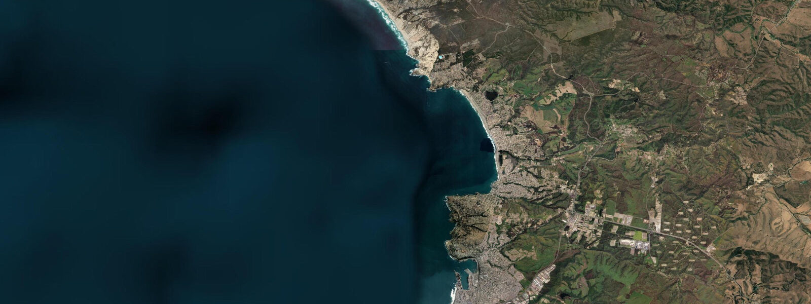
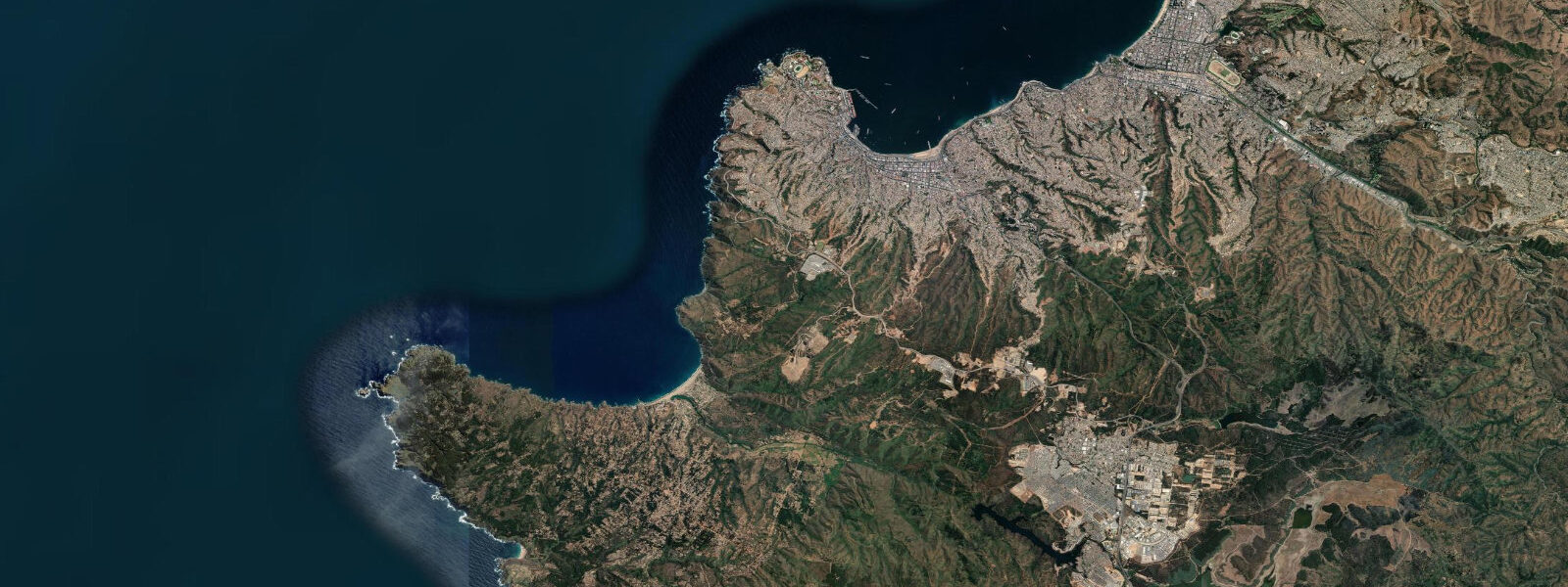
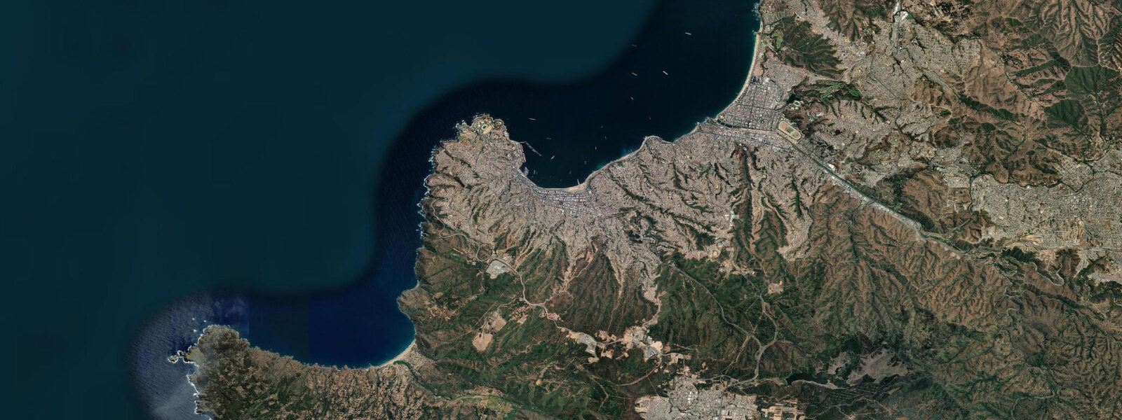
San Antonio is 100 km south of Valparaíso on Chile's Pacific coast — a working port city where the tide matters for commercial reasons before it matters for recreation. The port handles more fresh fruit export volume than any other in Chile: table grapes, apples, and citrus move through here in refrigerated containers bound for Europe and Asia, loaded onto vessels whose keel clearance in the navigation channel depends on where the tide stands. The largest refrigerated cargo ships operate at draught limits that require tide planning on neap lows, when the range compresses to the lower end of the 1.2–1.8 m spring range and channel depth is at its minimum.
The semidiurnal Pacific tide at San Antonio produces a mean spring range of 1.2–1.8 m — the same regime as Viña del Mar 100 km to the north and Cartagena 5 km to the north of the port. High spring water reaches approximately 1.5–1.6 m above chart datum; neap lows sit around 0.2–0.3 m. The Humboldt Current offshore keeps surface temperatures in the 13–16°C range, with pronounced upwelling events in the austral winter pushing surface readings below 13°C for short periods. The current runs north at 0.5–1.5 knots parallel to the coast, strongest offshore, weaker inshore where the seafloor shoals.
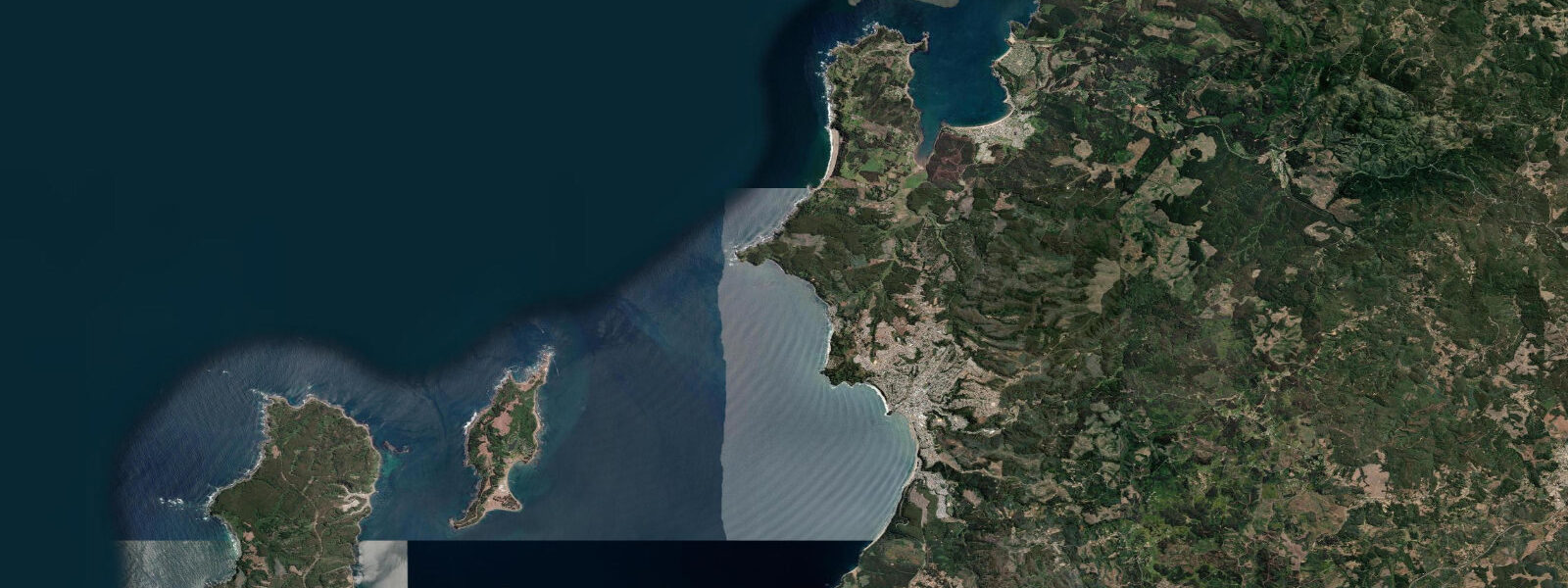
The Río Maipo discharges into the Pacific 10 km south of the port at Llolleo. The Maipo is the longest and most hydrologically significant river in central Chile — it drains the snowmelt from the Andes above Santiago and supplies most of the freshwater to the Santiago metropolitan area. Where it meets the Pacific at Llolleo, the estuary opens into a shallow tidal flat that floods on each rising tide and drains on the ebb. The flat is a bird-watching zone: black-necked swans (Cygnus melancoryphus) feed on the aquatic vegetation in the shallower sections, Chilean flamingos (Phoenicopterus chilensis) probe the mudflat margins, and a range of shorebirds — oystercatchers, godwits, sandpipers — work the tide line as it moves. The incoming tide compresses the accessible mudflat area and concentrates the shorebirds toward the upper estuary edges; the two hours after low water, when the flat is draining but still shallow, produce the highest bird density. A gravel track off the Panamericana Sur reaches the Llolleo estuary bank without requiring four-wheel drive.
Twenty kilometres south of San Antonio, on a clifftop above the Pacific at Isla Negra, stands the house Pablo Neruda used as his primary residence for the last decades of his life. The house — known as Casa de Isla Negra — is now a Fundación Neruda museum, open to the public. Neruda accumulated objects obsessively: ship figureheads, bottles, maps, telescopes, compasses, and nautical instruments fill the rooms. The house perches above the Pacific on a cliff of wave-cut rock; the view from the study window Neruda used is a direct westward line to open ocean. A Humboldt penguin colony occupies the rocks below the cliff, visible from the museum grounds. The penguins nest in crevices in the wave-cut platform and are undisturbed by the museum visitors above.
Cartagena — the Chilean coastal town, not the Colombian port — is 5 km north of San Antonio. Playa de Cartagena is a 1 km arc of sand with a pier that projects 150 m into the Pacific at the northern end. Shore fishing from the pier targets corvina, lisa (Mugil cephalus, grey mullet), and reineta (Brama australis, Pacific pomfret) on the incoming tide. The corvina and reineta feed actively in the two hours before high water when the current picks up bait against the pier pilings. Lisa are taken throughout the tidal cycle but concentrate at the pier base during the tide change. Santiago is 100 km inland via the Autopista del Sol — a 90-minute drive on a clear run — which makes Cartagena and San Antonio viable day-trip destinations from the capital on summer weekends.
For paddlers and kayakers, the San Antonio coastline is exposed and requires appropriate experience and equipment. There is no sheltered bay comparable to Pucusana to the north; the coast runs as open cliff and beach with occasional rocky headlands. The Cartagena pier provides a launch reference and some wind shelter on its lee side. Kayaking to Isla Negra from Cartagena (approximately 15 km each way) is an experienced-paddler route — the Humboldt Current runs north and the return leg against it requires planning for wind and current windows. Most visitors reach Isla Negra by road.
Tide data for San Antonio, Valparaíso Region comes from the Open-Meteo Marine API, a gridded model product. Timing accuracy is ±45 minutes, height accuracy ±0.3 m — usable for trip planning, not for navigation.
Tide questions about San Antonio, Valparaíso Region
Quick answers to the most common questions about tide times, range, and water access at San Antonio, Valparaíso Region.
How does the tide affect port operations and vessel movements at San Antonio?
San Antonio is Chile's busiest fresh-fruit export port, and the largest refrigerated cargo vessels calling here operate at draught limits that make tidal state relevant. The navigation channel depth constrains some vessels on neap lows, when the tidal range compresses to the lower end of the 1.2–1.8 m spring range and minimum water depths occur. Port pilots and vessel operators reference official Chilean hydrographic service (SHOA) tide tables for scheduling deep-draught movements. For recreational users — kayakers, fishing boats, beach visitors — the tidal range produces manageable conditions with no navigation constraints on small craft at any tide state.
When is the best time to watch birds at the Río Maipo estuary at Llolleo?
The Río Maipo estuary at Llolleo, 10 km south of San Antonio, is most productive for bird-watching in the two hours after low water, when the tidal flat is draining and the receding tide concentrates shorebirds — oystercatchers, godwits, sandpipers — toward the shallow margins. Black-necked swans feed in the shallower vegetated sections throughout the tidal cycle. Chilean flamingos probe the mudflat margins on the rising tide. Morning visits after a neap low (lower tidal range, longer period of exposed flat) maximise the accessible habitat area. Access is via a gravel track off the Panamericana Sur without requiring four-wheel drive. The spring range of 1.2–1.8 m means the flat floods and drains significantly with each cycle.
Can I visit Pablo Neruda's house at Isla Negra from San Antonio?
Casa de Isla Negra, Pablo Neruda's primary residence and now a Fundación Neruda museum, is 20 km south of San Antonio by the coastal road. The museum is open to the public (check Fundación Neruda's website for current hours and booking requirements — timed entry is often required in summer). Neruda's collection of ship figureheads, nautical instruments, maps, and bottles fills the rooms; the house sits on a cliff with a direct Pacific view. A Humboldt penguin colony occupies the wave-cut rock platform below the cliff, visible from the museum grounds without descending to the shore. The drive from San Antonio takes approximately 25 minutes. Santiago is 100 km inland — Isla Negra is a viable day trip from the capital.
What fish can I catch from the pier at Cartagena beach near San Antonio?
Shore fishing from the Cartagena pier, 5 km north of San Antonio, targets corvina (Cilus gilberti), lisa (Mugil cephalus, grey mullet), and reineta (Brama australis, Pacific pomfret). Corvina and reineta feed most actively in the two hours before high water when tidal current concentrates bait against the pier pilings. Lisa are taken throughout the tidal cycle but concentrate at the pier base during the tide change. The mean spring range of 1.2–1.8 m produces a moderate tidal current at the pier that improves fishing versus the slack around high and low water. Autumn and winter (April–August) are the most productive seasons as Humboldt Current upwelling intensifies and bait-fish concentrations increase.
How accurate is the tide data for San Antonio on tideturtle.com?
Tide predictions for San Antonio come from the Open-Meteo Marine API, a gridded global model. Timing accuracy is ±45 minutes and height accuracy is ±0.3 m. For the port's commercial navigation operations, official SHOA (Servicio Hidrográfico y Oceanográfico de la Armada de Chile) tide tables are the correct reference — not tideturtle.com. For recreational uses — timing fishing sessions at the Cartagena pier, planning bird-watching visits to the Maipo estuary at Llolleo, or organising a beach day to Cartagena — the tideturtle.com predictions are reliable enough. The ±45 minute timing window means arriving 45–60 minutes before the predicted low or high water will keep you within the target tidal window.
7-day tide table — San Antonio, Valparaíso Region
Heights relative to MSL. Predictions: Open-Meteo Marine (MeteoFrance SMOC, 0.08° grid) — heights relative to MSL (not chart datum / LAT). Model-derived.
| Day | Type | Time | Height |
|---|---|---|---|
| Fri 19 Jun | High | 01:11 | 0.3m |
| Low | 06:39 | -0.5m | |
| High | 13:15 | 0.8m | |
| Low | 20:08 | -0.6m | |
| Sat 20 Jun | High | 02:08 | 0.3m |
| Low | 07:40 | -0.4m | |
| High | 14:06 | 0.7m | |
| Low | 20:57 | -0.6m | |
| Sun 21 Jun | High | 03:02 | 0.3m |
| Low | 08:50 | -0.4m | |
| High | 15:00 | 0.5m | |
| Low | 21:46 | -0.6m | |
| Mon 22 Jun | High | 04:10 | 0.3m |
| Low | 10:03 | -0.3m | |
| High | 16:00 | 0.3m | |
| Low | 22:36 | -0.5m | |
| Tue 23 Jun | High | 05:07 | 0.3m |
| Low | 11:21 | -0.3m | |
| High | 17:04 | 0.2m | |
| Low | 23:22 | -0.4m | |
| Wed 24 Jun | High | 06:07 | 0.4m |
| Low | 12:37 | -0.3m | |
| High | 18:12 | 0.2m | |
| Thu 25 Jun | Low | 00:06 | -0.4m |
| High | 06:54 | 0.5m | |
| Low | 13:37 | -0.3m | |
| High | 19:00 | 0.1m |