Charlottetown, PEI tide times
Charlottetown, PEI tide forecast — heights relative to MSL.
Today's tide times for Charlottetown, PEI
Tide times at Charlottetown, PEI on Sunday, 21 June 2026: first high tide at 03:27pm, first low tide at 10:00pm. Sunrise 05:20am, sunset 09:07pm.
Tide chart for Charlottetown, PEI
24-hour cosine-interpolated curve around the present moment. Heights relative to MSL. Predictions: Predictions: Open-Meteo Marine (MeteoFrance SMOC, 0.08° grid).
Sun, moon and conditions on Sun 21 Jun
Snapshot at build time — refreshes daily. Sea state from Open-Meteo Marine.
Highs and lows next 7 days
Every predicted high and low for the next week, with the daily tidal coefficient (0–120; higher = bigger swing, > 95 means stronger currents).
Other spots nearby
The three closest curated TideTurtle locations to Charlottetown, PEI, measured by great-circle distance.
Today's solunar windows
Solunar tradition: major periods are the ≈3h windows around moon transit and opposition; minor are ≈2h around moonrise and moonset. Pair with the local tide stage and wind for the best read.
Cycle dates near Charlottetown, PEI
Next spring tide on Sun 21 Jun (range 1.6m). Next neap on Thu 25 Jun.
Spring tides cluster around new and full moons (biggest swings). Neap tides land on quarter moons (smallest swings). See the spring tide and neap tide glossary entries for the why.
About tides at Charlottetown, PEI
A short guide to the coastline at Charlottetown, PEI — geography, sea state, and what the tide is actually doing under your feet.
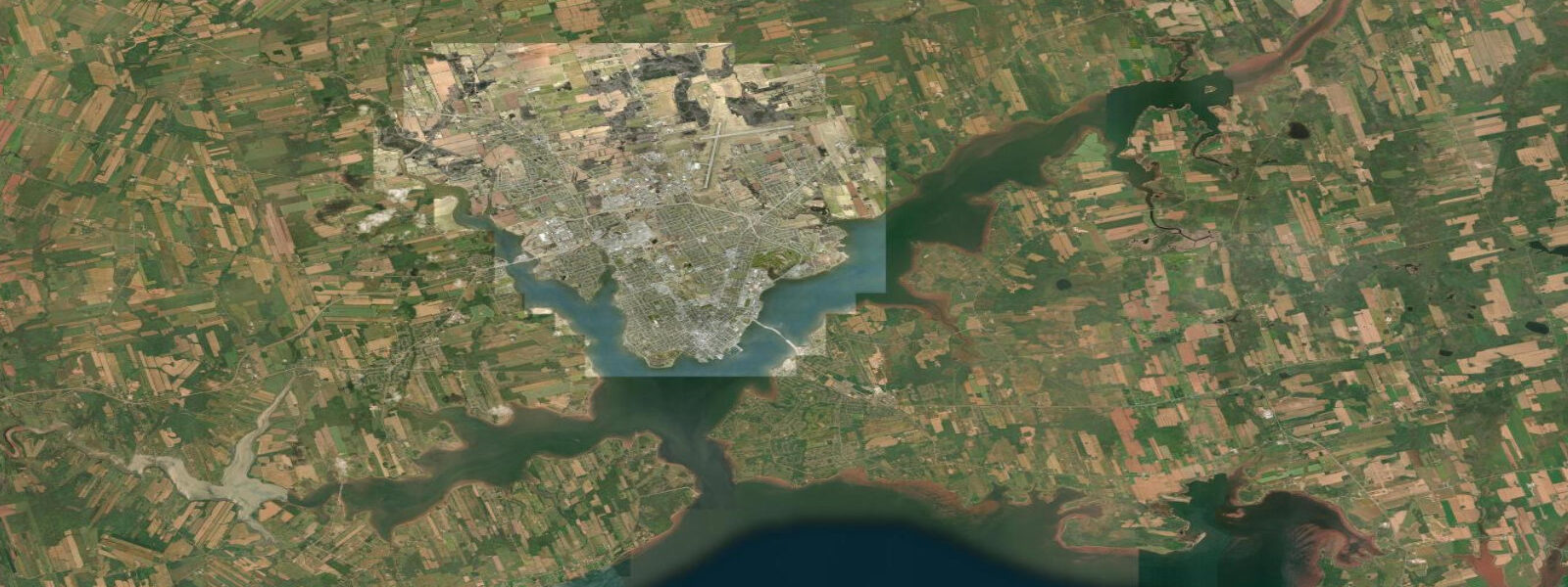
Charlottetown sits at the head of the Hillsborough River estuary on PEI's south coast, where three rivers — the North, West, and Hillsborough — converge before opening into Northumberland Strait. The harbour is sheltered, the water warm by Canadian standards, and the tidal range is moderate: mean range approximately 1.2 metres above MLLW; spring range reaching around 1.5 metres. The Hillsborough River estuary is tidal for several kilometres upstream from the harbour; the twice-daily tidal flushing drives the renewal cycle that sustains the oyster and mussel beds in the bays and coves around the city.
Charlottetown is the provincial capital and the 'Birthplace of Confederation' — Province House on Great George Street hosted the Charlottetown Conference of September 1864, the first of the three conferences that produced the Canadian Confederation in 1867. Province House (1847, Italianate sandstone) is a national historic site; the confederation chamber interior is preserved. The city's identity is layered between that 19th-century constitutional weight and the present-day food, arts, and tourism economy that PEI has built since the 1990s.
The Victoria Park waterfront on the southwest side of the city runs along the Charlottetown Harbour, with views across to Rocky Point on the west shore of the Hillsborough River. At low water the tidal flats below the park are exposed — red-sand intertidal zone, accessible for clamming and birdwatching. The Victoria Row arts district and the Peake's Wharf waterfront development are the commercial-cultural anchors of the downtown.
PEI's food economy is tidal in the most literal sense. Malpeque oysters, grown in the bays of the northwest coast on lease sites that tidal currents keep flushed, are harvested year-round (hand-harvested, PEI aquaculture regulations require it for the quality product). PEI blue mussels are farmed on longlines in the estuaries; the mussel harvest season peaks in autumn. Charlottetown's farmers' market at the Charlottetown Event Grounds and the waterfront restaurants carry the local product directly. Gateway Village on the Confederation Bridge approach at Borden-Carleton (60 km west) is the entry point for most visitors arriving by car; the bridge itself — 12.9 kilometres long, completed 1997 — is the longest bridge over ice-covered water in the world.
Gulf water temperature in Charlottetown Harbour reaches 19 to 21°C in late July and August — warmest swimming in PEI is typically the last two weeks of July and first two weeks of August. The shallow Gulf of St. Lawrence heats faster than the open Atlantic; Northumberland Strait temperatures can exceed those of beaches much further south. Victoria Beach and nearby Northumberland Strait beaches 30 to 40 kilometres west of the city are the primary swimming destination.
Tide predictions on this page come from Open-Meteo Marine, a gridded global ocean model. Accuracy is typically within plus or minus 45 minutes on timing and 0.2 to 0.3 metres on height — model-derived, not from the DFO Charlottetown gauge. For authoritative official Canadian predictions, consult Fisheries and Oceans Canada (DFO) at tides.gc.ca — the DFO publishes verified gauge-based predictions for Charlottetown Harbour.
Tide questions about Charlottetown, PEI
Quick answers to the most common questions about tide times, range, and water access at Charlottetown, PEI.
What is the tidal range at Charlottetown and how does it affect the harbour and estuary?
Mean tidal range at Charlottetown is approximately 1.2 metres; spring range reaches around 1.5 metres. The tide is semidiurnal — two highs and two lows each day. The Hillsborough River estuary is tidal several kilometres upstream; the twice-daily flush drives the water renewal that sustains oyster and mussel beds in the surrounding bays. At low water in Charlottetown Harbour, the intertidal flats below Victoria Park are exposed — red sand and tidal mud accessible on foot for clamming and shorebird watching. At high water the flats are submerged and the harbour is at its fullest. The tidal range here is modest compared to the Bay of Fundy 250 kilometres west, but sufficient to drive the aquaculture productivity PEI is known for.
What is the Charlottetown Conference and why does it matter?
The Charlottetown Conference of 1–9 September 1864 was the first meeting of the Fathers of Confederation — colonial politicians from the Province of Canada (Ontario and Quebec), New Brunswick, Nova Scotia, and PEI who assembled to discuss a political union of British North America. The meeting in Province House on Great George Street laid the groundwork for the Quebec Resolutions (October 1864) and ultimately for the British North America Act (1867) that created Canada. Province House is preserved as a national historic site; the Confederation Chamber where the meetings were held has been restored to its 1864 appearance. Charlottetown has been called the 'Birthplace of Confederation' ever since.
Why is PEI seawater so warm compared to other Atlantic Canadian locations?
The Gulf of St. Lawrence is a shallow, semi-enclosed sea — average depth around 60 metres — that absorbs solar heat through the summer without the deep cold-water mixing that cools open Atlantic coastal locations. By late July and August, Northumberland Strait water temperatures around Charlottetown reach 19 to 21°C, occasionally higher in shallow embayments. This makes PEI waters warmest for swimming north of Virginia on the east coast. The same warming effect supports the island's mussel and oyster aquaculture by extending the productive growth season. The downside is that the Gulf is also more vulnerable to summer algal blooms when nutrient loading from agricultural runoff combines with warm, calm conditions.
What are Malpeque oysters and how are they connected to the tidal cycle?
Malpeque oysters (Crassostrea virginica, Eastern oyster) are grown on lease sites in Malpeque Bay and surrounding Gulf of St. Lawrence estuaries on PEI's northwest coast. The name has become a quality designation — Malpeque oysters are typically briny, firm, and copper-finished from the clean tidal flow through their growing environment. Tidal flushing is the mechanism: each tidal cycle brings phytoplankton-rich water across the oyster beds, the oysters filter-feed, and the nutrient-laden ebb carries waste away. Hand harvesting is required under PEI aquaculture regulations for the premium category. Charlottetown restaurants serve them year-round; the PEI International Shellfish Festival (September, Charlottetown) is the showcase event.
Are the tide predictions on this page official forecasts I can use for navigation or vessel planning?
No. The predictions shown here come from Open-Meteo Marine, a global ocean model with typical accuracy of plus or minus 45 minutes on timing and 0.2 to 0.3 metres on height. They are appropriate for planning waterfront walks, timing low-tide flat access, or understanding the tidal cycle in the estuary — not for vessel navigation, harbour entry, or any safety-critical decision. For authoritative official Canadian predictions, use Fisheries and Oceans Canada (DFO) at tides.gc.ca. The DFO publishes verified gauge-based predictions for Charlottetown Harbour. Ice conditions in Northumberland Strait in winter also affect navigation beyond what tide tables address.
7-day tide table — Charlottetown, PEI
Heights relative to MSL. Predictions: Open-Meteo Marine (MeteoFrance SMOC, 0.08° grid) — heights relative to MSL (not chart datum / LAT). Model-derived.
| Day | Type | Time | Height |
|---|---|---|---|
| Sun 21 Jun | High | 15:27 | 0.4m |
| Low | 22:00 | -1.3m | |
| Mon 22 Jun | High | 04:16 | 0.3m |
| Low | 10:33 | -1.1m | |
| High | 16:44 | 0.3m | |
| Low | 22:58 | -1.0m | |
| Tue 23 Jun | High | 05:13 | 0.2m |
| Low | 11:33 | -1.1m | |
| High | 18:05 | 0.2m | |
| Low | 23:47 | -0.7m | |
| Wed 24 Jun | High | 05:54 | 0.4m |
| Low | 12:43 | -1.0m | |
| High | 19:00 | 0.0m | |
| Thu 25 Jun | Low | 00:42 | -0.8m |
| High | 06:51 | 0.2m | |
| Fri 26 Jun | Low | 01:40 | -0.7m |
| High | 07:39 | 0.2m | |
| Sat 27 Jun | Low | 02:19 | -0.5m |
| High | 08:16 | 0.4m | |
| Low | 15:24 | -1.3m | |
| High | 20:00 | -0.2m |