Twillingate tide times
Twillingate tide forecast — heights relative to MSL.
Tide chart for Twillingate
24-hour cosine-interpolated curve around the present moment. Heights relative to MSL. Predictions: Predictions: Open-Meteo Marine (MeteoFrance SMOC, 0.08° grid).
Sun, moon and conditions on Sun 21 Jun
Snapshot at build time — refreshes daily. Sea state from Open-Meteo Marine.
Highs and lows next 7 days
Every predicted high and low for the next week, with the daily tidal coefficient (0–120; higher = bigger swing, > 95 means stronger currents).
Other spots nearby
The three closest curated TideTurtle locations to Twillingate, measured by great-circle distance.
Today's solunar windows
Solunar tradition: major periods are the ≈3h windows around moon transit and opposition; minor are ≈2h around moonrise and moonset. Pair with the local tide stage and wind for the best read.
Cycle dates near Twillingate
Next spring tide on Fri 26 Jun (range 0.8m). Next neap on Wed 24 Jun.
Spring tides cluster around new and full moons (biggest swings). Neap tides land on quarter moons (smallest swings). See the spring tide and neap tide glossary entries for the why.
About tides at Twillingate
A short guide to the coastline at Twillingate — geography, sea state, and what the tide is actually doing under your feet.
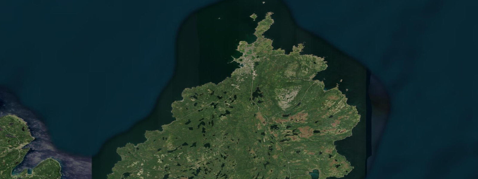
Twillingate sits on two islands — North and South Twillingate — in Notre Dame Bay on Newfoundland's north coast, connected to each other and to the mainland by causeways. The setting is island outport Newfoundland in concentrated form: the harbour faces southwest into the protected bay, the rocky headlands on the north side face the open Labrador Sea, and icebergs drifting down Iceberg Alley pass close enough to the outer shores to ground on the shoals offshore. Mean tidal range at Twillingate is approximately 1.5 metres; spring range reaches roughly 1.8 metres.
The 'Iceberg Capital of the World' tag that Twillingate's tourism board has run with for decades reflects a genuine geographic reality: the town sits on the southern edge of the Notre Dame Bay iceberg corridor, where icebergs from western Greenland round the Labrador coast and slow as they enter the bay's relatively shallower water. Some ground on shoals and remain stationary for days or weeks, allowing close approach by boat. The annual Twillingate Fish, Fun and Folk Festival (late July) is built partly around iceberg season overlap, though peak iceberg passage is May and June.
The Long Point Lighthouse, on the northern headland of North Twillingate Island, is the best land-based iceberg and whale-watching point. The headland rises to approximately 30 metres above sea level; the lighthouse was established in 1876. At low water, the rock platforms at the base of the headland extend seaward; access to the lower shore requires a scramble down from the lighthouse parking area and is feasible only at low to mid water. At high water on a northerly swell, the lower rocks are not safe.
Humpback whales follow capelin inshore to Notre Dame Bay from July through September. The capelin roll — the annual mass spawning event when capelin beach themselves to spawn on gravel shores in June — is one of the most accessible wildlife spectacles in Newfoundland; beaches around Notre Dame Bay, including those near Twillingate, see capelin spawning in late June and early July. The spectacle is tide-independent: spawning occurs on the beach itself at the high-tide line.
Cod dominated Twillingate's economy from the 17th century until the 1992 moratorium. The outport fishing culture is preserved in the Twillingate Museum and in the physical fabric of the town — the stages, stores, and wharves oriented toward the harbour. Crab and lobster have partially filled the economic gap; the Twillingate harbour remains an active fishing port.
North Twillingate's coastal trails give good cliff-top access to the outer shore. The trail to Devil's Cove on the northeast side of North Twillingate Island crosses exposed headland — the view north is open ocean to Labrador and beyond. Wind is a constant factor on the outer headlands; the trail is best walked on a day with light winds and good visibility for the iceberg-scan.
Tide predictions on this page come from Open-Meteo Marine, a gridded global ocean model. Accuracy is typically within plus or minus 45 minutes on timing and 0.2 to 0.3 metres on height — model-derived, not from a DFO gauge. For authoritative official Canadian predictions, consult Fisheries and Oceans Canada (DFO) at tides.gc.ca.
Tide questions about Twillingate
Quick answers to the most common questions about tide times, range, and water access at Twillingate.
When is the best time to see icebergs at Twillingate?
Peak iceberg passage through Notre Dame Bay is May and June. The Long Point Lighthouse headland on North Twillingate Island is the primary land-based viewing point; some years produce grounded icebergs within 1 to 2 kilometres of shore that remain stationary for days. Late April can produce early-season sightings; by mid-July most icebergs have melted or passed south. The Canadian Ice Service (ice.ec.gc.ca) and the Iceberg Finder app provide near-real-time iceberg positions. Twillingate's annual Fish, Fun and Folk Festival runs late July — by then iceberg numbers are declining but whale activity is at its peak.
What is the capelin roll and where can you see it near Twillingate?
The capelin roll is the annual mass spawning event when capelin — small forage fish critical to the North Atlantic food web — swim inshore in enormous numbers and beach themselves on gravel shores to spawn. Females spawn at the high-tide line; males fertilise the eggs in the surf. The event occurs in late June and early July in Notre Dame Bay, typically within a 10-day window. Gravel beaches around the bay, including several accessible from Twillingate, host the spawning. The smell of capelin and the density of spawning fish is striking. Humpback whales and seabirds concentrate inshore to feed on the capelin; the roll marks the start of the peak whale-watching period.
What is the tidal range at Twillingate and when is the Long Point headland accessible?
Mean tidal range at Twillingate is approximately 1.5 metres; spring range reaches roughly 1.8 metres. The Long Point Lighthouse headland on North Twillingate Island has rock platforms at its base accessible at low to mid water — roughly 2 to 3 hours either side of low water. At high water the lower platforms are submerged. The headland path from the lighthouse parking area to the base of the rocks requires a scramble and should not be attempted on a northerly swell at mid to high water. For iceberg scanning and whale watching, the lighthouse platform itself is accessible regardless of tide.
What is Twillingate's connection to the cod fishery?
Twillingate operated as a salt-cod outport from the 17th century, with an economy built on the inshore cod trap fishery and the salt-fish export trade to Europe and the Caribbean. The federal cod moratorium of July 1992 — imposed when Northern Cod biomass fell to less than 1% of its pre-fishing levels — ended that economy overnight. The moratorium is the single largest layoff in Canadian history by community impact. Twillingate absorbed the transition through crab and lobster licences, tourism, and the iceberg economy. The Twillingate Museum covers the fishery history. The physical structures of the outport economy — fish stages, salt stores, boat sheds — remain visible around the harbour.
Are the tide predictions on this page official forecasts I can use for navigation or safety planning?
No. The predictions shown here come from Open-Meteo Marine, a global ocean model with typical accuracy of plus or minus 45 minutes on timing and 0.2 to 0.3 metres on height. They are appropriate for planning headland walks, timing access to low-tide rock platforms, or understanding the tidal cycle in Notre Dame Bay — not for vessel navigation, harbour transit, or any safety-critical decision. For authoritative official Canadian predictions, use Fisheries and Oceans Canada (DFO) at tides.gc.ca. Notre Dame Bay's island and shoal geography creates complex local current patterns that require local knowledge beyond what any tide table provides.
7-day tide table — Twillingate
Heights relative to MSL. Predictions: Open-Meteo Marine (MeteoFrance SMOC, 0.08° grid) — heights relative to MSL (not chart datum / LAT). Model-derived.
| Day | Type | Time | Height |
|---|---|---|---|
| Sun 21 Jun | — | ||
| Mon 22 Jun | Low | 07:42 | -0.7m |
| High | 13:40 | -0.3m | |
| Low | 19:50 | -0.7m | |
| Tue 23 Jun | High | 01:45 | -0.3m |
| Low | 08:00 | -0.8m | |
| Wed 24 Jun | High | 15:47 | -0.1m |
| Low | 22:50 | -0.6m | |
| Thu 25 Jun | High | 16:40 | -0.2m |
| Fri 26 Jun | Low | 10:15 | -0.7m |
| High | 17:36 | -0.1m | |
| Sat 27 Jun | Low | 00:10 | -0.8m |
| High | 06:10 | -0.3m | |
| Low | 11:00 | -0.7m | |
| High | 18:15 | 0.0m | |
| Low | 20:00 | -0.1m | |