Koh Rong tide times
Koh Rong tide forecast — heights relative to MSL.
Today's tide times for Koh Rong
Tide times at Koh Rong on Sunday, 21 June 2026: first high tide at 07:00am, first low tide at 10:20am. Sunrise 05:46am, sunset 06:31pm.
Tide chart for Koh Rong
24-hour cosine-interpolated curve around the present moment. Heights relative to MSL. Predictions: Predictions: Open-Meteo Marine (MeteoFrance SMOC, 0.08° grid).
Sun, moon and conditions on Sun 21 Jun
Snapshot at build time — refreshes daily. Sea state from Open-Meteo Marine.
Highs and lows next 7 days
Every predicted high and low for the next week, with the daily tidal coefficient (0–120; higher = bigger swing, > 95 means stronger currents).
Other spots nearby
The three closest curated TideTurtle locations to Koh Rong, measured by great-circle distance.
Today's solunar windows
Solunar tradition: major periods are the ≈3h windows around moon transit and opposition; minor are ≈2h around moonrise and moonset. Pair with the local tide stage and wind for the best read.
About tides at Koh Rong
A short guide to the coastline at Koh Rong — geography, sea state, and what the tide is actually doing under your feet.
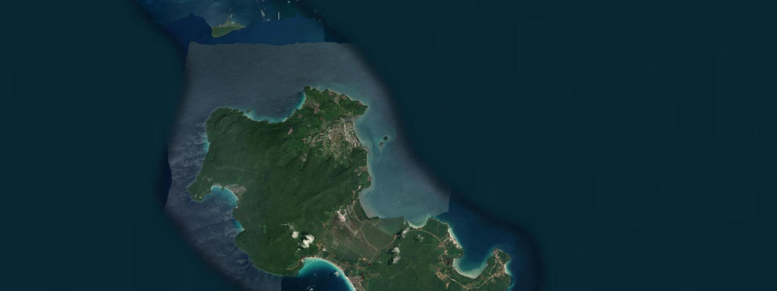
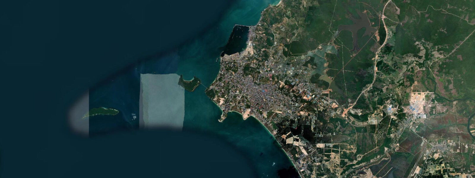
Koh Rong is Cambodia's second-largest island, roughly 78 km² of forested volcanic terrain rising to 235 m at its central peak, positioned 25 km west of Sihanoukville across open Gulf of Thailand water. The island holds several distinct coastal environments: the southeast, where the ferry pier and the village of Koh Tuch concentrate most visitor services, is a sheltered bay with shallow sandy approaches; the west coast from Village 4 (Koh Rong Village) northward runs 7 km of largely undeveloped beach that is among the finest in Southeast Asia; and the northern coast and the mangrove-fringed channels on the island's eastern side are shallow and tide-sensitive.
The tidal regime at Koh Rong mirrors Sihanoukville's mixed diurnal Gulf pattern. The island sits far enough offshore to experience slightly more open-water conditions than the mainland bays, but the fundamental Gulf of Thailand tidal character applies: one dominant rise and fall per day through much of the monsoon season (June to September), compressing to a range of 0.6 to 0.8 m on the most diurnal days, and two recognisable tidal cycles per day in the November-to-February season with spring ranges approaching 1.0 to 1.2 m. The tidal flats around the Koh Tuch ferry pier area on the southeast coast partially dry at spring low water, affecting access for small wooden fishing boats and the shallow-draft water taxis that serve beach resorts on the northern side of the village bay.
The bioluminescent plankton phenomenon in the shallow bays of Koh Rong — Pyrodinium bahamense, which emits blue-green light when physically disturbed — is one of the island's most frequently cited attractions. The phenomenon is best observed by wading into calm, shallow water at night and disturbing the surface. It is not tide-stage dependent in the sense that the plankton is present at all tidal stages; however, calm nights with little swell and minimal cloud cover provide the best conditions, and the new moon period gives the darkest skies and makes the bioluminescence most visually striking against the dark water.
The west coast beaches from Village 4 northward represent some of the least-developed beach stretches in the Gulf of Thailand region. Access is on foot from the village via jungle trail, by boat, or by a rough track that connects to the east coast road. The shallow gradient of the western beach means the waterline shifts 10 to 20 m between spring high and low water on the more semidiurnal days. On the most diurnal days the apparent change is smaller because the total daily range is compressed.
Snorkelling and diving off Koh Rong centres on the reef patches around the southern tip, around the satellite islets to the east (Koh Toch Loch), and at dedicated dive sites accessed by liveaboard or day-boat. Visibility depends on sea state, sedimentation from river runoff after rain, and tidal current stage; the slack-water windows around the predicted high and low give the clearest conditions at reef sites.
The island's only road connects Koh Tuch on the southeast coast to the north-facing beaches; most of the western coast is accessible only by boat or the jungle trail. In the dry season (November through April) the trail is passable; in the wet season it can be slippery and poorly marked. Fresh water on Koh Rong comes from springs and small streams; the island has no mains water system and resorts manage their own supply. Electricity on the outer beaches is typically solar or generator. These practical facts shape the character of the island as much as any tidal or weather consideration. Predictions on this page come from Open-Meteo Marine, a gridded global ocean model; accuracy is typically within plus or minus 45 minutes on timing and 0.2 to 0.3 m on height. The Department of Meteorology, Hydrology and Hydrography of Cambodia (DMHH) is the national authority for tide data in Cambodian waters.
Tide questions about Koh Rong
Quick answers to the most common questions about tide times, range, and water access at Koh Rong.
How do I get to Koh Rong from Sihanoukville?
Fast catamaran ferries from the main port pier and the Ochheuteal pier in Sihanoukville reach Koh Rong's Koh Tuch pier in approximately 45 minutes. Slow boats take 2 to 2.5 hours. Several operators run daily services, with frequency highest November through April. The journey crosses 25 km of open Gulf of Thailand water; in the southwest monsoon season (May through October), sea state can be rough and some departures are delayed or cancelled. Ferry schedules are not tide-dependent — the Koh Tuch pier and the port approach channel have adequate depth at all tidal stages. Check the operator's conditions and the weather forecast when travelling in monsoon season.
When is the bioluminescent plankton visible at Koh Rong?
The bioluminescent plankton (Pyrodinium bahamense) in the shallow bays is present year-round at Koh Rong and not tied to any particular tidal stage. The best viewing conditions combine: a calm night with minimal swell, no rain, low ambient light, and dark skies. New moon periods give the darkest conditions and the most vivid display — the full moon reduces contrast significantly. Enter the water slowly in a shallow bay and sweep your hand or paddle through the surface; the light is emitted by the plankton in response to physical disturbance. Water temperature and plankton density vary seasonally but the phenomenon is generally reliable throughout the year at the sheltered bay locations on the island's south and west sides.
What is the tide range at Koh Rong?
Koh Rong follows the Gulf of Thailand mixed diurnal pattern — similar to Sihanoukville 25 km to the east. Spring range in the more semidiurnal months (November through February) reaches approximately 1.0 to 1.2 m, producing two recognisable highs and two lows per day. During the southwest monsoon months (June through September), the pattern shifts toward diurnal with an effective daily range of 0.6 to 0.8 m and often only one clearly distinguishable high and low per 24-hour period. The practical consequence at Koh Rong: the tidal flats near the Koh Tuch pier partially expose at spring low water and affect small-boat access; the western beach waterline shifts 10 to 20 m on the most semidiurnal spring-tide days.
Is the west coast of Koh Rong accessible without a boat?
Village 4 (Koh Rong Village) on the west coast is reachable from Koh Tuch by jungle trail — roughly 3 to 4 km on foot through the interior. The trail is passable in dry season and can be muddy and poorly marked in wet season (June through October). Some stretches of the west coast beyond Village 4 require either boat access or low-water beach-walking when headland outcrops can be rounded on foot on a spring ebb. The 7 km west coast beach is continuous in character but interrupted by small rocky points; the northern sections are effectively boat-access only at high water. Most guesthouses on Koh Tuch can arrange boat transfers to the west coast beaches.
Where do these tide predictions come from?
Open-Meteo Marine, a gridded global ocean model. Accuracy is typically within plus or minus 45 minutes on timing and 0.2 to 0.3 m on height. At Koh Rong, sitting in the outer Gulf of Thailand, the model's grid resolution and the complex mixed diurnal pattern mean the prediction is an approximation of the tidal rhythm rather than a precisely calibrated harmonic forecast. For safety-critical marine activity in Cambodian waters ��— including the Sihanoukville-to-Koh Rong crossing and small-boat operations around the island — the Department of Meteorology, Hydrology and Hydrography of Cambodia (DMHH) is the authoritative source.
8-day tide table — Koh Rong
Heights relative to MSL. Predictions: Open-Meteo Marine (MeteoFrance SMOC, 0.08° grid) — heights relative to MSL (not chart datum / LAT). Model-derived.
| Day | Type | Time | Height |
|---|---|---|---|
| Sun 21 Jun | High | 07:00 | 0.5m |
| Low | 10:20 | 0.2m | |
| Mon 22 Jun | High | 01:00 | 0.7m |
| Tue 23 Jun | Low | 00:00 | 0.6m |
| High | 02:00 | 0.6m | |
| Low | 10:10 | 0.4m | |
| Wed 24 Jun | — | ||
| Thu 25 Jun | — | ||
| Fri 26 Jun | — | ||
| Sat 27 Jun | High | 19:50 | 1.1m |
| Sun 28 Jun | Low | 06:00 | 0.1m |