Koh Kong, Cambodia tide times
Koh Kong, Cambodia tide forecast — heights relative to MSL.
Today's tide times for Koh Kong, Cambodia
Tide times at Koh Kong, Cambodia on Saturday, 4 July 2026: first high tide at 07:00am, first low tide at 09:50am. Sunrise 05:48am, sunset 06:35pm.
Tide chart for Koh Kong, Cambodia
24-hour cosine-interpolated curve around the present moment. Heights relative to MSL. Predictions: Predictions: Open-Meteo Marine (MeteoFrance SMOC, 0.08° grid).
Sun, moon and conditions on Sat 04 Jul
Snapshot at build time — refreshes daily. Sea state from Open-Meteo Marine.
Highs and lows next 7 days
Every predicted high and low for the next week, with the daily tidal coefficient (0–120; higher = bigger swing, > 95 means stronger currents).
Other spots nearby
The three closest curated TideTurtle locations to Koh Kong, Cambodia, measured by great-circle distance.
Today's solunar windows
Solunar tradition: major periods are the ≈3h windows around moon transit and opposition; minor are ≈2h around moonrise and moonset. Pair with the local tide stage and wind for the best read.
About tides at Koh Kong, Cambodia
A short guide to the coastline at Koh Kong, Cambodia — geography, sea state, and what the tide is actually doing under your feet.
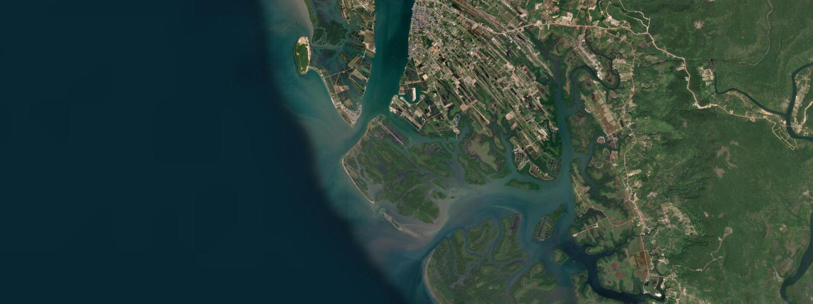
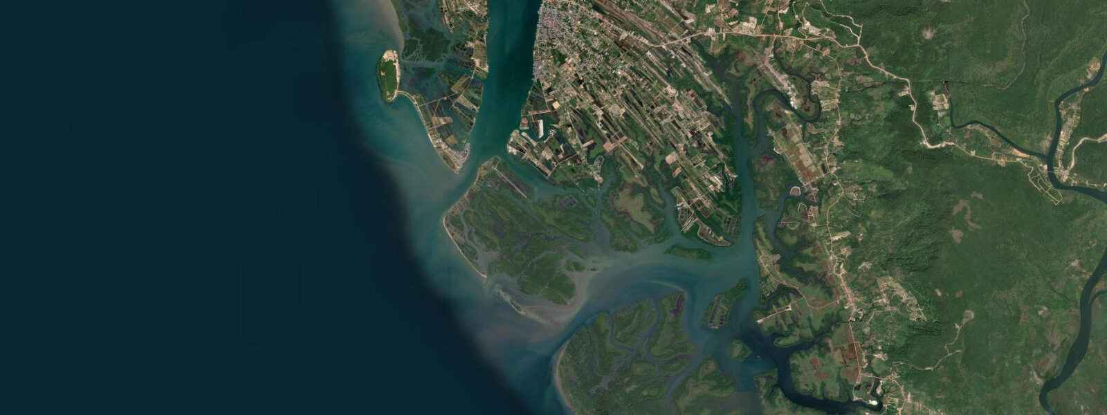
Koh Kong sits at the westernmost edge of Cambodia on the Gulf of Thailand, a border town where the Koh Kong Island channel and the Tatai River estuary meet the open Gulf, and the Thai crossing at Ban Hat Lek/Cham Yeam is 10 km up the road. The Cardamom Mountains rise immediately behind the town, their forested ridgelines visible over the rooftops; this is the largest remaining contiguous lowland tropical forest in mainland Southeast Asia, covering roughly 4 million hectares across two provinces and harbouring sun bears, clouded leopards, gibbons, and wild elephants.
The Tatai River enters the Gulf through a mangrove estuary 30 km north of Koh Kong town. River tours by kayak or longtail boat move through flooded forest during the wet season (June–October), when water levels rise high enough to paddle between the trunks of submerged trees. The Tatai Waterfall on the main tributary is accessible by a 2 to 3 hour upstream paddle from the guesthouse cluster near the bridge; a current-assisted return on the ebb makes the round trip practical in a half-day. The Peam Krasaop Wildlife Sanctuary mangroves at the river mouth have a boardwalk accessible at all tide states and a guided boat-tour circuit through the tidal channels.
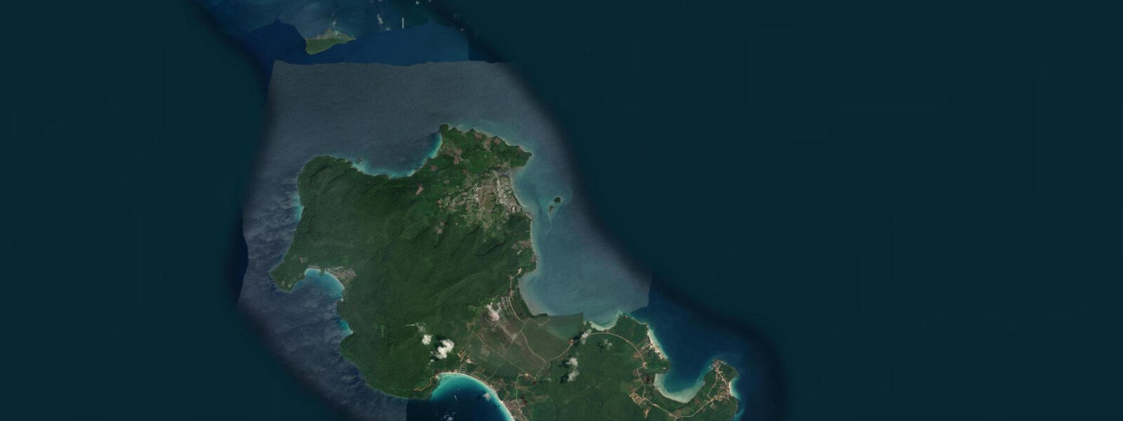
Koh Kong Island, 20 km south across open Gulf water, has white sand beaches and exceptionally clear water on its western side, but minimal facilities — a few seasonal beach stalls and no permanent accommodation. Day trips by speedboat depart from Koh Kong pier; the crossing takes 40 to 60 minutes depending on the boat and sea state. The western beaches are accessible on calm days; northeast monsoon season (November–March) is the calm window and the best period for the island.
The tidal regime is Gulf of Thailand mixed semidiurnal: spring range 1.0 to 2.0 m in this area — the northern Gulf of Thailand produces slightly larger ranges than the Kep coast to the east, as the bay geometry amplifies the tidal signal somewhat. Two unequal highs and two unequal lows each day. Tidal currents in the Koh Kong Island channel run 0.5 to 1.0 knots; relevant for kayakers crossing the channel to the island mangrove shore from the town pier. The flood tide pushing saltwater into the Tatai mangrove system concentrates mangrove jack, barracuda, and the occasional barramundi in the tidal channels — experienced anglers work the incoming against the mangrove roots from small boats.
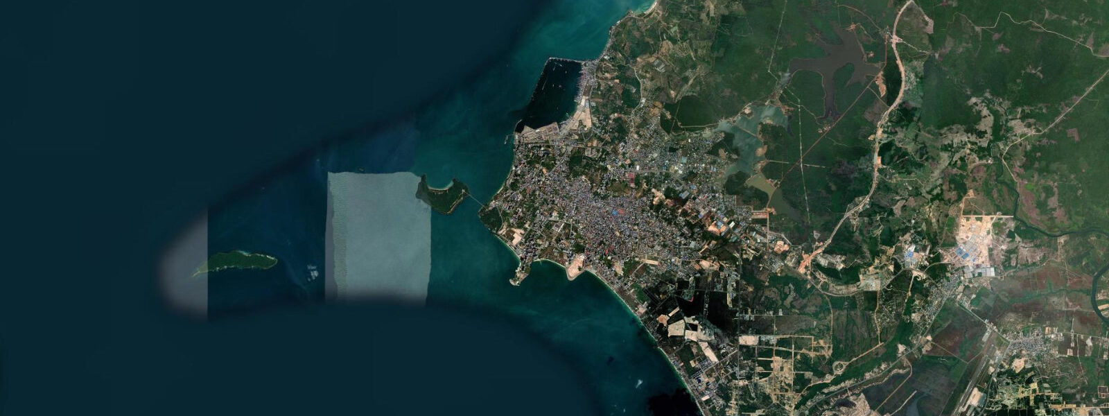
The border crossing to Ranong, Thailand at Ban Hat Lek is 10 km from Koh Kong town; shared taxis and motodups cover the route in 20 minutes. The crossing is busy with goods traffic. Predictions on this page come from Open-Meteo Marine (gridded model, ±45 min / ±0.2–0.3 m). The Koh Kong Saturday market on the main road is the commercial and social hub of the town, with produce, dried fish, and household goods from both sides of the Thai border. The market starts at 05:30 and winds down by 09:00; arriving early gives access to the full spread before the best items sell. The town's central location between the Cardamom highlands and the Gulf coast makes it a natural base for 2 to 3 day excursions covering both the mountain forest and the coastal island system. The Tatai River estuary to the north adds a freshwater dimension: during the dry season runoff is low and saline intrusion from the gulf reaches several kilometres upstream, making tidal prediction relevant for paddlers well inland of the coast. Monsoon season shifts this dynamic, with river outflow suppressing the tidal signal in the upper reaches. Photographers working the Tatai mangroves should plan for incoming tide in the afternoon, when the light from the west catches the water between the prop roots. Fishing villages along the coast use the tidal rhythm to time their trap checks and net sets; the local fleet typically returns to the Koh Kong pier on the flooding tide to take advantage of the current assist. The Cardamom Mountains National Park boundary runs close to the coast here, and wildlife activity near the shoreline — including water monitors and estuarine crocodiles — tracks the tidal state, with more sightings at low water when mud banks are exposed.
Tide questions about Koh Kong, Cambodia
Quick answers to the most common questions about tide times, range, and water access at Koh Kong, Cambodia.
When is the next high tide at Koh Kong?
The hero block shows the next predicted high at Koh Kong in Indochina Time (ICT, UTC+7). Mixed semidiurnal pattern, spring range 1.0 to 2.0 m. The largest swings of the month occur around new and full moons, when the spring tides expose the mangrove roots and the Tatai estuary mudflats most fully. Predictions from Open-Meteo Marine (gridded model, ±45 min / ±0.2–0.3 m). The spring tides around new and full moon give the largest tidal swings; those are the dates when the mangrove flat exposure and the crab-trap access is greatest.
What is the tidal range at Koh Kong?
Spring range runs 1.0 to 2.0 m at Koh Kong — somewhat larger than the Kep coast to the east because the northern Gulf of Thailand geometry amplifies the tidal signal. The mixed semidiurnal pattern means two unequal pairs of highs and lows each day; the larger high can be nearly double the smaller one. At the spring low, the mangrove root systems at the Tatai estuary margin are exposed by 1.0 to 1.5 m. The mixed semidiurnal pattern means not all lows are equal; the larger low on a spring day can be 1.5 to 2.0 m, while the smaller low on the same day may be only 0.5 to 0.8 m.
Where do these predictions come from?
Open-Meteo Marine, a free gridded global ocean model, accuracy ±45 min / ±0.2–0.3 m. No openly accessible national gauge data for the Koh Kong coast is available at time of writing. The Gulf of Thailand mixed semidiurnal regime is well-represented in the model at this latitude, making the gridded prediction a reliable planning baseline. The Gulf of Thailand mixed semidiurnal regime is one of the most complex tidal patterns in Southeast Asia, with significant diurnal inequality; Open-Meteo handles it adequately for planning purposes.
Can I kayak to the Tatai Waterfall?
Yes, with a guide or in a group with local knowledge. The Tatai River is navigable by kayak from the guesthouse bridge area to the waterfall, a journey of 2 to 3 hours upstream. Paddle the flood tide to reduce effort going up; return on the ebb. During the dry season (November–May), river levels fall and some sections need portaging. The wet season (June–October) is the best paddling period with the highest water and the most dramatic flooded forest sections. Saltwater crocodiles are present in the lower estuary — stay in the kayak, do not trail limbs in the water near the mangrove banks.
Is this safe to use for navigation?
No. TideTurtle is a planning tool, not a nautical resource. The Koh Kong Island channel, the Tatai estuary, and the Gulf of Thailand approaches in this area have shoaling, mangrove-fringed channels, and tidal current conditions requiring chart navigation and local knowledge. Use official Cambodian maritime authority sources for vessel operations. The Koh Kong Island channel and the Gulf of Thailand approaches here have shoaling areas and tidal current that require chart navigation; Cambodian maritime authority guidance applies for vessel operations.
6-day tide table — Koh Kong, Cambodia
Heights relative to MSL. Predictions: Open-Meteo Marine (MeteoFrance SMOC, 0.08° grid) — heights relative to MSL (not chart datum / LAT). Model-derived.
| Day | Type | Time | Height |
|---|---|---|---|
| Sat 04 Jul | High | 07:00 | 0.3m |
| Low | 09:50 | -0.0m | |
| Sun 05 Jul | High | 00:43 | 1.4m |
| Low | 10:03 | 0.1m | |
| Mon 06 Jul | High | 01:00 | 1.1m |
| Low | 10:06 | 0.2m | |
| Tue 07 Jul | High | 00:50 | 0.9m |
| Low | 10:20 | 0.3m | |
| Wed 08 Jul | High | 18:15 | 1.0m |
| Thu 09 Jul | Low | 09:00 | 0.4m |
| High | 18:06 | 1.0m |