Primorsko tide times
Primorsko tide forecast — heights relative to MSL.
Today's tide times for Primorsko
Tide times at Primorsko on Sunday, 21 June 2026: first low tide at 03:00am. Sunrise 05:32am, sunset 08:48pm.
Tide chart for Primorsko
24-hour cosine-interpolated curve around the present moment. Heights relative to MSL. Predictions: Predictions: Open-Meteo Marine (MeteoFrance SMOC, 0.08° grid).
Sun, moon and conditions on Sun 21 Jun
Snapshot at build time — refreshes daily. Sea state from Open-Meteo Marine.
Highs and lows next 7 days
Every predicted high and low for the next week, with the daily tidal coefficient (0–120; higher = bigger swing, > 95 means stronger currents).
Other spots nearby
The three closest curated TideTurtle locations to Primorsko, measured by great-circle distance.
Today's solunar windows
Solunar tradition: major periods are the ≈3h windows around moon transit and opposition; minor are ≈2h around moonrise and moonset. Pair with the local tide stage and wind for the best read.
About tides at Primorsko
A short guide to the coastline at Primorsko — geography, sea state, and what the tide is actually doing under your feet.
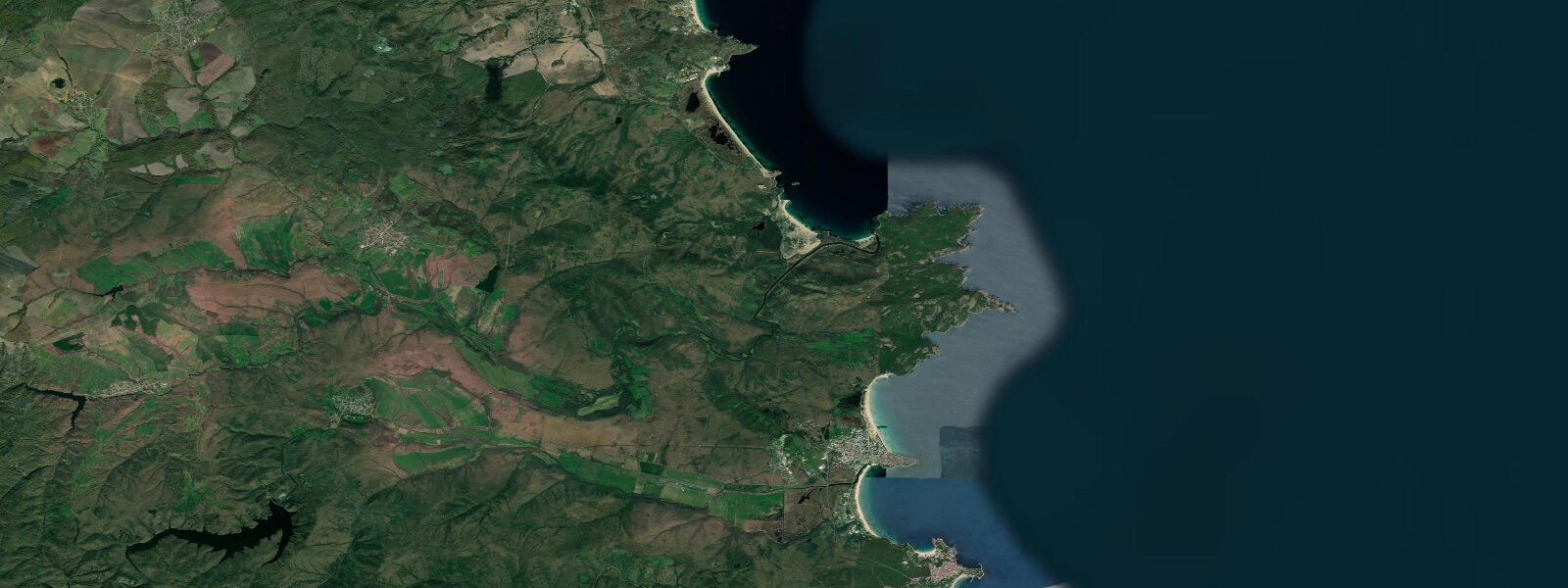
Primorsko is a small resort on a low peninsula between two rivers — the Dyavolska to the north and the Ropotamo to the south — approximately 55 kilometres south of Burgas and 25 kilometres from the Turkish border. The town occupies the gently sloping tip of the peninsula between two bays: Primorsko North Beach in the main bay to the north-west, and the smaller Yug (South) Beach on the south-east, more exposed side. The peninsula itself is largely forested; pine plantations from the 1950s cover the central spine of the headland, giving the resort an unusually green backdrop for a Bulgarian Black Sea town.
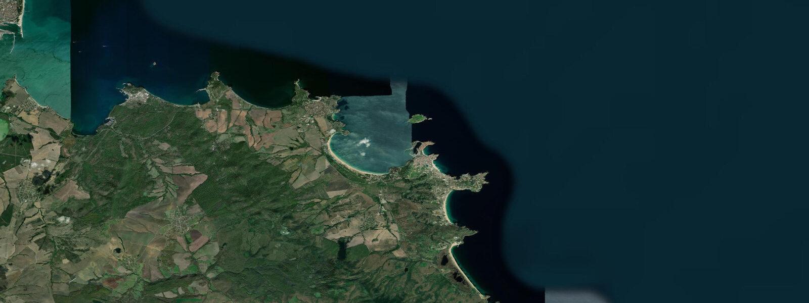
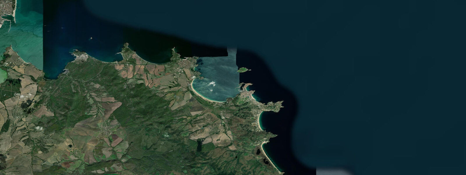
The pine forest was planted during the socialist period as a shelterbelt; its dense canopy reaches the outer margins of the resort zone and provides shade that the more open beach towns to the north lack. The most significant feature of the Primorsko area is not the town itself but the Ropotamo Nature Reserve immediately to the south. The Ropotamo River runs through protected wetland — reed beds, lotus, riparian forest, sand dunes — before meeting the Black Sea 3 kilometres south of the resort.
The dune system at the Ropotamo mouth is the best-preserved coastal dune habitat on the Bulgarian Black Sea coast; the dunes are partially stabilised by European beach grass and sea buckthorn (Hippophae rhamnoides), with mobile dune crest areas active between them. The reserve is a key site on the Via Pontica migratory bird route; spring (April–May) and autumn (September–October) migration periods bring significant raptor, heron, and passerine counts through the reserve. River boat tours from the Ropotamo mouth jetty operate daily from May through October, covering the lower 3 kilometres of the river through the lotus-carpeted reed corridor and back.
The tidal regime at Primorsko is the same as throughout the Bulgarian Black Sea coast: astronomical range 5 to 15 centimetres — no practical impact on beach, harbour, or river access. The Ropotamo river mouth is tidal in name only; the 5-to-15-centimetre sea-level change means the tidal influence on the river is detectable only with sensitive instruments in the very lowest reach. What varies water level at the Primorsko beaches is wind.
The bielan (north-easterly) builds swell on the east-facing Yug Beach and the outer northern bay; the North Beach is more sheltered from north-easterly swell by the peninsula geometry but remains exposed to south-easterly fetch across the bay. 8 metres and produce significant wave height at the North Beach. NIMH (Национален институт по метеорология и хидрология) Bulgaria publishes sea-level and storm-surge data; the Burgas gauge (55 kilometres north) is the reference for this section of coast.
Shore fishing from the southern jetties and from the rocky points around the Ropotamo mouth is a local practice; the species are the same as the rest of the Bulgarian southern coast — horse mackerel (Trachurus trachurus) and garfish (Belone belone) in summer, flatfish (turbot and flounder) year-round from the sandy patches. The garfish is taken on lure or small live bait in the surface layer during July and August when it is present in large numbers. Anglers working the Ropotamo jetties at dusk report the best garfish activity in the hours following sunset.
The Black Sea water temperature at Primorsko peaks at 23 to 25°C in August, slightly cooler than the northern coast at Varna, reflecting the increased depth of the southern Bulgarian shelf and the slightly fresher inshore water near the Ropotamo outflow. Predictions on this page come from Open-Meteo Marine, a gridded global ocean model. For the Black Sea's 5-to-15-centimetre astronomical range, the model's accuracy margin far exceeds the total tidal signal.
Wind-driven sea-level variation and the weather forecast are the relevant planning inputs at Primorsko.
Tide questions about Primorsko
Quick answers to the most common questions about tide times, range, and water access at Primorsko.
When is the next high tide at Primorsko?
The hero block shows the next predicted high at Primorsko in local Eastern European Time (EET/EEST, UTC+2/UTC+3). The Black Sea astronomical tidal range here is 5 to 15 centimetres — no practical difference between high and low water at the beach, the harbour, or the Ropotamo river mouth. Sea level at Primorsko is controlled by wind and atmospheric pressure. Southerly and south-easterly storm systems can raise Burgas Bay water levels 0.4 to 0.8 metres above the mean; the bielan north-easterly generates the most frequent sea-level anomaly. NIMH Bulgaria (Burgas gauge) is the authoritative source for sea-level data on this coast.
What is the Ropotamo Nature Reserve and how do I visit?
The Ropotamo Nature Reserve protects a coastal wetland 3 kilometres south of Primorsko where the Ropotamo River reaches the Black Sea through reed beds, lotus-covered water, riparian forest, and coastal sand dunes. The reserve covers approximately 1,000 hectares and is a designated Important Bird Area on the Via Pontica migration route. River boat tours from the jetty at the Ropotamo mouth operate daily May through October, running 45 to 60 minutes upstream through the reed and lotus corridor and back. The tour boats are small flat-bottomed vessels seating 8 to 15 passengers; tours run continuously through the day and do not require pre-booking outside of weekends in July and August. The reserve walking trails along the dune system and the river bank are accessible independently; entry to the protected zone requires a permit fee (approximately 2 to 5 BGN) from the entrance booth on the coastal road.
Where can I fish for garfish at Primorsko?
Garfish (Belone belone) are surface-feeding predators present in the Bulgarian southern Black Sea in large numbers from July through late August. The southern jetties at Primorsko — the breakwater protecting the small harbour — and the rocky points at the Ropotamo river mouth are the most productive shore positions. Garfish feed in the upper metre of the water column on small prey fish; they respond to lures, small spinners, and live small-bait rigs fished without a sinker. The species is active at dawn and dusk; anglers fishing the Ropotamo jetties in the hour after sunset in July and August report consistent catches. Garfish grow to 60 to 80 centimetres in the Black Sea; the flesh is green-boned (a natural pigment, not a sign of spoilage) but good eating when fresh. Horse mackerel (Trachurus trachurus) are taken from the same positions on light lures throughout the summer months.
Is it safe to swim in the Ropotamo river mouth?
The very lower reach of the Ropotamo River, immediately at its mouth where the reed beds open to the Black Sea, is a mixed freshwater-saltwater zone. The Black Sea tidal range of 5 to 15 centimetres means there is no significant tidal current in the river mouth; the water movement is driven by the river flow and by wind setup. The mouth area is popular for swimming from the small beach on the south bank of the river where it meets the sea. The water is calmer than the open beach at Primorsko when north-easterly wind produces swell. Current in the main river channel immediately above the mouth is gentle in dry summer conditions when river flow is low. The reserve rules restrict motor boat use in the protected section; swimming in the river-mouth zone is permitted and is a common activity for visitors arriving on the river boat tours.
Where do these tide predictions come from?
Open-Meteo Marine, a free gridded global ocean model. For the Black Sea, where the astronomical tidal range is 5 to 15 centimetres, the model's standard accuracy range — plus or minus 45 minutes on timing and 0.2 to 0.3 metres on height — is an order of magnitude larger than the total tidal signal. The high and low predictions for Primorsko are indicative only; they identify a minor water-level oscillation pattern with no practical significance for beach access, fishing, or the Ropotamo river boat tours. NIMH Bulgaria publishes authoritative sea-level and storm-surge data; the Burgas gauge is the nearest reference station. This page is not suitable for navigation.
7-day tide table — Primorsko
Heights relative to MSL. Predictions: Open-Meteo Marine (MeteoFrance SMOC, 0.08° grid) — heights relative to MSL (not chart datum / LAT). Model-derived.
| Day | Type | Time | Height |
|---|---|---|---|
| Sun 21 Jun | Low | 03:00 | -0.5m |
| Mon 22 Jun | High | 14:00 | -0.5m |
| Tue 23 Jun | Low | 05:00 | -0.5m |
| Wed 24 Jun | — | ||
| Thu 25 Jun | — | ||
| Fri 26 Jun | — | ||
| Sat 27 Jun | High | 15:00 | -0.4m |