San Antonio Oeste tide times
San Antonio Oeste tide forecast — heights relative to MSL.
Today's tide times for San Antonio Oeste
Tide times at San Antonio Oeste on Sunday, 21 June 2026: first high tide at 04:04, first low tide at 10:11, second high tide at 16:18, second low tide at 22:44. Sunrise 08:44, sunset 17:59.
Tide chart for San Antonio Oeste
24-hour cosine-interpolated curve around the present moment. Heights relative to MSL. Predictions: Predictions: Open-Meteo Marine (MeteoFrance SMOC, 0.08° grid).
Sun, moon and conditions on Sun 21 Jun
Snapshot at build time — refreshes daily. Sea state from Open-Meteo Marine.
Highs and lows next 7 days
Every predicted high and low for the next week, with the daily tidal coefficient (0–120; higher = bigger swing, > 95 means stronger currents).
Other spots nearby
The three closest curated TideTurtle locations to San Antonio Oeste, measured by great-circle distance.
Today's solunar windows
Solunar tradition: major periods are the ≈3h windows around moon transit and opposition; minor are ≈2h around moonrise and moonset. Pair with the local tide stage and wind for the best read.
Cycle dates near San Antonio Oeste
Next spring tide on Sun 21 Jun (range 6.7m). Next neap on Thu 25 Jun.
Spring tides cluster around new and full moons (biggest swings). Neap tides land on quarter moons (smallest swings). See the spring tide and neap tide glossary entries for the why.
About tides at San Antonio Oeste
A short guide to the coastline at San Antonio Oeste — geography, sea state, and what the tide is actually doing under your feet.
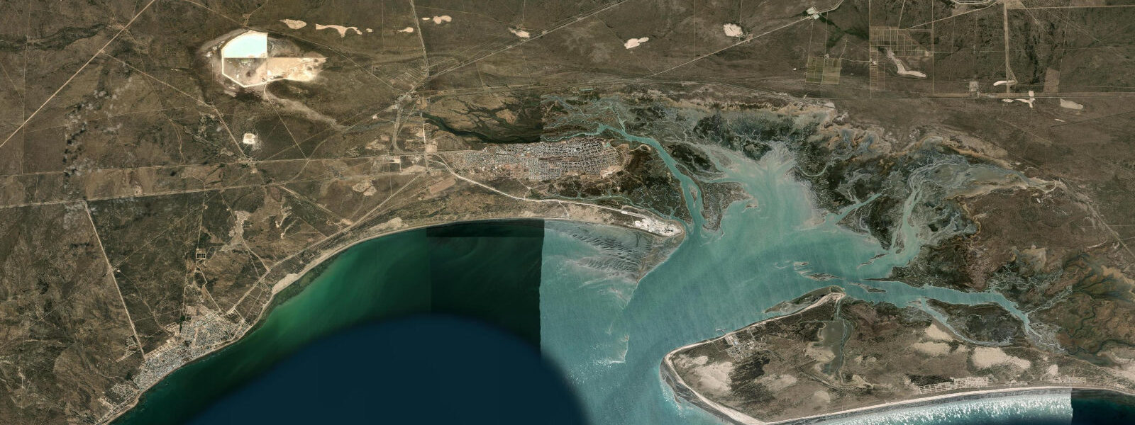
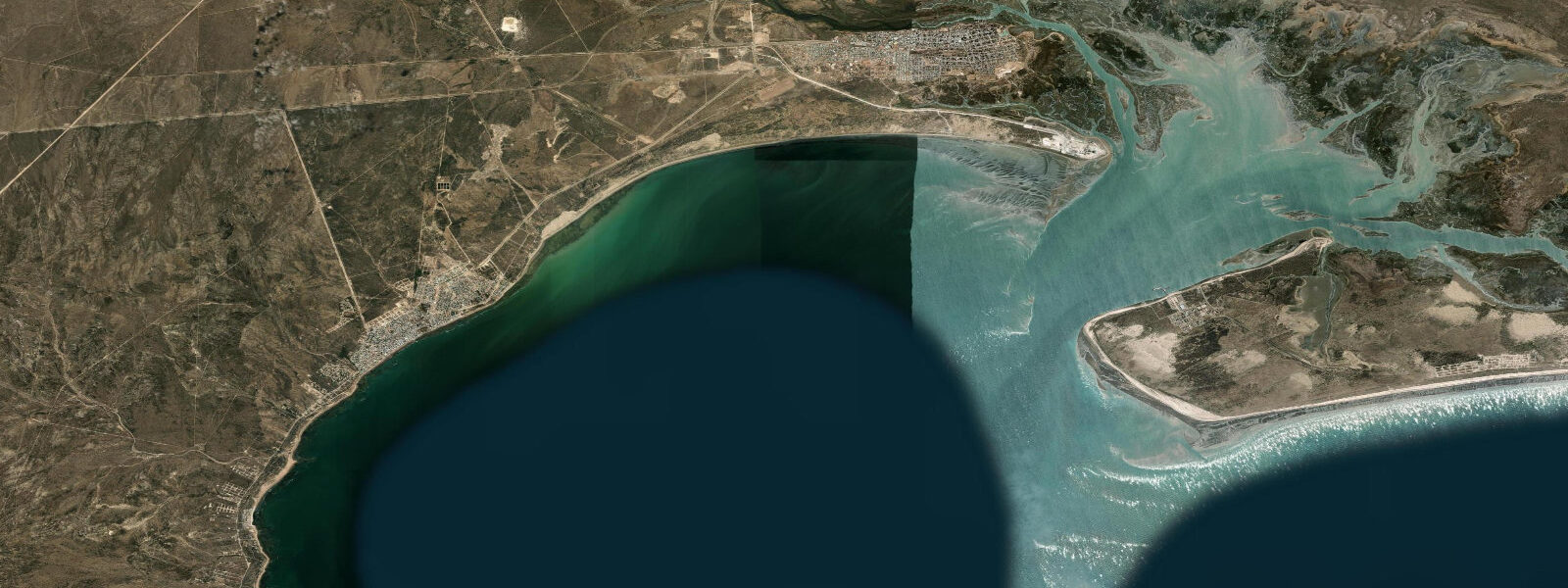
San Antonio Oeste is a small port town at the inner end of the San Matías Gulf, 14 km northeast of Las Grutas. It is the reference tide gauge station for the northern Patagonian coast and the site of one of the largest tidal ranges in South America: spring range at San Antonio Oeste is 6.0–7.0 m above Chart Datum, driven by the funnel geometry of the San Matías Gulf concentrating the Patagonian shelf tidal prism into an increasingly narrow basin.
The tidal flat at San Antonio Oeste is extraordinary. At spring low water, the sea retreats roughly 3–5 km from the town shore; the exposed flat is a broad expanse of compacted sand and mud that remains wet and soft in the channels but is firm enough to walk on the higher sand areas. During February and March, this tidal flat is one of the most important shorebird staging areas in the Western Hemisphere. Red knot (Calidris canutus rufa) — a small wader that breeds in the Canadian high Arctic and overwinters in Tierra del Fuego — staggers its northward migration through San Antonio Oeste, fuelling on the extraordinary density of bivalves (Darina solenoides, a small clam) in the flat's upper intertidal zone. Counts of 40,000–60,000 red knot on the San Antonio flats in February–March have been recorded; along with similar numbers of sanderlings, dunlin, and other sandpipers.
The port at San Antonio Oeste handles fish processing, supply to the oil and gas operations in the Neuquén basin (via road connections inland), and some general cargo. The port access and the commercial dock are tidal-dependent: vessels enter and depart within a tide window around the high. The town itself sits above the high-water line; the land drops steeply to the tidal flat at the shoreline.
For visitors interested in the shorebird migration, the most productive viewing is from the high-water line at rising tide, when the flood pushes the birds off the flat and concentrates them on the upper beach in tight flocks. At low water the birds spread across the vast flat and individual species are harder to pick out. Binoculars are essential; telescope desirable. SHN Argentina has a permanent tide gauge at San Antonio Oeste — the official reference station for the San Matías Gulf. Tide predictions here come from Open-Meteo Marine: accuracy ±45 min / ±0.2–0.3 m.
The Área Natural Protegida Bahía San Antonio was created in 2001 specifically to protect the shorebird staging habitat; the designation covers the tidal flat, the surrounding salt marsh, and the coastal dune system. BirdLife International has designated the San Antonio Bay as an Important Bird and Biodiversity Area (IBA). The WHSRN (Western Hemisphere Shorebird Reserve Network) has listed San Antonio Bay as a site of hemispheric importance, recognising that the loss of this habitat would affect migratory shorebird populations across two continents. Visiting in February–March specifically to observe the red knot migration requires binoculars and ideally a telescope; the flock densities are high enough that even without optical aid the cloud of birds at high-water roosting is visible from the beach access road.
The shorebird migration at San Antonio has attracted international ornithological attention since the 1980s; the site appears on the migration route maps of every major shorebird conservation organisation. The journey of the red knot subspecies rufa — breeding in the Canadian Arctic, wintering in Tierra del Fuego, staging at San Antonio and other South American sites — has been described as one of the longest migrations relative to body size in the animal kingdom. Satellite transmitter tracking studies have shown individual red knots making 8,000 km non-stop flights over the Atlantic between the Tierra del Fuego wintering grounds and the North American staging areas.
Tide questions about San Antonio Oeste
Quick answers to the most common questions about tide times, range, and water access at San Antonio Oeste.
What is the tidal range at San Antonio Oeste, and why is it so large?
Spring range at San Antonio Oeste is 6.0–7.0 m above Chart Datum — one of the largest tidal ranges on the South American Atlantic coast. The San Matías Gulf is a semi-enclosed triangular embayment open to the south; as the South Atlantic tidal wave enters the gulf and travels toward the closed northern end where San Antonio sits, the funnel geometry amplifies the tidal prism. The same effect produces large ranges in the Bay of Fundy (Canada) and the Severn Estuary (UK) for analogous geometric reasons. The San Matías Gulf funnel geometry is among the clearest examples of tidal resonance amplification on the South American coast.
When is the shorebird migration at San Antonio Oeste?
The main shorebird staging period is February through March, when red knot (Calidris canutus rufa) and other Arctic-breeding waders stop at the San Antonio tidal flat to feed and refuel during their northward migration from Tierra del Fuego wintering grounds to Canadian Arctic breeding areas. Peak knot counts of 40,000–60,000 birds have been recorded. The best viewing is at high water when the rising tide concentrates birds on the upper beach; at low water the flock spreads across the full flat. Binoculars are essential. The red knot subspecies rufa (Calidris canutus rufa) completes one of the longest migrations of any bird: breeding in the Canadian Arctic and wintering in Tierra del Fuego, with San Antonio as the critical refuelling stop in February–March.
Where do the tide predictions on this page come from?
Open-Meteo Marine, a free gridded global ocean model. Accuracy is typically ±45 minutes on timing and ±0.2–0.3 m on height. SHN (Servicio de Hidrografía Naval) Argentina operates the official permanent tide gauge at San Antonio Oeste — this is the primary reference station for the San Matías Gulf region. The SHN tide tables are the authoritative source for navigation and commercial port operations. This page is not for navigation. The SHN permanent gauge at San Antonio Oeste is referenced in the IHO global sea-level network and accessible via the PSMSL (Permanent Service for Mean Sea Level) archive.
Is it possible to walk on the tidal flat at San Antonio Oeste?
Walking on the upper sections of the San Antonio tidal flat is possible within two hours of spring low water when the firm sand areas are exposed. The flat is enormous (3–5 km from the shore at spring low); the flood tide rises roughly 1.0–1.2 m per hour and the inner channels can isolate walkers who go too far out. Do not attempt to walk the full extent of the flat without local knowledge of the drainage channel locations. Keep the shore clearly in sight and turn back at least 60 minutes before the predicted low so the returning flood is still manageable. The inner tidal channels on the San Antonio flat are deeper than the surrounding flat and can be knee-to-waist deep even at spring low; stay on the outer flat edge.
Are there viewing facilities for the shorebird migration?
The town of San Antonio Oeste has a coastal path and a small lookout at the beach access point overlooking the upper tidal flat. There are no permanent hides. The Área Natural Protegida Bahía San Antonio is the formal conservation designation for the flat; access to the protected zones of the flat itself is managed but not restricted for day visitors. Local birdwatching guides are available through contacts in San Antonio Oeste and Viedma; guided visits during February–March are recommended for first-time visitors unfamiliar with the flat's tidal drainage channels. Contact Viedma-based birdwatching guides through Aves Patagónicas or similar organisations for guided February–March visits.
7-day tide table — San Antonio Oeste
Heights relative to MSL. Predictions: Open-Meteo Marine (MeteoFrance SMOC, 0.08° grid) — heights relative to MSL (not chart datum / LAT). Model-derived.
| Day | Type | Time | Height |
|---|---|---|---|
| Sun 21 Jun | High | 04:04 | 3.2m |
| Low | 10:11 | -2.8m | |
| High | 16:18 | 3.6m | |
| Low | 22:44 | -3.3m | |
| Mon 22 Jun | High | 04:58 | 3.4m |
| Low | 11:14 | -2.8m | |
| High | 17:17 | 3.2m | |
| Low | 23:39 | -3.1m | |
| Tue 23 Jun | High | 05:54 | 3.1m |
| Low | 12:07 | -2.6m | |
| High | 18:12 | 3.0m | |
| Wed 24 Jun | Low | 00:33 | -2.9m |
| High | 06:47 | 3.0m | |
| Low | 13:08 | -2.8m | |
| High | 19:14 | 2.6m | |
| Thu 25 Jun | Low | 01:28 | -2.8m |
| High | 07:42 | 2.8m | |
| Low | 14:04 | -2.8m | |
| High | 20:08 | 2.3m | |
| Fri 26 Jun | Low | 02:22 | -2.9m |
| High | 08:38 | 2.6m | |
| Low | 14:57 | -2.8m | |
| High | 21:05 | 2.5m | |
| Sat 27 Jun | Low | 03:13 | -2.4m |
| High | 09:30 | 3.2m | |
| Low | 15:49 | -2.3m | |
| High | 20:00 | 1.7m |