El Cóndor tide times
El Cóndor tide forecast — heights relative to MSL.
Today's tide times for El Cóndor
Tide times at El Cóndor on Sunday, 21 June 2026: first high tide at 04:59, first low tide at 10:51, second high tide at 16:59. Sunrise 08:36, sunset 17:49.
Tide chart for El Cóndor
24-hour cosine-interpolated curve around the present moment. Heights relative to MSL. Predictions: Predictions: Open-Meteo Marine (MeteoFrance SMOC, 0.08° grid).
Sun, moon and conditions on Sun 21 Jun
Snapshot at build time — refreshes daily. Sea state from Open-Meteo Marine.
Highs and lows next 7 days
Every predicted high and low for the next week, with the daily tidal coefficient (0–120; higher = bigger swing, > 95 means stronger currents).
Other spots nearby
The three closest curated TideTurtle locations to El Cóndor, measured by great-circle distance.
Today's solunar windows
Solunar tradition: major periods are the ≈3h windows around moon transit and opposition; minor are ≈2h around moonrise and moonset. Pair with the local tide stage and wind for the best read.
Cycle dates near El Cóndor
Next spring tide on Mon 22 Jun (range 3.6m). Next neap on Sun 21 Jun.
Spring tides cluster around new and full moons (biggest swings). Neap tides land on quarter moons (smallest swings). See the spring tide and neap tide glossary entries for the why.
About tides at El Cóndor
A short guide to the coastline at El Cóndor — geography, sea state, and what the tide is actually doing under your feet.
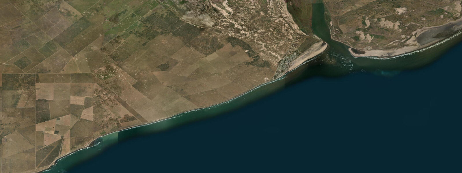
El Cóndor is a small coastal settlement at the mouth of the Río Negro, 30 km south of Viedma on the North Patagonian Atlantic coast. The Río Negro is the second-largest river in Argentina by volume; its mouth at El Cóndor opens to the South Atlantic through a broad, sandy estuary. The cliffs on both sides of the river mouth — particularly the north cliff — are the site of the largest burrowing parrot (Myiopsitta monachus) colony in the world: an estimated 35,000–50,000 pairs nest in the sandstone bluff, producing a continuous cloud of green-and-grey birds and a constant noise audible several hundred metres away.
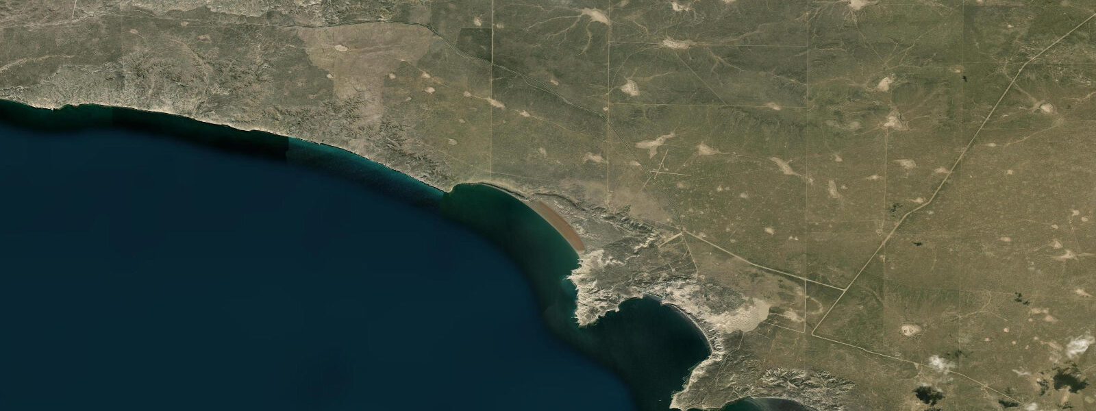
The tidal regime at El Cóndor is macrotidal semidiurnal; spring range is approximately 3.5–4.5 m above Chart Datum. This is smaller than the San Antonio Oeste range 300 km to the north — El Cóndor is exposed to the open South Atlantic rather than enclosed within the San Matías Gulf, and the Gulf's amplification effect does not extend this far south. Two nearly equal highs and two nearly equal lows occur each day; the range varies predictably through the spring-neap cycle.
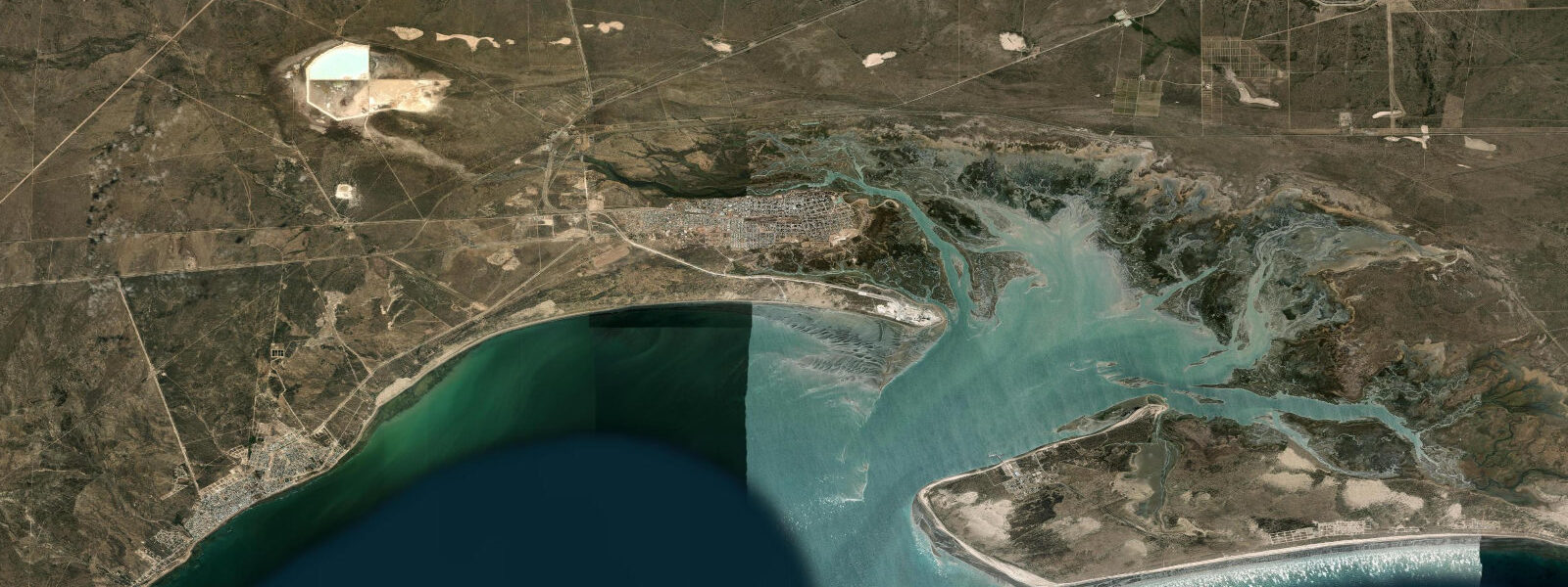
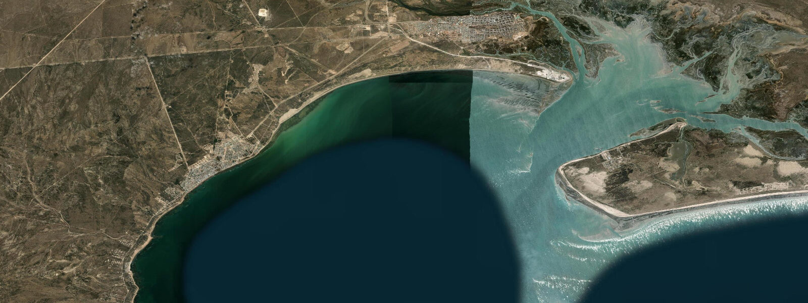
The Río Negro mouth at El Cóndor is an active estuarine environment: the river's freshwater discharge meets the South Atlantic tidal pulse. The flood tide runs upstream in the Río Negro for 30–40 km from the mouth; estuary salinity and water depth at the crossing point both change markedly through the tidal cycle. The beach on the Atlantic side of the river mouth — Playa El Cóndor — is a broad, exposed south-facing beach that receives South Atlantic swell. At spring low water the beach extends 200–300 m seaward of the high-water mark; at spring high water the beach is minimal.
The burrowing parrot colony in the cliffs is accessible from a boardwalk and lookout on the north cliff. The colony is most active in the mornings (07:00–10:00) and late afternoons (17:00–19:00) when the birds return to the cliff from feeding inland. Tide state does not directly affect the parrot colony, but a morning low-tide visit allows the best combination of parrot activity and beach access on the exposed flat below the cliffs.
Fishing in the Río Negro estuary targets pejerrey (Odontesthes argentinensis) and corvina (Micropogonias furnieri) in the brackish zone near the mouth. The most productive windows are the first two hours of the incoming tide, when salt water and bait fish push into the estuary. Shore casting from the beach on the Atlantic side targets the same species in marine water. SHN Argentina publishes tide tables for the Río Negro mouth area; Viedma is the nearest official gauge reference. Predictions here: Open-Meteo Marine, ±45 min / ±0.2–0.3 m.
The Río Negro mouth is an important ecological transition zone. The freshwater discharge from the river extends a buoyancy plume into the South Atlantic that is visible as a colour change — olive-brown river water meeting the greenish Atlantic — particularly after rain events in the Río Negro basin. Sea fishing in the plume margin, where the river nutrients meeting marine productivity creates a productive mixing zone, is a traditional Patagonian activity. The current at the river mouth can be strong; boat fishing in the channel during the active flood or ebb requires experience with estuarine currents.
The Río Negro itself is a significant river; it drains the northern Patagonian Andes and delivers a substantial freshwater discharge to the South Atlantic throughout the year, with peak flow in spring and autumn following snowmelt events. The freshwater plume from the Río Negro mouth extends 20–30 km offshore in the South Atlantic and is detectable in satellite sea-surface salinity measurements. The river mouth habitat — the brackish zone where the freshwater plume meets the tidal intrusion — is the most productive fishing zone; shore fishing from the beach at El Cóndor works this transition boundary on the incoming tide.
Tide questions about El Cóndor
Quick answers to the most common questions about tide times, range, and water access at El Cóndor.
What is the burrowing parrot colony at El Cóndor?
The sandstone cliffs at El Cóndor, particularly the north cliff at the Río Negro mouth, host the largest burrowing parrot (Myiopsitta monachus) colony in the world — an estimated 35,000–50,000 pairs nesting in burrows excavated into the soft cliff face. The colony is active year-round; peak nesting activity is October–December. Burrowing parrots are not seabirds but colonial nesters that exploit the soft sandstone cliffs; their proximity to the coast is coincidental to the cliff geology, not to the marine environment. A boardwalk and lookout provide close viewing. The parrot colony at El Cóndor was formally studied by CONICET researchers; the estimate of 35,000–50,000 breeding pairs makes it the largest documented colony of this species globally.
How does the tide affect the Río Negro estuary at El Cóndor?
The tidal flood runs 30–40 km upstream in the Río Negro from El Cóndor. At the river mouth, the tidal range is approximately 3.5–4.5 m at spring, enough to significantly change both the water depth and the salinity of the brackish zone immediately inside the mouth. The estuary channel narrows and deepens at the mouth; the current reverses direction with each tide turn and runs 1.5–2.5 knots at springs in the main channel. Small boats crossing the mouth should time the crossing at or near slack water (within 30 minutes of the predicted high or low) to avoid the current. The tidal prism on the Río Negro is significantly modified by the river discharge; during high-flow periods (autumn and spring snowmelt), the effective tidal range at the mouth is reduced by the freshwater head.
Where do the tide predictions on this page come from?
Open-Meteo Marine, a free gridded global ocean model. Accuracy is typically ±45 minutes on timing and ±0.2–0.3 m on height. SHN (Servicio de Hidrografía Naval) Argentina publishes official tide tables for the Argentine coast; Viedma (on the Río Negro, 30 km inland from El Cóndor) is the nearest official gauge reference. Tide height at the river mouth may differ slightly from the open-coast prediction due to estuary effects. This page is not for navigation. The SHN Viedma gauge is located on the river 30 km upstream; the open-coast tidal signal at El Cóndor is slightly modified by the river mouth hydraulics.
When is the best time of day to visit El Cóndor to see the parrots?
The burrowing parrot colony is most active in the early morning (07:00–10:00) and late afternoon (17:00–19:00) when birds depart and return from inland feeding areas. At these times the sky around the north cliff is filled with thousands of birds in flight. Mid-day is quiet — most birds are inland feeding. A morning low-tide visit (depending on the day's predicted low) allows the best combination: parrot departure activity, good light, and wide beach access on the exposed tidal flat below the cliffs. Check the predicted low on this page before planning your timing. The parrot colony is also visible from the El Cóndor lighthouse access road; morning visits before 09:00 see the maximum flight activity as birds depart to feeding areas inland.
Is beach fishing productive at El Cóndor?
Yes. The Playa El Cóndor beach on the Atlantic side of the river mouth is productive for pejerrey and corvina, particularly on the incoming tide from one hour after the predicted low through to high water. The tidal flat at spring low water extends 200–300 m; fishing from the surf zone at the water's edge on the rising tide is the most consistent approach. Inside the estuary the brackish zone produces the same species on the flood tide; the current in the river mouth channel at springs can be strong enough to make bank fishing difficult. The best beach fishing at El Cóndor is October–April when water temperatures are above 16°C and corvina and pejerrey are most active inshore.
7-day tide table — El Cóndor
Heights relative to MSL. Predictions: Open-Meteo Marine (MeteoFrance SMOC, 0.08° grid) — heights relative to MSL (not chart datum / LAT). Model-derived.
| Day | Type | Time | Height |
|---|---|---|---|
| Sun 21 Jun | High | 04:59 | 1.8m |
| Low | 10:51 | -1.3m | |
| High | 16:59 | 2.1m | |
| Mon 22 Jun | Low | 12:02 | -1.3m |
| High | 18:08 | 1.8m | |
| Tue 23 Jun | Low | 00:28 | -1.7m |
| High | 06:54 | 1.9m | |
| Low | 13:00 | -1.3m | |
| High | 19:10 | 1.8m | |
| Wed 24 Jun | Low | 01:28 | -1.5m |
| High | 07:48 | 1.8m | |
| Low | 14:06 | -1.5m | |
| High | 20:20 | 1.4m | |
| Thu 25 Jun | Low | 02:23 | -1.5m |
| High | 08:44 | 1.7m | |
| Low | 15:08 | -1.6m | |
| High | 21:13 | 1.2m | |
| Fri 26 Jun | Low | 03:19 | -1.6m |
| High | 09:42 | 1.5m | |
| Low | 15:58 | -1.5m | |
| High | 22:14 | 1.4m | |
| Sat 27 Jun | Low | 04:09 | -1.1m |
| High | 10:37 | 2.1m | |
| Low | 16:52 | -0.9m | |
| High | 20:00 | 0.8m |